
|
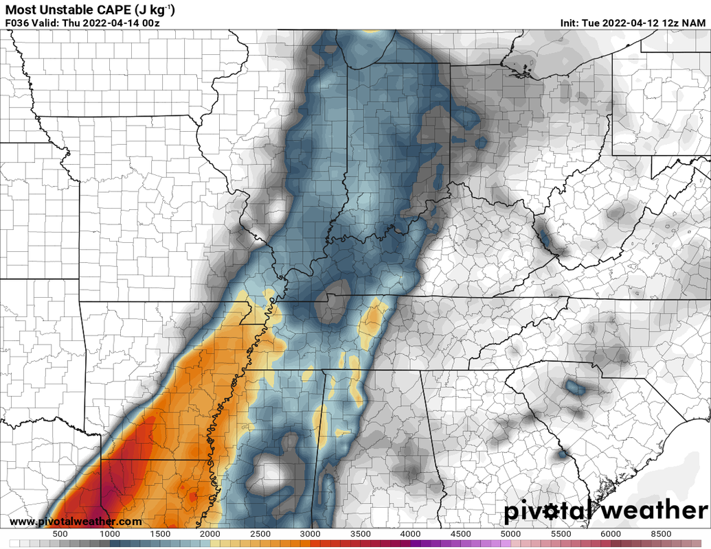
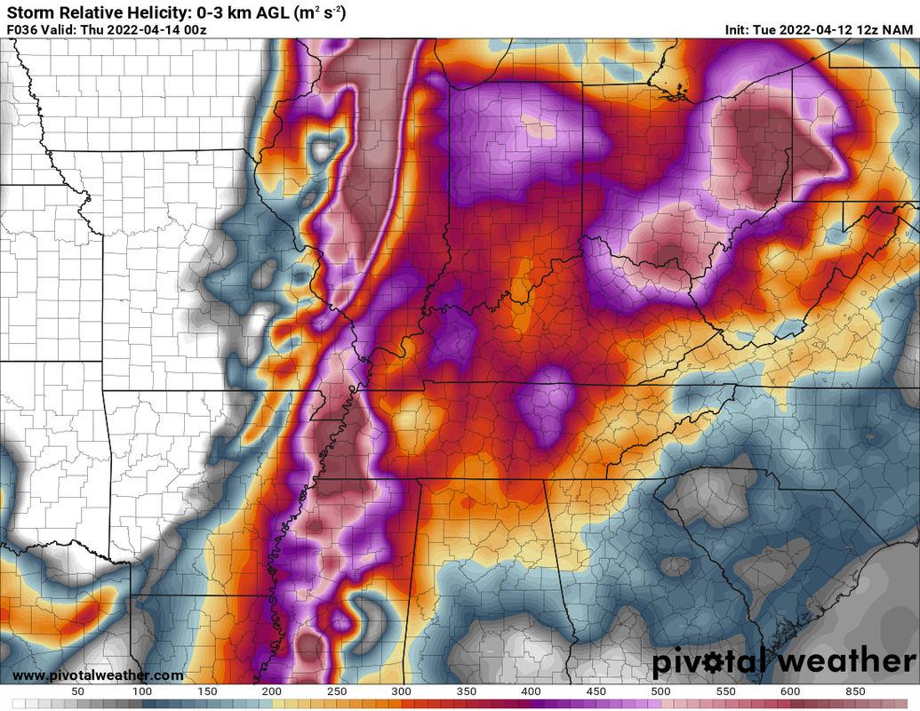
7Tomorrow certainly has the makings for the first bout of severe weather for the state this year. This isn't really saying that much since it has been generally cooler than average since the beginning of the year. That being said, Wednesday could be a big day for the area. Emphasis on the COULD. The Storm Prediction Center in Norman, OK has added a moderate risk to for tomorrow in their 1730z update today. The moderate risk for the far SW portions of the state while most of the state is under an enhanced risk or slight risk. 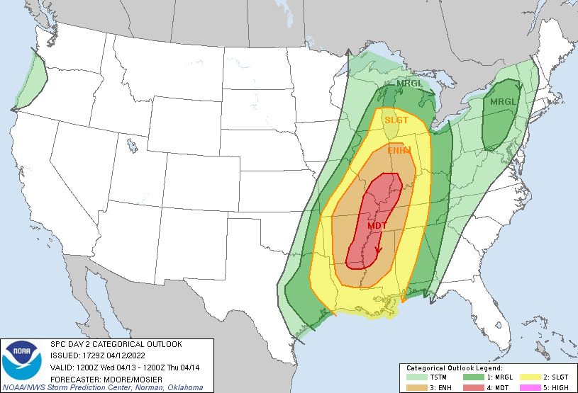 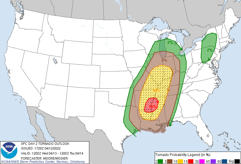 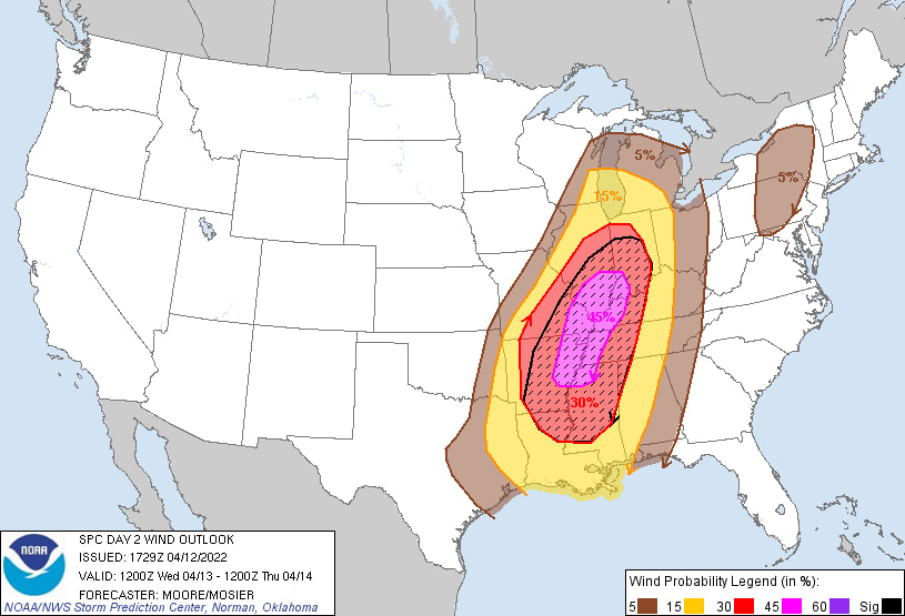  While the southwestern areas of the state have a higher chance of seeing damaging severe weather, that doesn't mean the rest of the state is off the hook! Ok now time for the meteorology... There will be cloud cover and possibility of isolated storms/showers earlier in the day normally is a bad thing for severe weather. You need that atmospheric instability to fuel storms. Tomorrow we will have a low level jet (LLJ) above the surface feeding in warm, moist air from the south into the state. By afternoon things will start to feel muggy with temperatures in the upper 60s and dewpoints in the low 60s. 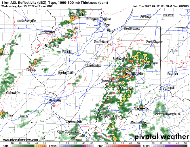 We will have decent CAPE (a measure of atmospheric stability) and wind shear. The CAPE is on the somewhat lower side, but between the two there is more than enough. There is enough wind shear that we could possibly see some embedded tornados within the main line ahead of the cold front.
When I forecast I will also look at other indices which are combinations of a lot of the ingredients for severe weather in one product. I will show you one from the NAM model. STP (significant tornado parameter) outlines the chance of seeing an EF2+ tornado. The NAM paints an impressive amount. Goes to show while the main threat increases the more south you go, the tornado potential can exist elsewhere as well. 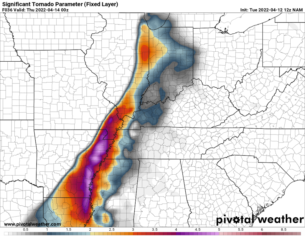 I will go ahead and throw in the simulated radar from the high resolution NAM (NAM3k). Don't take it for gospel, but this shows what we could see. The time frame for the main round is 5pm-9pm. 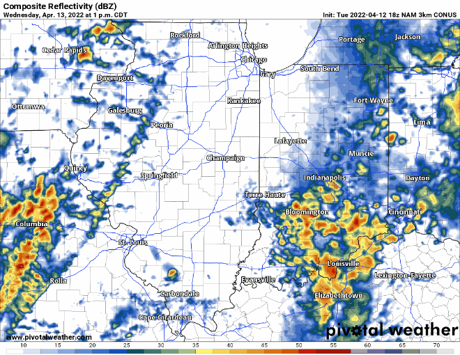 One caveat though is that this convection during the day could serve to stabilize the atmosphere enough so that there wouldn't be enough instability for any discrete storms. Any discrete storms ahead of the cold front/squall line and would have a higher tornado risk. I still believe even if this occurs the linear wind threat still will exist that night. Of course if there less clouds and/or rain earlier on we have a higher risk for rotation in discrete storms.
Tomorrow you will want to have your severe weather preparedness plan in place. Keep an eye on your normal weather information sources, the NWS, and have your weather radio and phones fully charged. Make sure you have multiple ways of receiving information. Go ahead and bring in any objects that could blow away. Even outside of storms, winds could gust up 30-50 mph. Know what to do if a warning is issued and where to go. No specifics are written in stone, but know conditions look to be quite favorable tomorrow. I will be busy during the morning, but will be posting updates throughout the afternoon and evening.
0 Comments
|
 RSS Feed
