
|
For today there is enough to talk about that I decided to write a blog to cover it all. First off is the short term. Right now in Kokomo, its 77 deg with an expected high of 82 deg. Highs over the next few days should hover in the upper 80s. dew points will also increase into the lower 70s so it will feel increasingly muggy out as well. 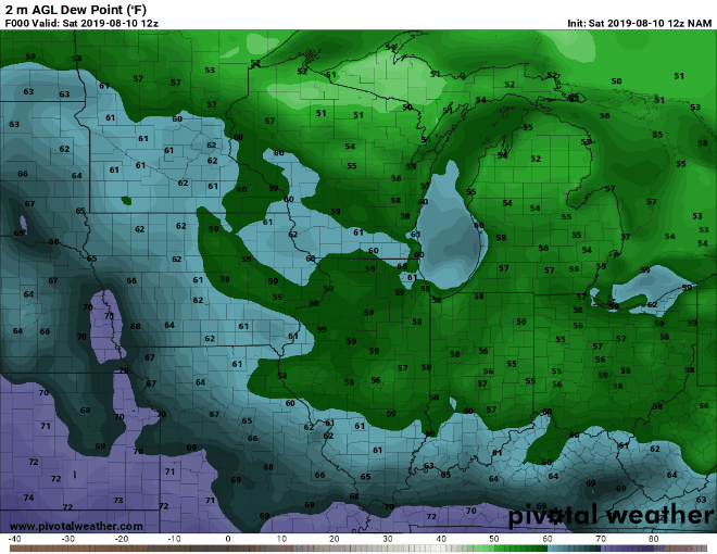 With this there is a slight threat of severe weather for Monday evening into Tuesday morning. 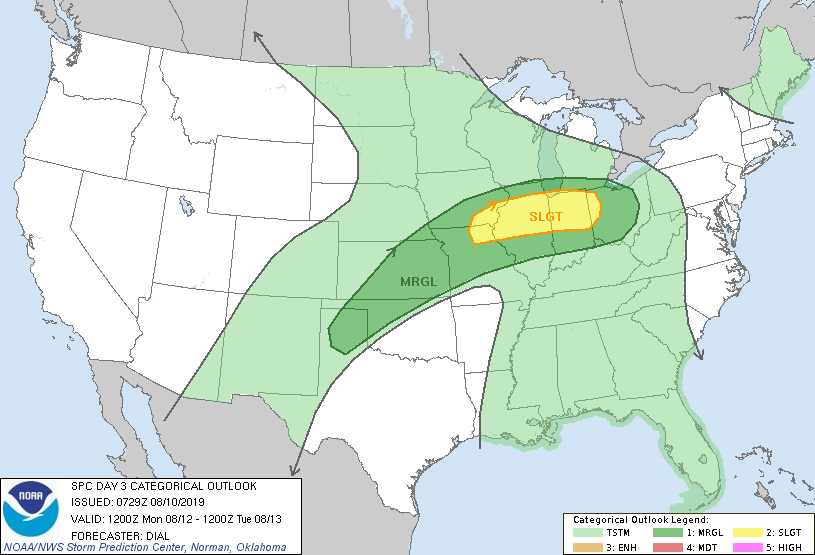   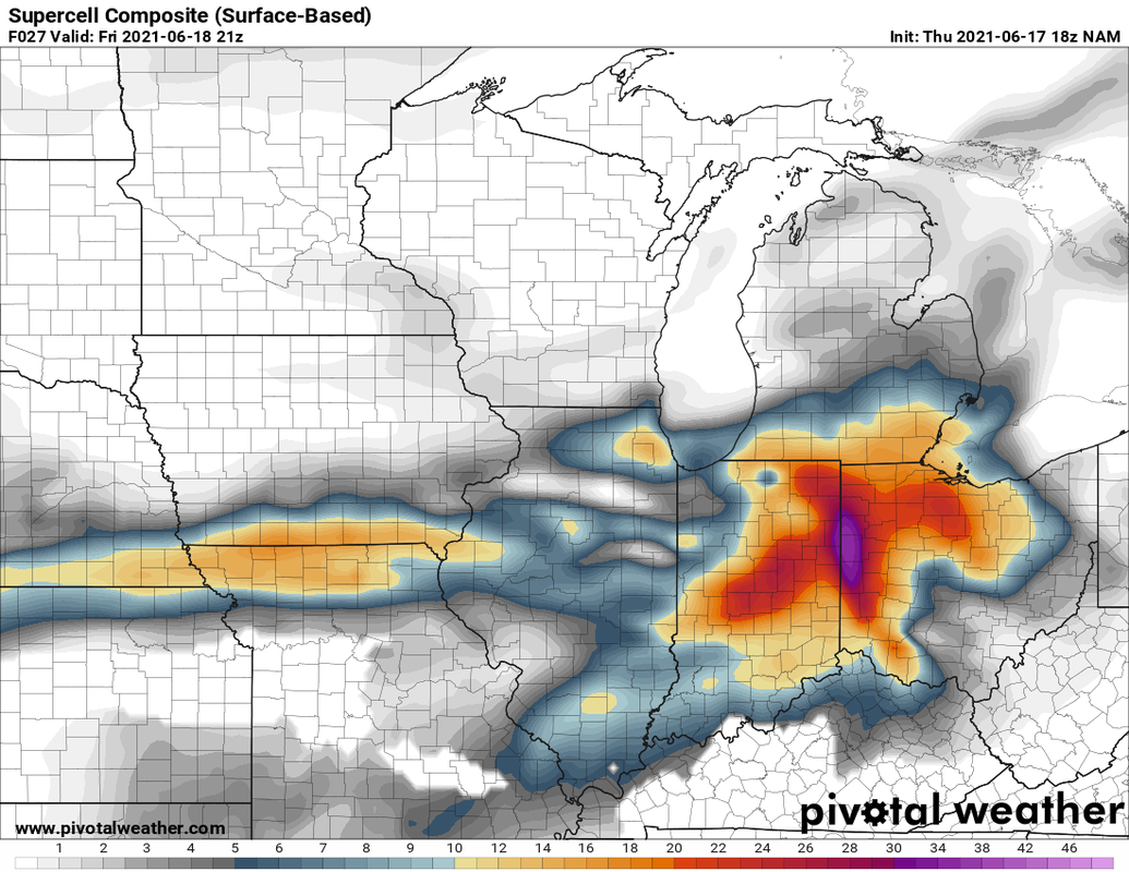 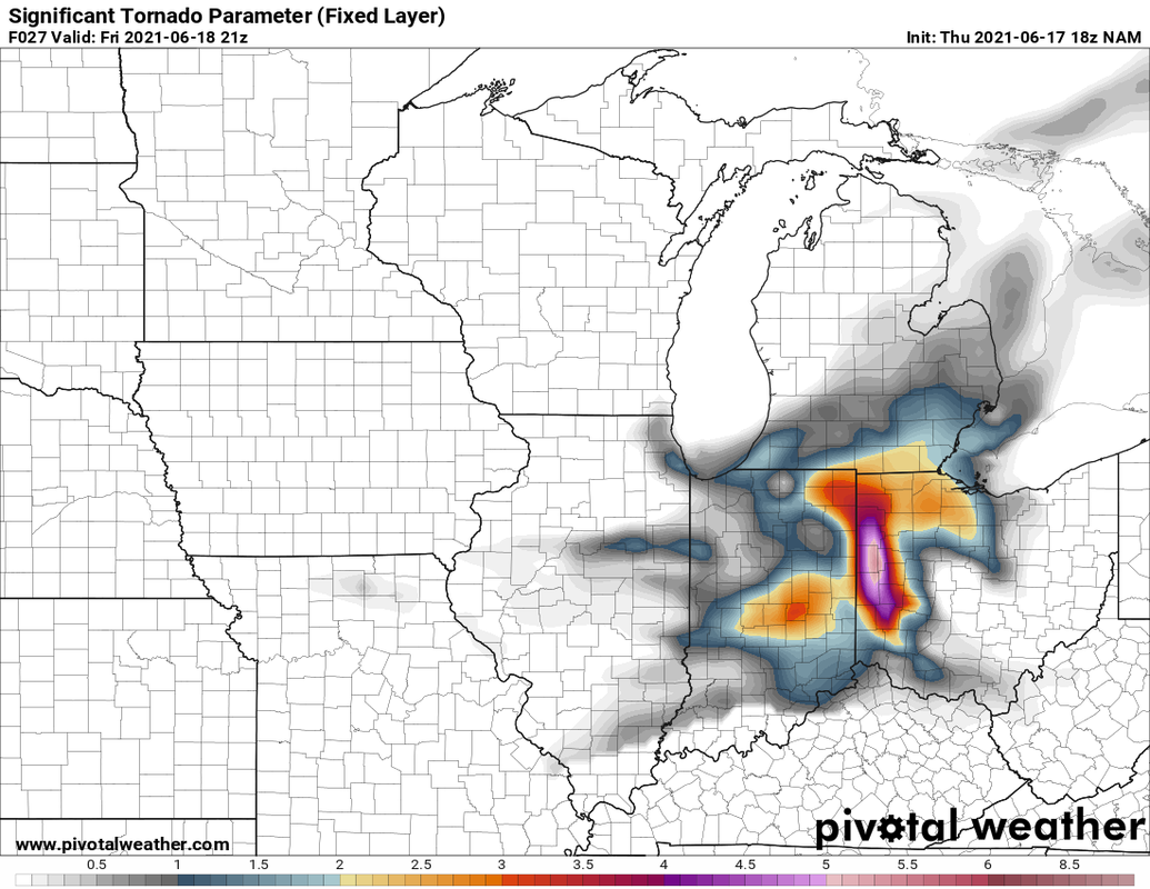 This looks top be a more nighttime threat with storms forming to our west and making their way toward here. Don't be too concerned if you are in the high parameters. We don't know how this will turn out. This could end u as nothing or big. We should get better data Sunday and Monday to look at. Stay weather aware Monday evening and night. ...Long Term... One word, dry. We are abnormally dry. I know farmer desperately want rain, but it could stay dry for a while. 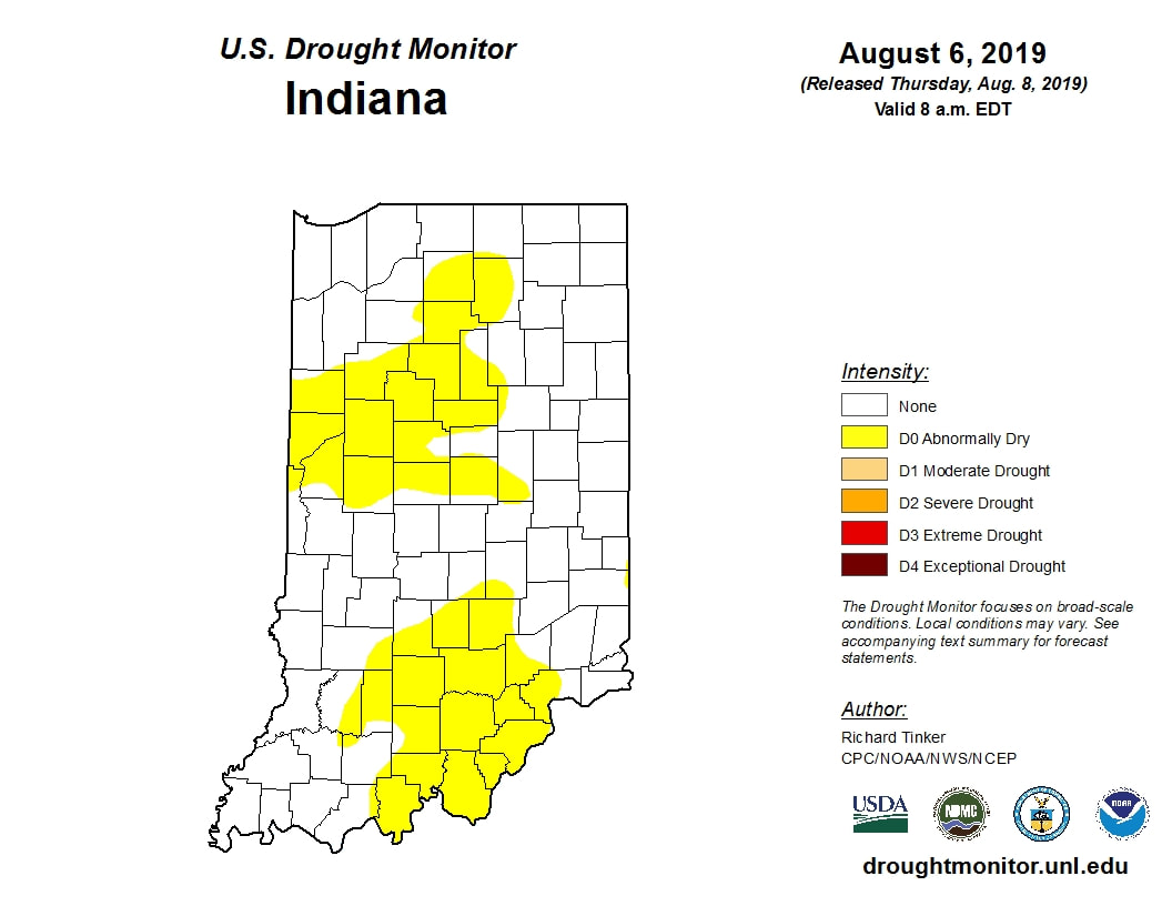 Data from the Climate Prediction center don't offer a lot of help. 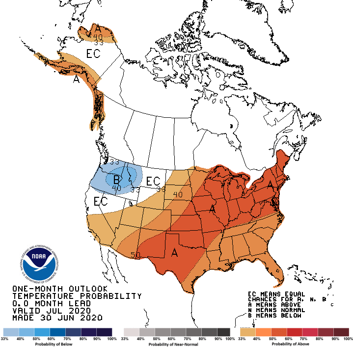 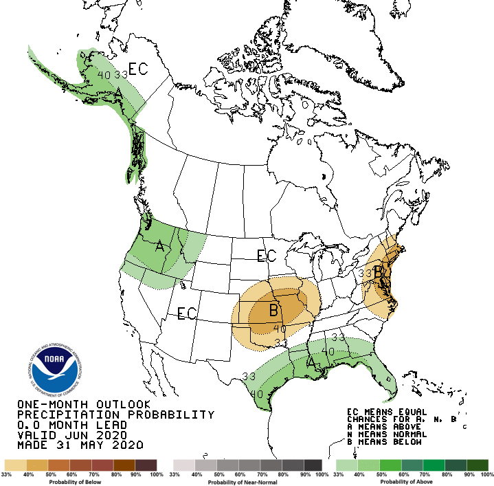 It generally looks to be dry and cooler for the next month. looking at the models still doesn't seem good. 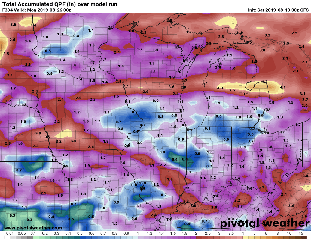 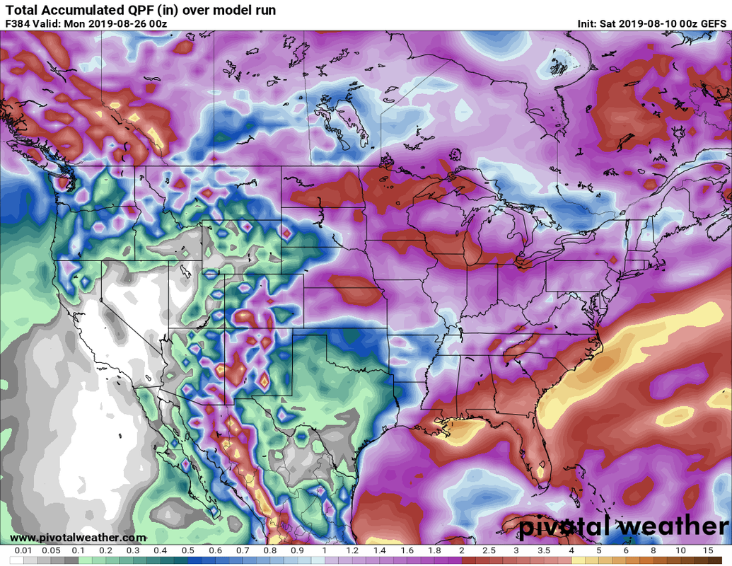 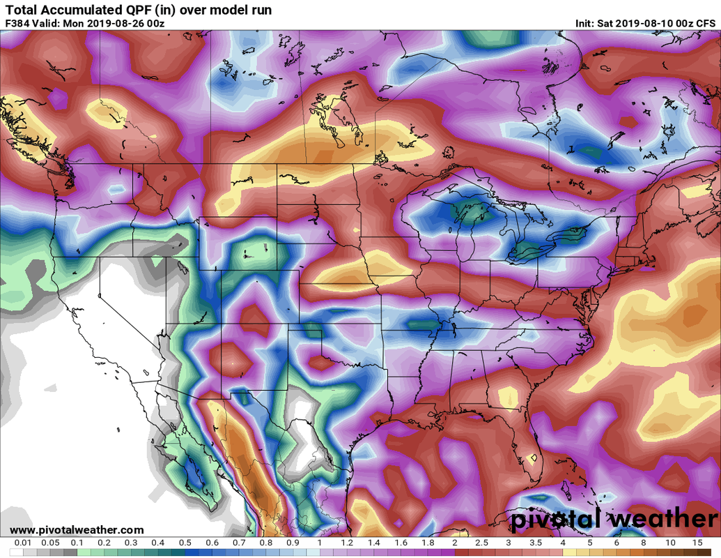 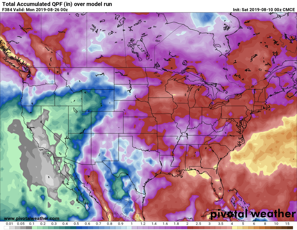 All of these show precipitation total through 384 hours (16 days) and range from roughly 1-3 inches.it should be noted that the American models seem to output less precip than he Canadian model shown and the CFS model. For reference Kokomo should receive around 4 inches in August.
Ill keep on eye on Mondays severe weather threat and will continue to post of the Facebook page as necessary.
0 Comments
|
 RSS Feed
