
|
We just came out of a warm and dry month and we have entered into July.
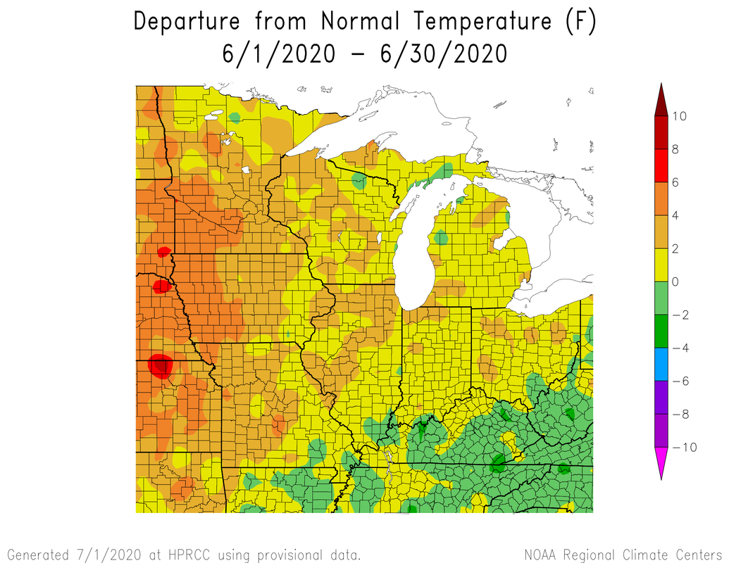
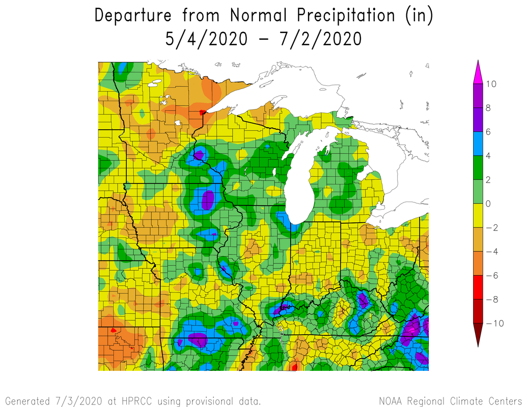
So here in Indiana we ranged anywhere from 2-4 deg warmer than average and since May 4th we have seen a fairly big deficit in rainfall. With the dry conditions much of the state categorized as abnormally dry in the latest US drought monitor. 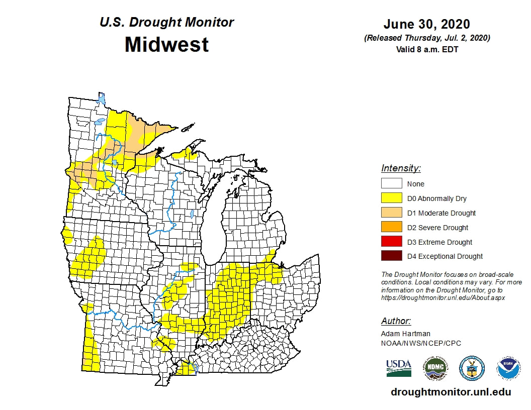 So what does the rest of July have in store for us. Well the answer looks like hot and dry. Looking at the CFS monthlies look, that looks to be the answer.
Now this depends on where the strong ridging sets up. 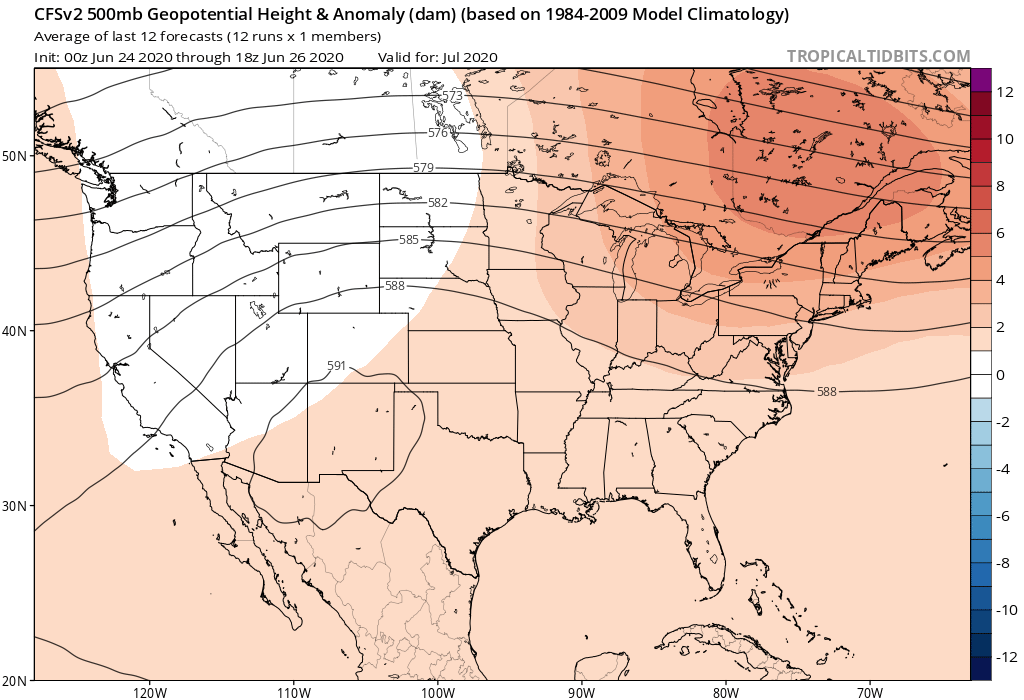 Remember ridges often mean warmer and dry conditions due to the high pressure. The models have some disagreements on placement, but both the GFS and Euro have strong ridges with the cores being at 594-600dm. The Euro places thre ridge more out west and the GFS more in the center of the country. This ridge can also wobble a bit over time, putting us under the hot dome or just slightly outside of it at times. This pattern looks to continue throughout the month and Id venture to say even ito August. Teleconnection patterns are also supporting this with ENSO entering into more La Nina like conditions along with the NAO and PNA.
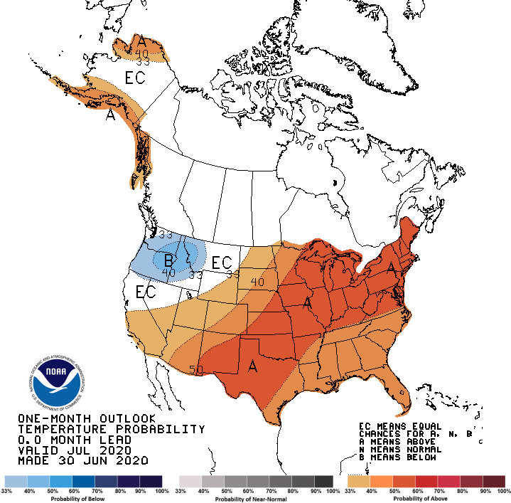
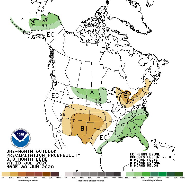
Another thing. There is a saying "same breeds same." If its dry it will become even dryer and if wet, even wetter later. That is we are losing soil moisture of around 0.20" a day or so and it will just get dryer and hotter. If there's more rain there would be higher dew points and probably more precipitation. We would have more rain chances if the ridge moves west enough to create a northwest flow type pattern, but thats dependent on the upper levels. Here is the NOAA monthly forecast.
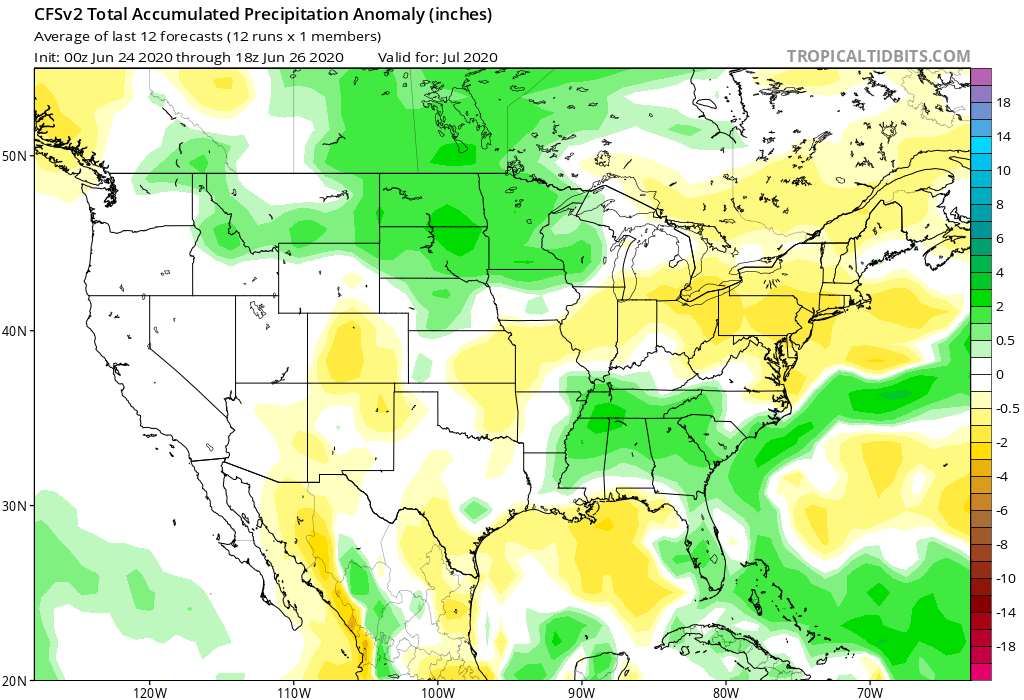
I'll leave you with the total rainfall through July 13 from several models (remember these are just possibilities and not set in stone.) Lets hope we can break out of this pattern before it begins. 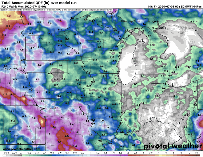
0 Comments
|

 RSS Feed
