
|
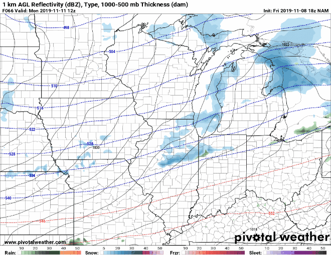
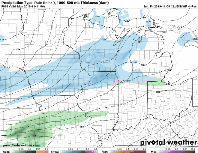
Halloween ended up being cold and snowy for many in the Howard county area. Saturday should a relatively nice sunny day with a high in the mid 40's with a low in the 20s. Sunday will be warmer with temps reaching the 50s. I am watching the possibility of snow on Monday. Here is the output from the NAM and Euro models from 5AM Monday through early Tuesday night. Also here are possible snow totals from several models.
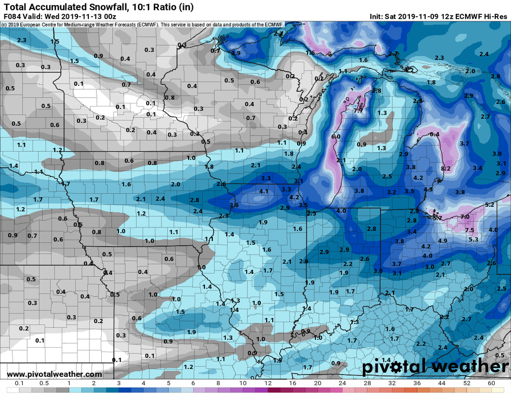 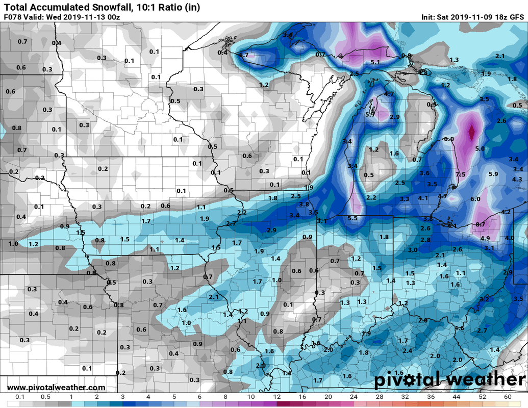 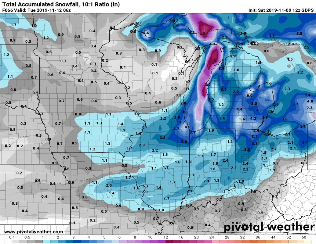 Some areas could see several inches of snowfall, not all will stick. Some areas closer to lake Michigan may even see some lake effect snow. Don't pay too much attention to the exact placement of snow. the models can and will change. Look at the overall pattern shown. The big story this week is the shot of unseasonably cold air Monday and Tuesday. These are temps we can see in January, not normally mid-November. The ensemble models indicate a large chuck of the US will see colder than normal temperatures. This is some cold air! 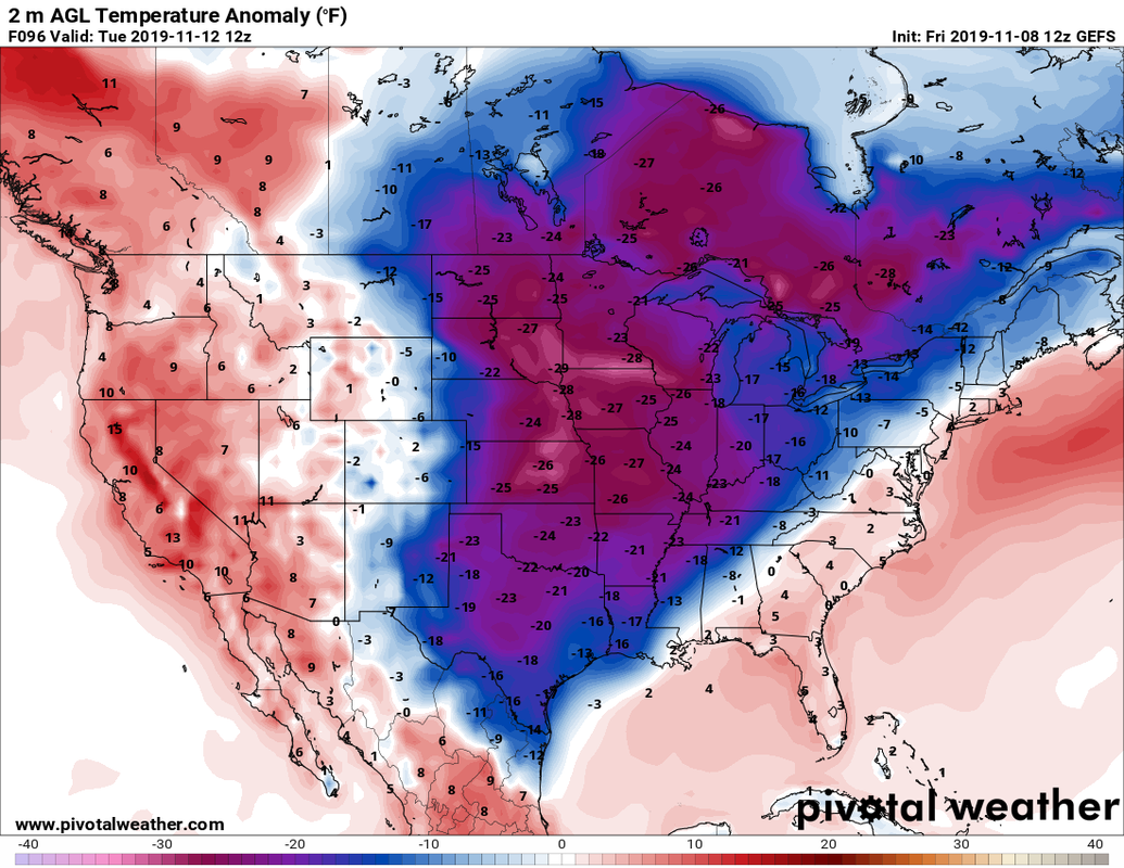 A cold front looks to pass through the state Monday morning bring in arctic air behind it. Temps will crash behind the front along with stronger winds. The question is when the front passes. Here are projected lows Tuesday morning, the colder of the two days looking at the european model and the american NAM model. 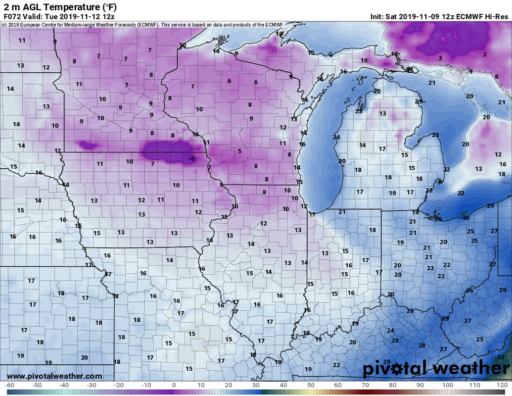 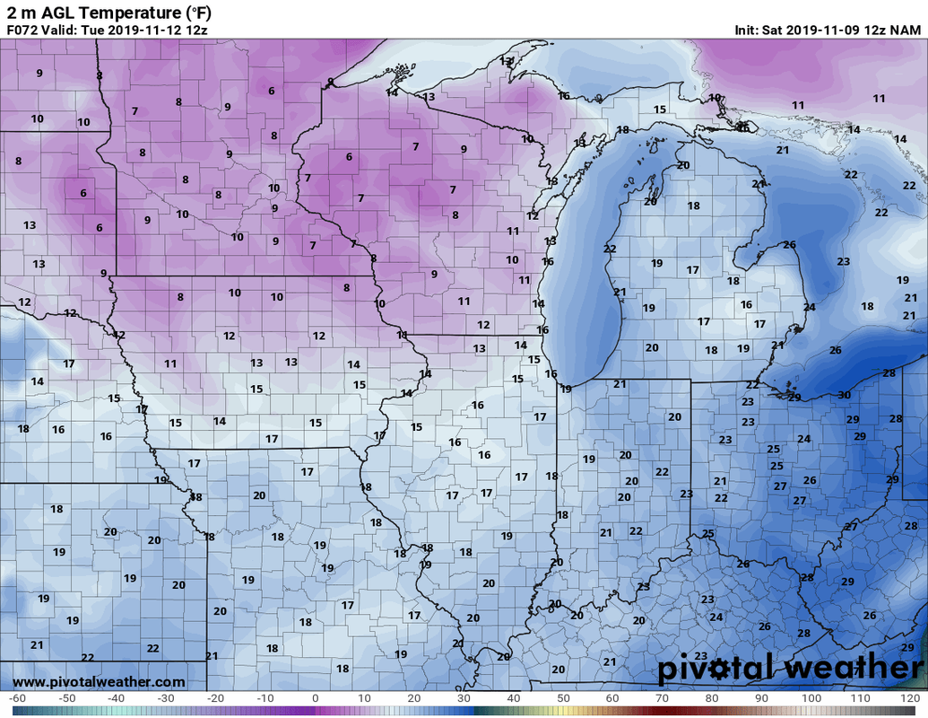 I think temps could be a bit colder depending on snow cover. The more snow the colder. For fun here are comparisons of the average highs and lows for Kokomo and the surrounding area. City High Low Kokomo 50 32 Lafayette 51 32 Tipton 51 32 Muncie 50 33 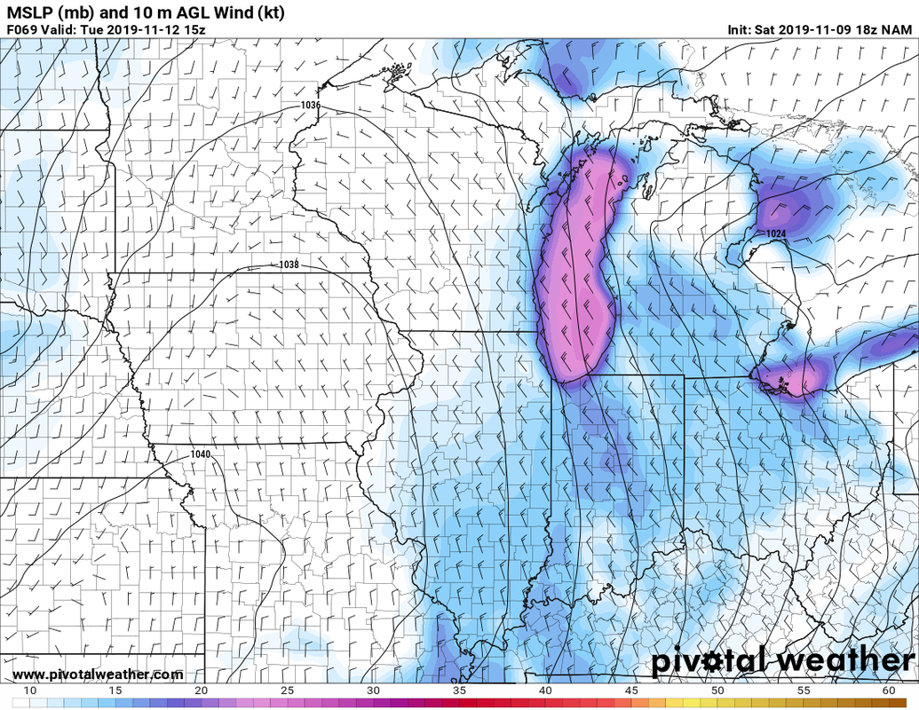 With these winds, wind chill will be an issue 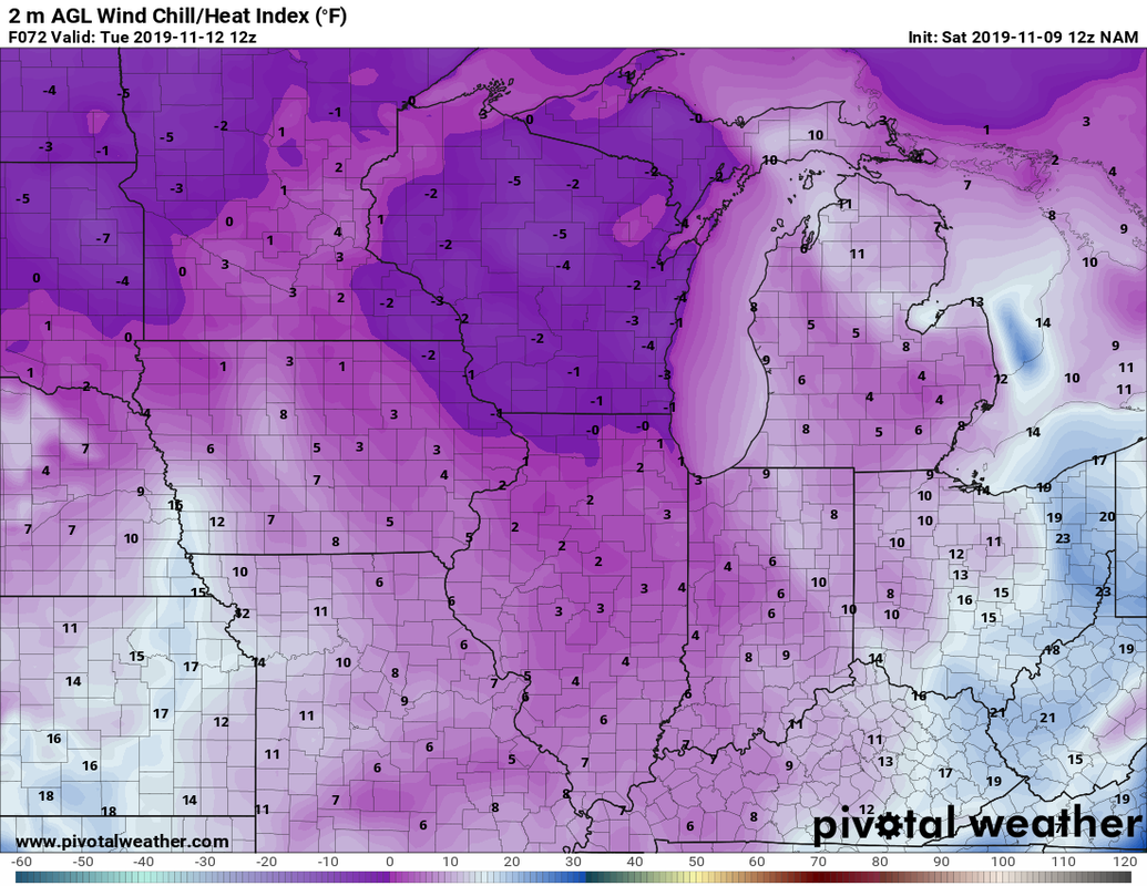 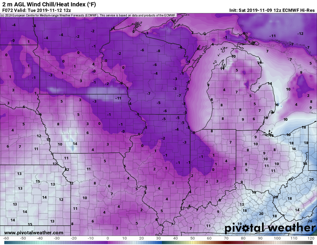 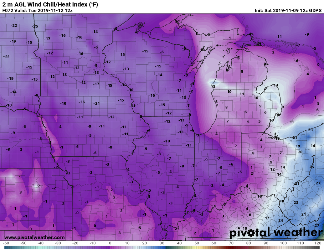 In Summary
I will have my 5 day forecast out this night. I will update you as necessary on the Howard county Weather facebook page.
0 Comments
|
 RSS Feed
