|
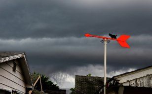
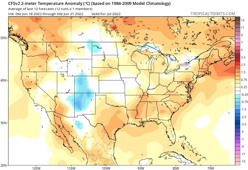
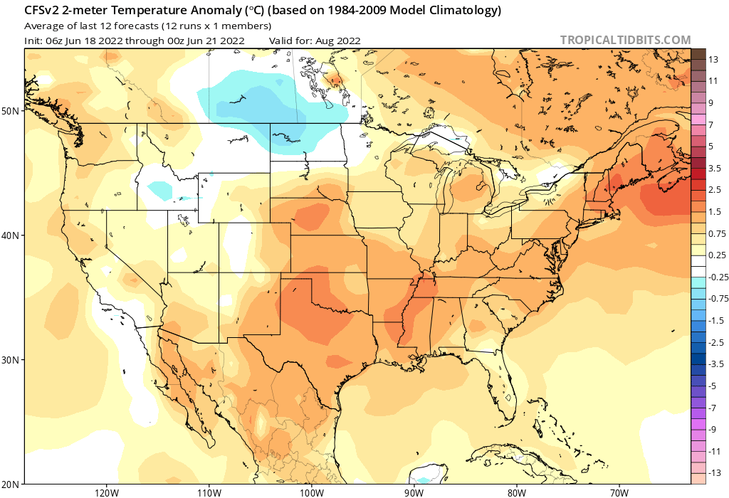
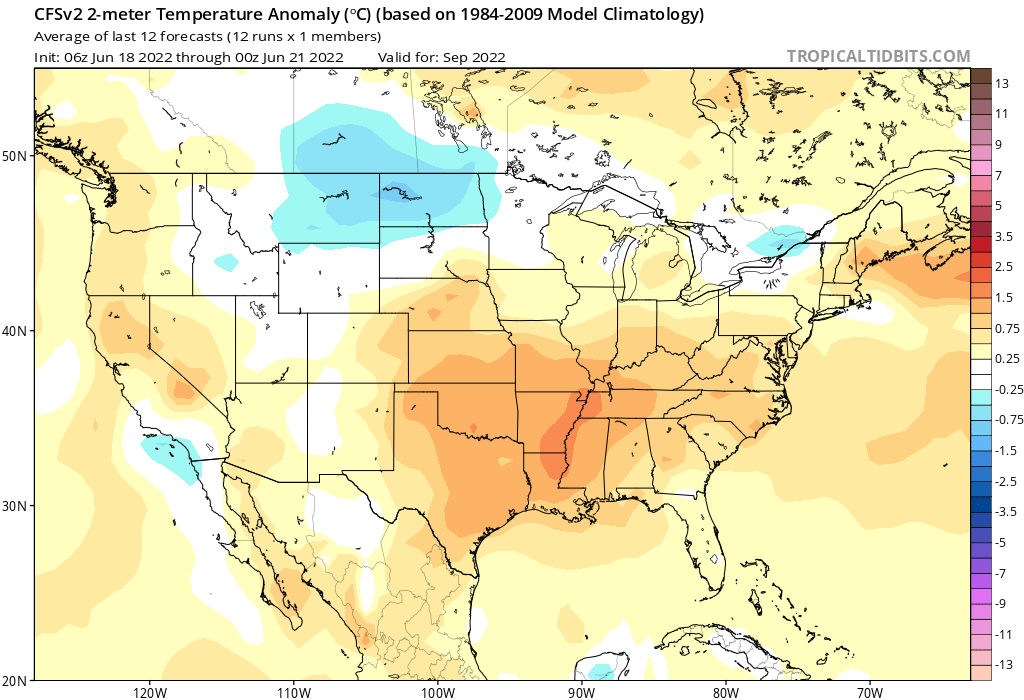
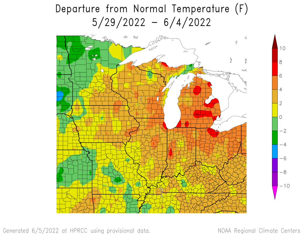
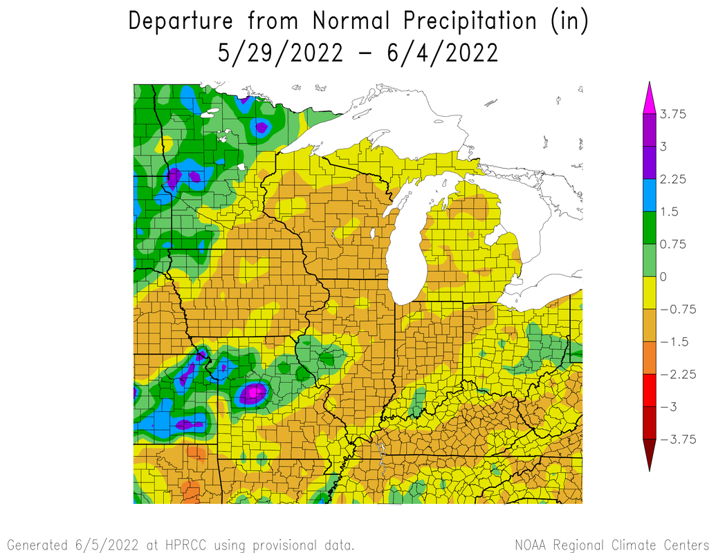
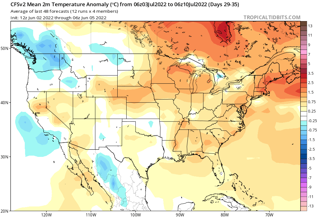
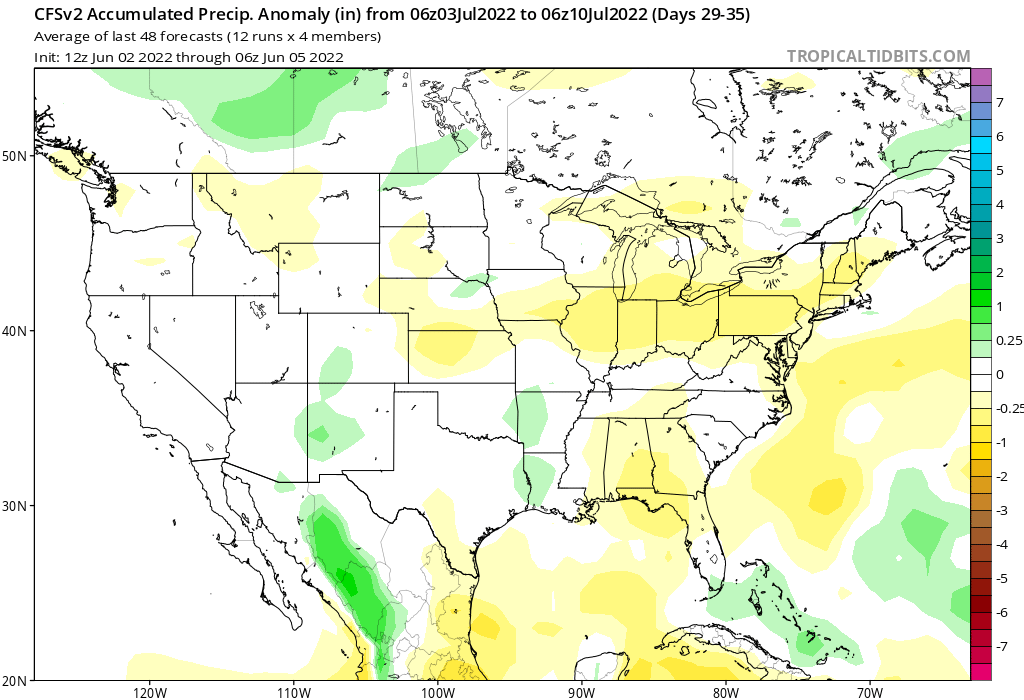
We have managed to survive our first big heatwave. Pretty much the entire state saw a high temperature above 90, but the incredible humidity present spiked the heat index into the triple digits triggering issuance of excessive heat warnings for several consecutive days. 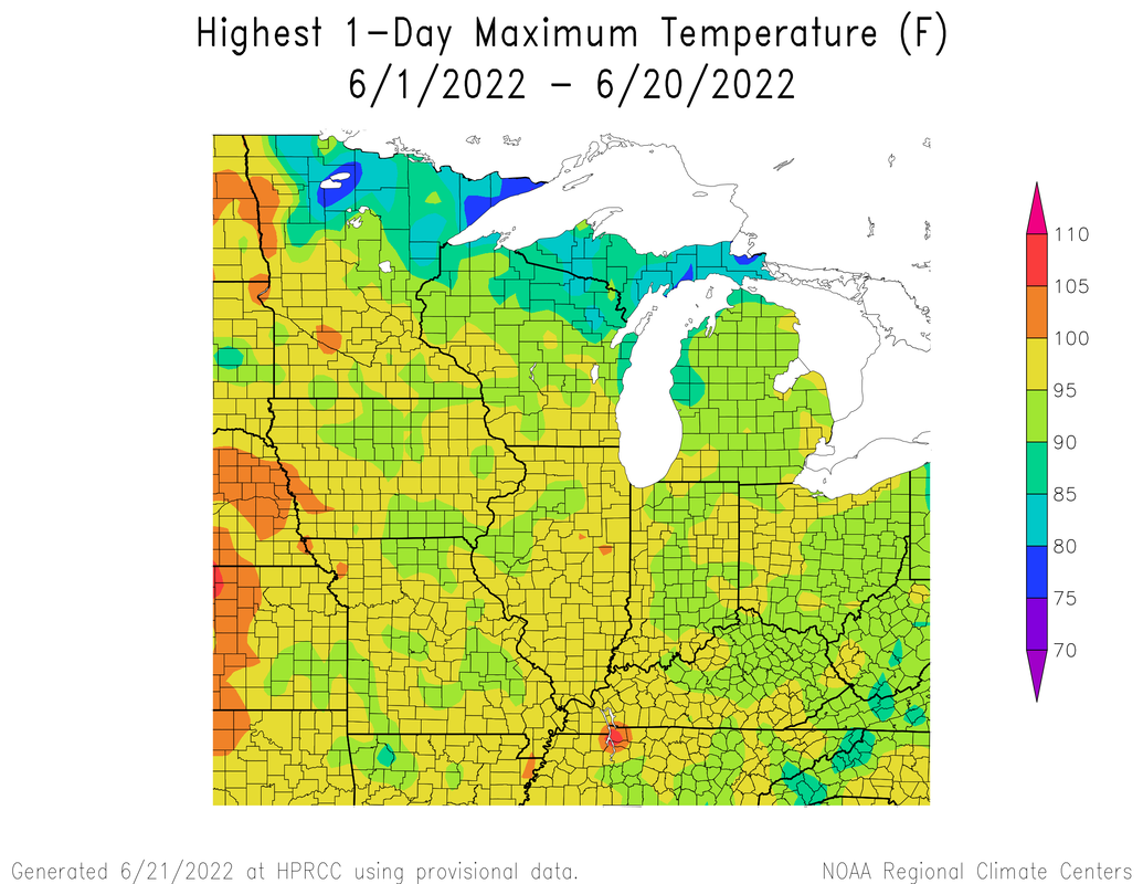 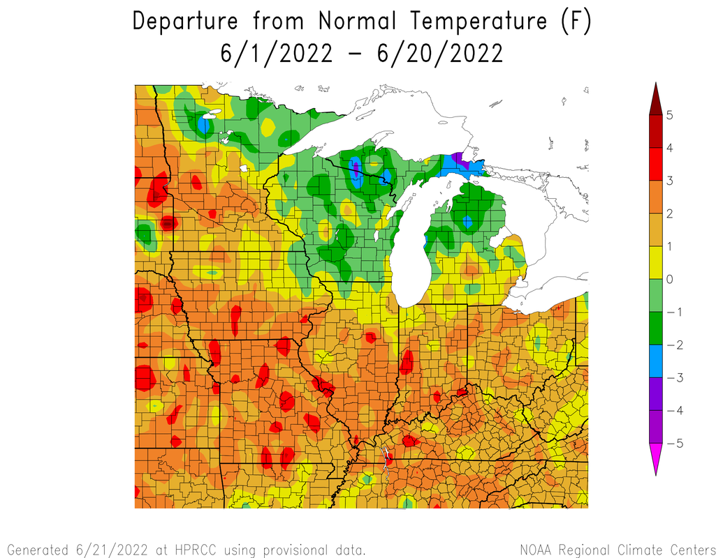 Earlier I said that there is the possibility of periodic clusters of thunderstorms riding up and over ridges of high pressure. That did occur last Monday. A derecho did form to our north and produced hurricane force winds, Ft. Wayne reported a gust of 98 mph. Locally we saw some thunderstorms form in the warm sector of the system, though quite a few did become severe-warned, not much came out of them. as the ridge temporarily backs off at times, we can continue to see occasional ring of fire type patterns at times which can come with the chance for severe weather.  Much of my forecast from earlier this month seems to be panning out. We look to remain warm into this week and early next week with virtually no chances for rain. Our best chance for rain over the next two weeks is early tomorrow and Sunday. Don't worry our next heatwave this week will not have as much humidity as earlier! 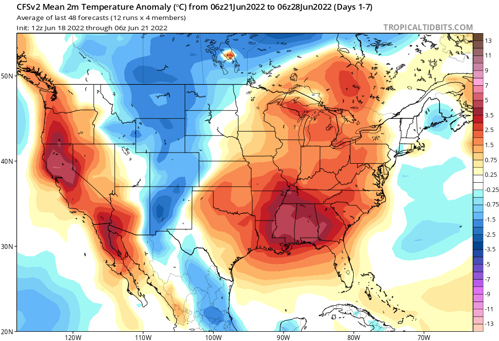 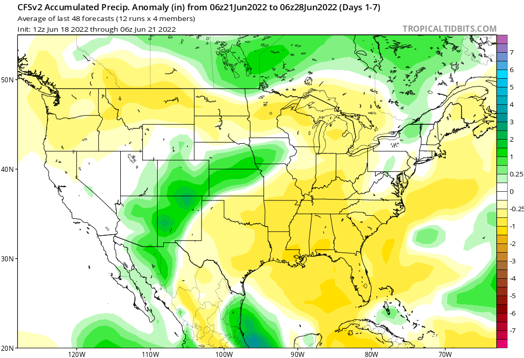 An omega block pattern has set up, which is hard to change. An omega block is an atmospheric pattern where a center of high pressure is stationary and blocked in by low pressure on each side. The low in the west is actually drawing in tropical Pacific moisture letting the southwest monsoon (which fun fact, is not technically a monsoon) to continue and the southwest desperately needs rain. The high pressure on the other hand has set up shop across the midwest and eastern half of the US causing a hot, dry pattern to continue. I am concerned about drought in western Indiana. Right now we are in a deficit of soil moisture. You may ask, Elliott why am I concerned with if the soil is wet or not? Same breeds same. For every day without rain, the soil loses around 0.25" of moisture. A dry soil tends to exacerbate heat and dryness and make it worse in a vicious cycle. Its possible flash-drought could occur. Flash drought is set in motion by below-normal precipitation, accompanied by abnormally high temperatures, winds, and/or solar radiation. This time of year, we have the most direct sun angle of the year. Basically the higher up in the sky the sun is, the more insolation or solar radiation can make it to the surface. 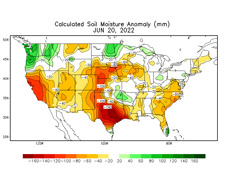 The US drought monitor shows an area of abnormal dryness for an area of western Indiana and eastern Illinois. Essentially the darker the color, the worse the drought status. Some of the worst drought right now in the United States are in the southwest. I recently spend two weeks out west for a university geographic field study so I experienced the profound dryness first hand especially in eastern new Mexico. 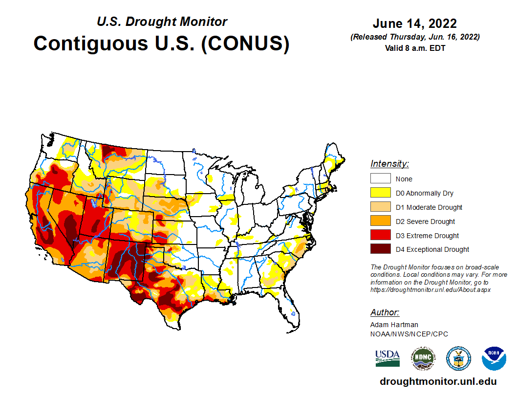 Here is data for the Midwest. it is clear, eastern Illinois and western Indiana is in a rain deficit. Notice what the Urban-Champaign area looks like on all three graphics. 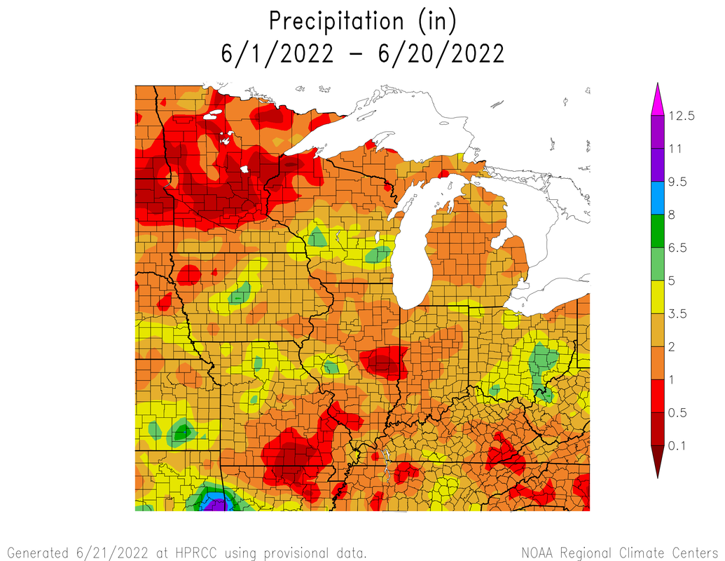 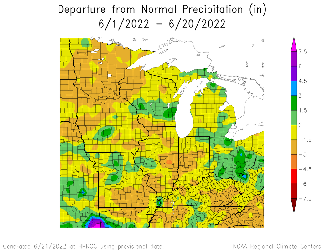 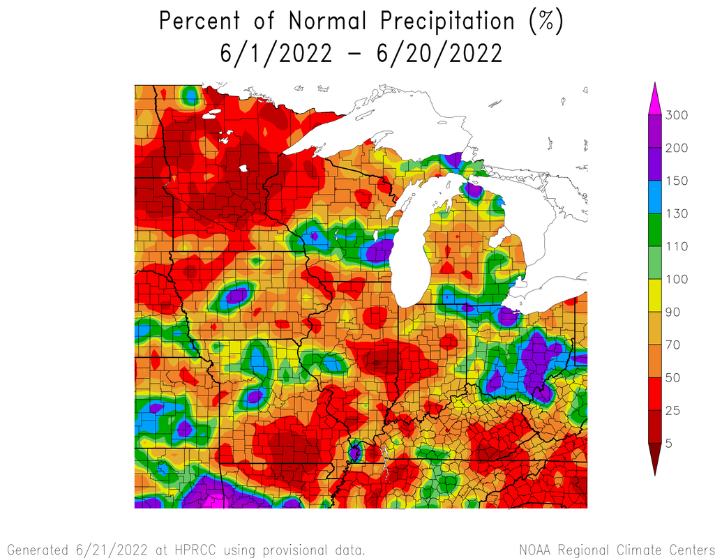 It is actually expected that parts of the state will end up in drought status. 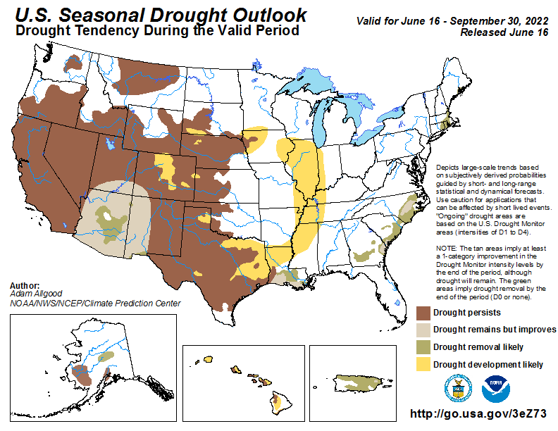 Based on available data, I believe at least part of the state will end up in drought based on the current pattern. 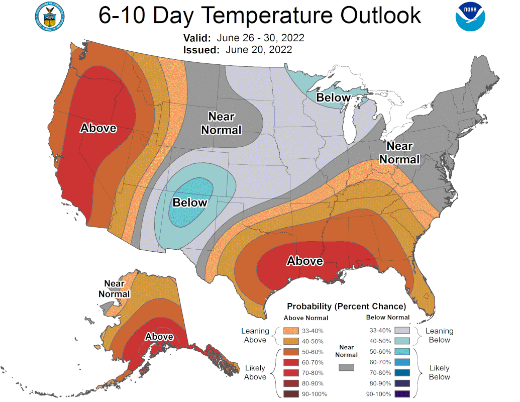 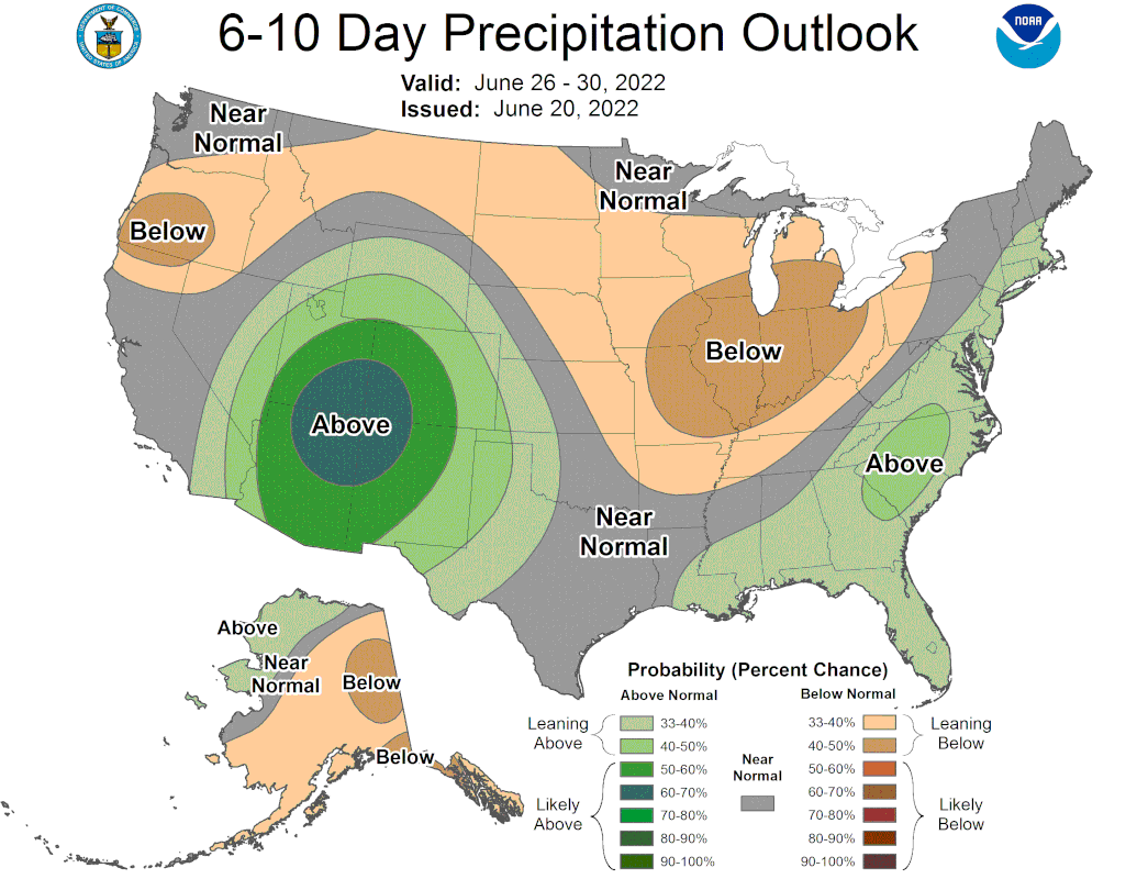 I will go ahead and include the CFS monthlies for the rest of the summer. Above average temperatures still likely and average to below average precipitation as well.
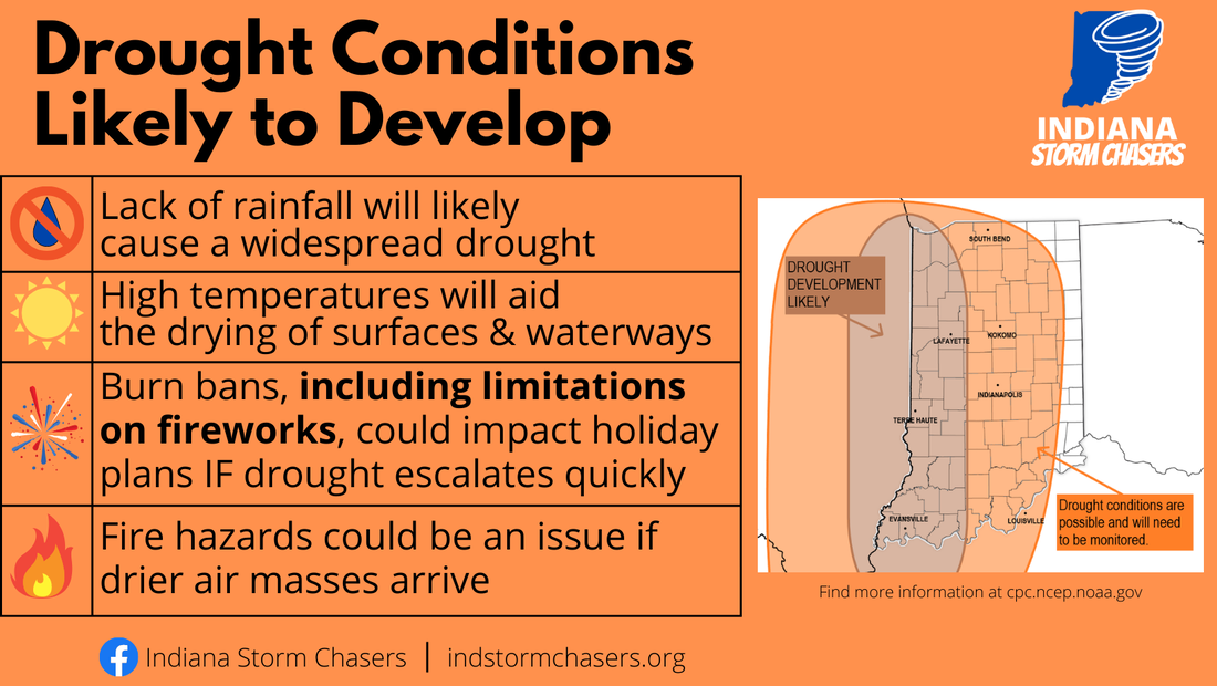 Graphic courtesy of: Indiana Storm Chasers
0 Comments
Welcome to meteorological summer! Now is the time of year we may be able to start to get the tropics affecting our local weather and statistically speaking June is when we see the most severe weather on average. For a little fun here is how 2022 is going in terms of severe weather to date. We are right in the middle of the pack in terms of severe thunderstorm and tornado warnings combined statewide on average. 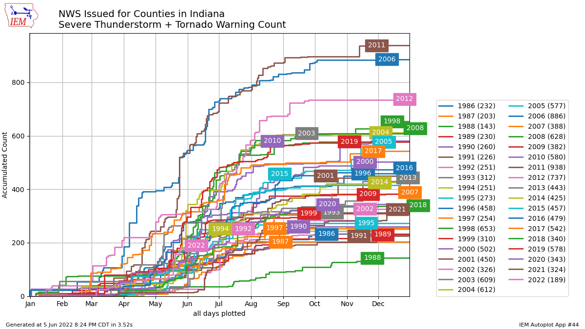 We started June with close to average temperatures and below normal rainfall amounts. There was quite a bit an uptick in local severe weather during the month of May (of which I was home for none of it :( since I was out west for a field class.)
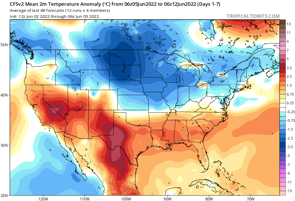
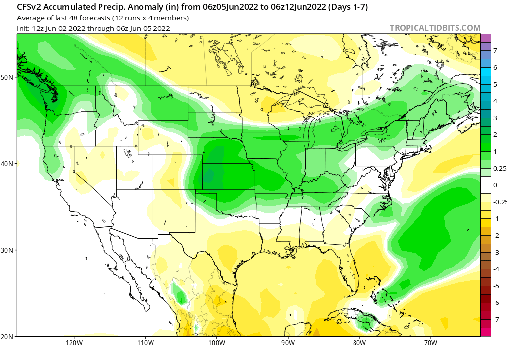
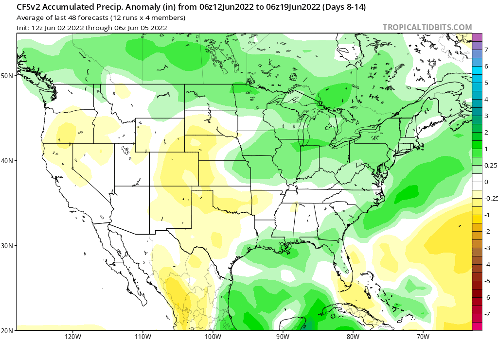
The next week looks to be average to cool temps and wet in general. Both the GFS and Euro models keep the high pressure to remain to our west through mid-month will keep the hotter air bottled up there. The CFS weeklies back up this idea.
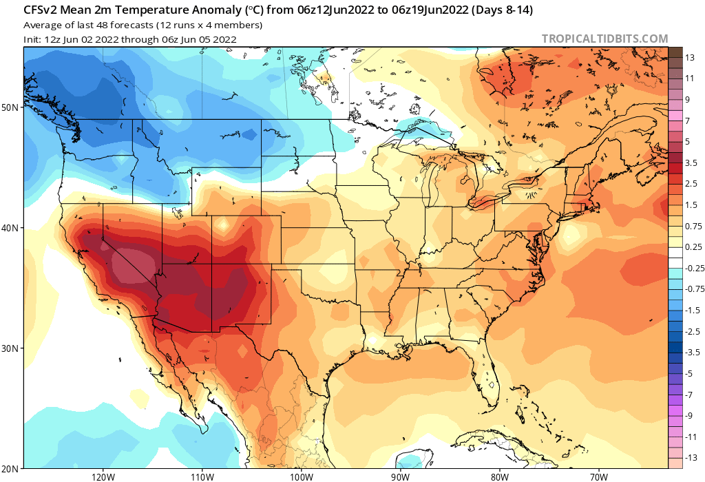
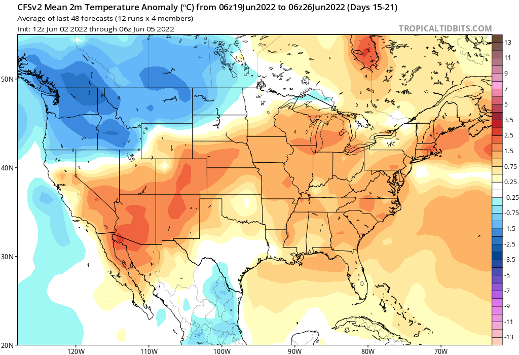
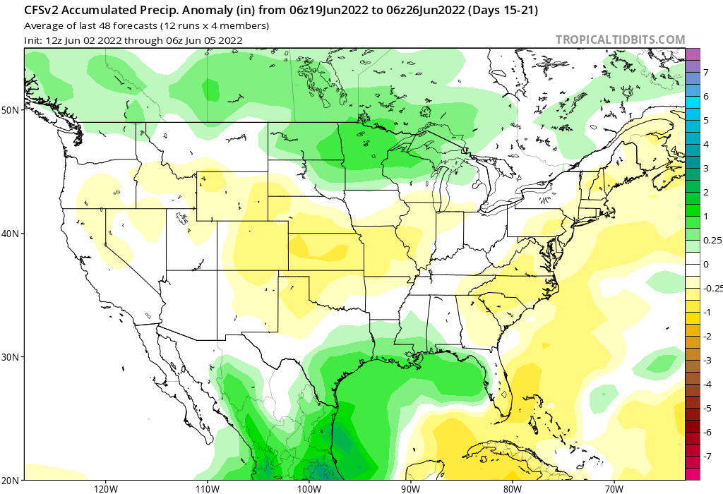
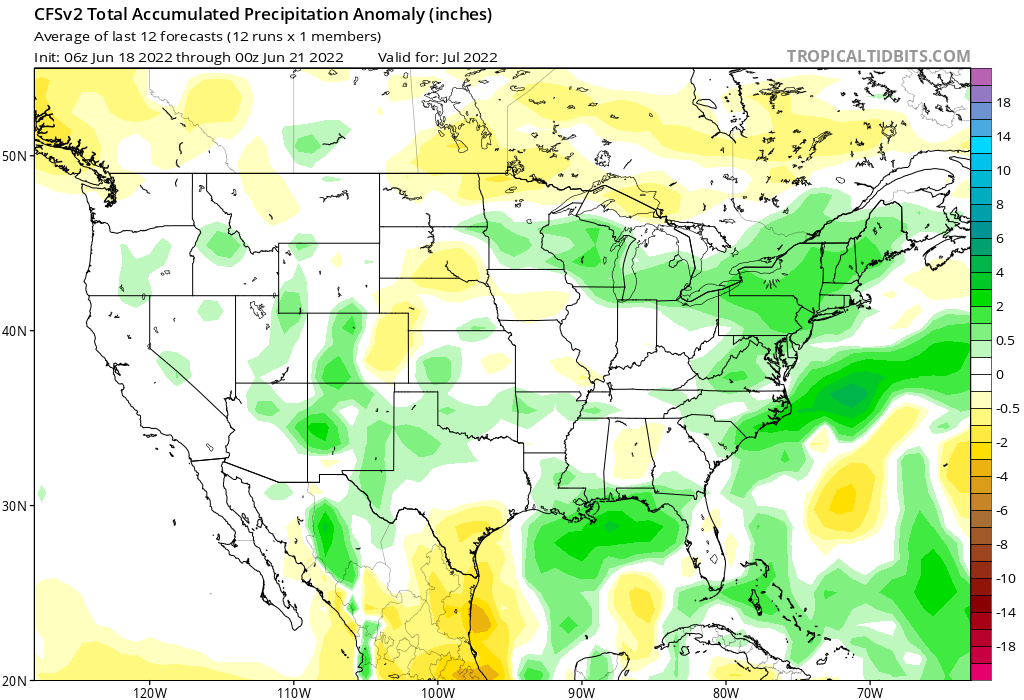
Our best chance for rain this week will be today. We could see some showers Wednesday and Friday into Saturday, but right now Monday looks to be the wettest day of the week. 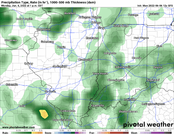 Overall, most areas of the state could receive around an inch of rain this week. Right now, it is important to get some rain. I will get a bit into why later So what about the rest of the month? I will attach the CFS weeklies heading into July. This week again looks cool to average with wet conditions then we flip midmonth to a drier hotter pattern thanks to a strengthening and growing high pressure system to our west. There is a possibility that as the heat dome expands we could get into a ring of fire pattern which would bring more chances of rain and severe weather. We need rain to ward off the possibility of drought. I can Definity see the possibility of at least a couple heatwaves later this month.
The first week of July looks about the same. It is still way too early to give a forecast for Independence Day weekend, but I will venture a very preliminary forecast of warm temps at least.
July overall looks similar to June with extended periods of warm to hot temperatures with below normal rainfall. If we stay dry in June and high pressure develops, I could see even hotter tempers possible at times. Dry areas and ridges of high pressure especially this time of year is the perfect recipe to get at least one 100+ deg F day.
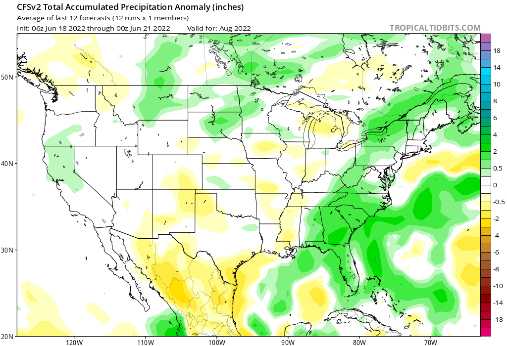
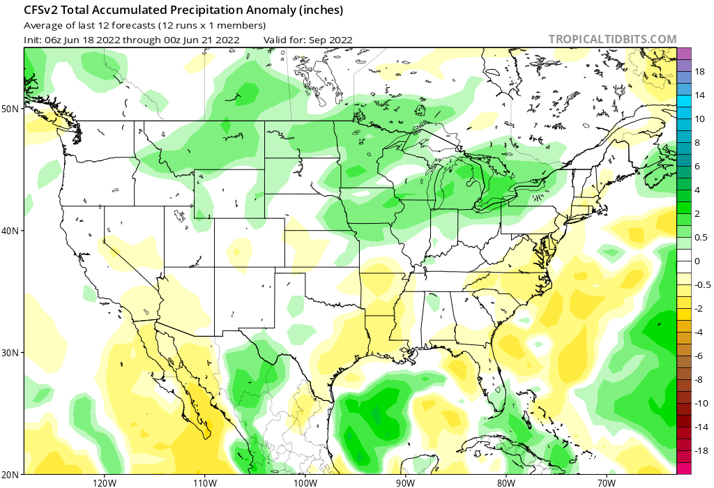
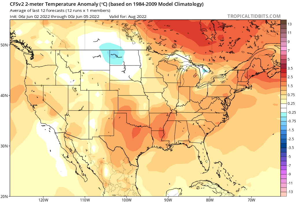
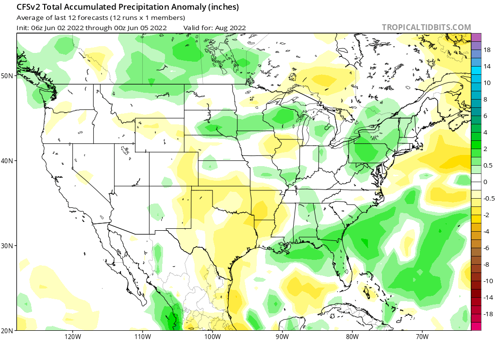
August could bring a bit of a pattern change. The western ridge eases up a bit and we may enter the ring of fire that brings us more rain and severe weather chances. My big worry is that the hot and dry conditions could lead to drought. At the moment the state is running between +4 inches and rain and -2 inches departures for the year thus far. That isn't a lot of moisture to withstand a prolonged dry period. One thing is the tropics look to be busy this season so if we can get some tropical moisture up into the Midwest that could really help farmers out a ton.
|


 RSS Feed
