|
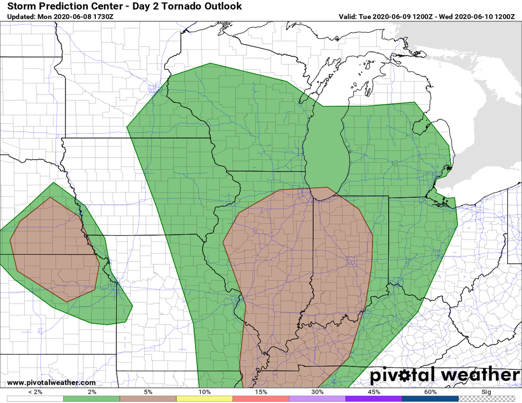
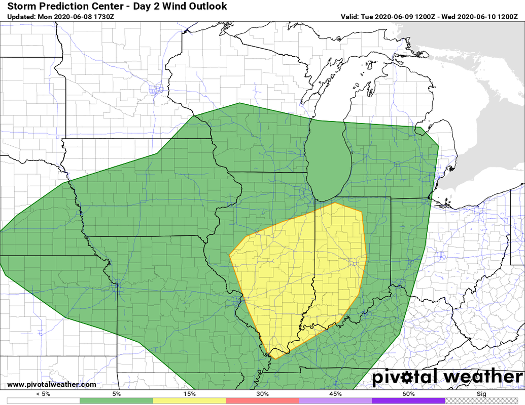
Well when I was talking about Cristobal being he source of the areas last good rain for at least a good chunk of June, I didnt think there would be severe weather involved. I decided to write this weather discussion as a blog post, not Facebook. I will also include a summary graphic at the end. Here is the official SPC day 2 outlook. 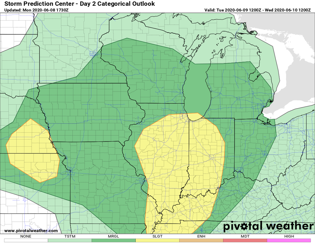
There is a smaller chance for hail, but right now the main threats look to be the possibility of tornados and winds, along with flash flooding and deadly lightning. Here are a few graphics of the main ingredients we look often look at.  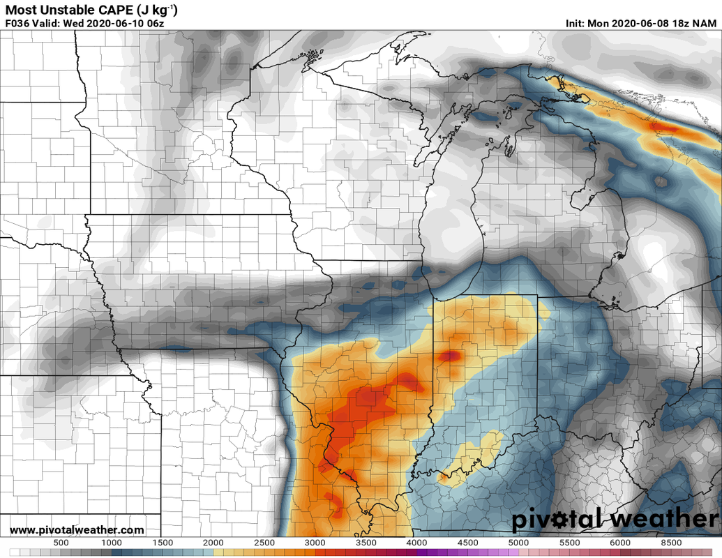 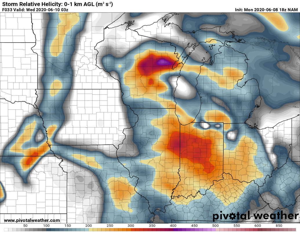 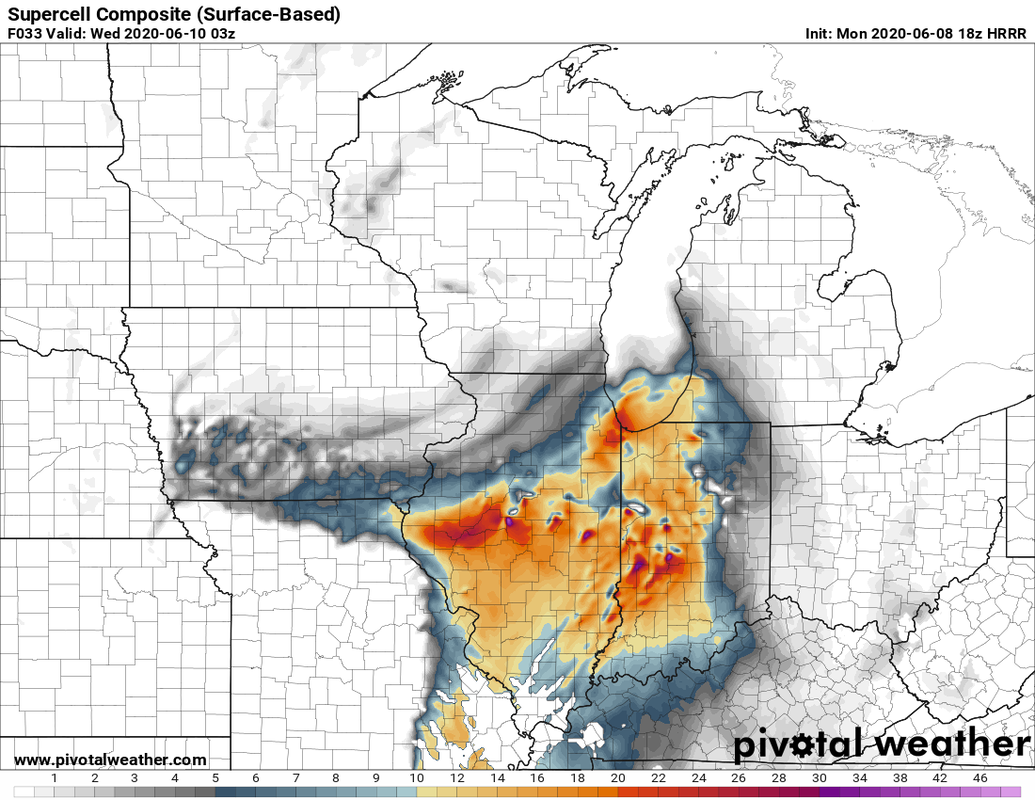 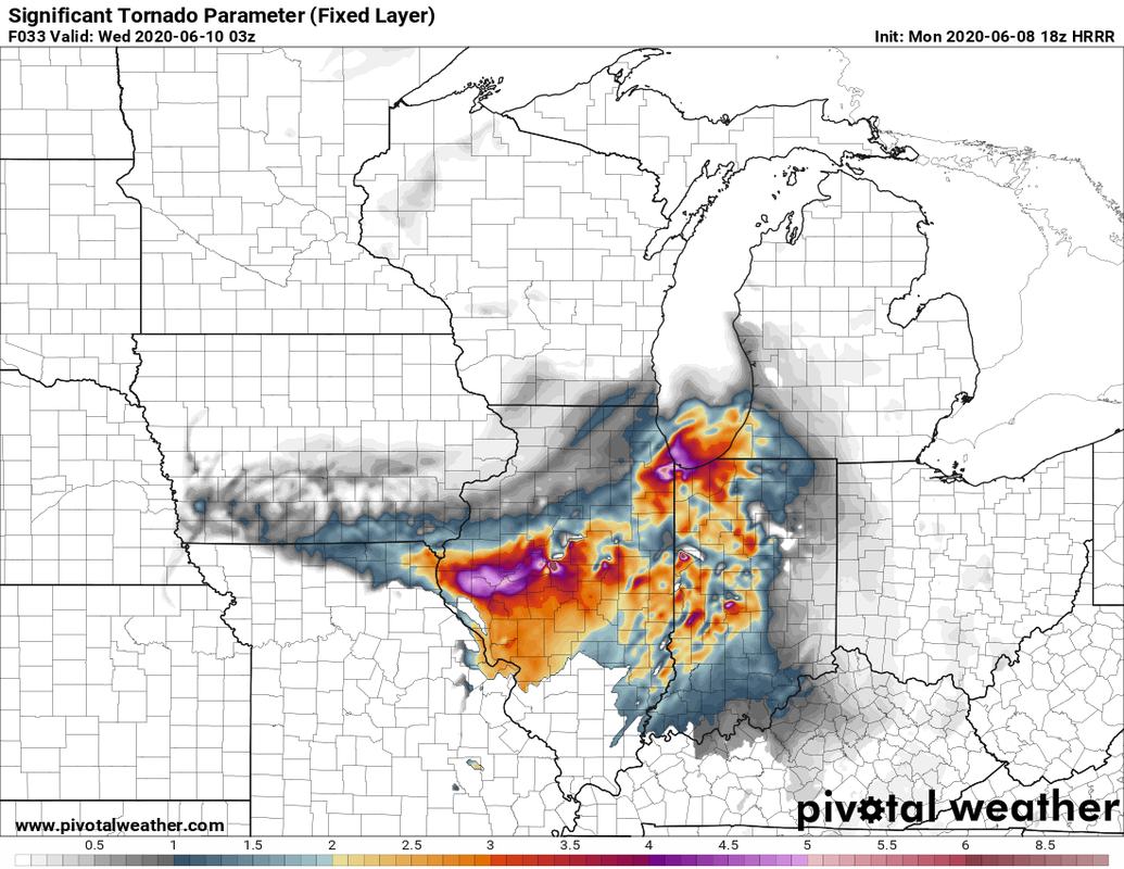 Dont focus on where the great areas are. look more at the pattern of where they are. And just for fun a point sounding for the area. 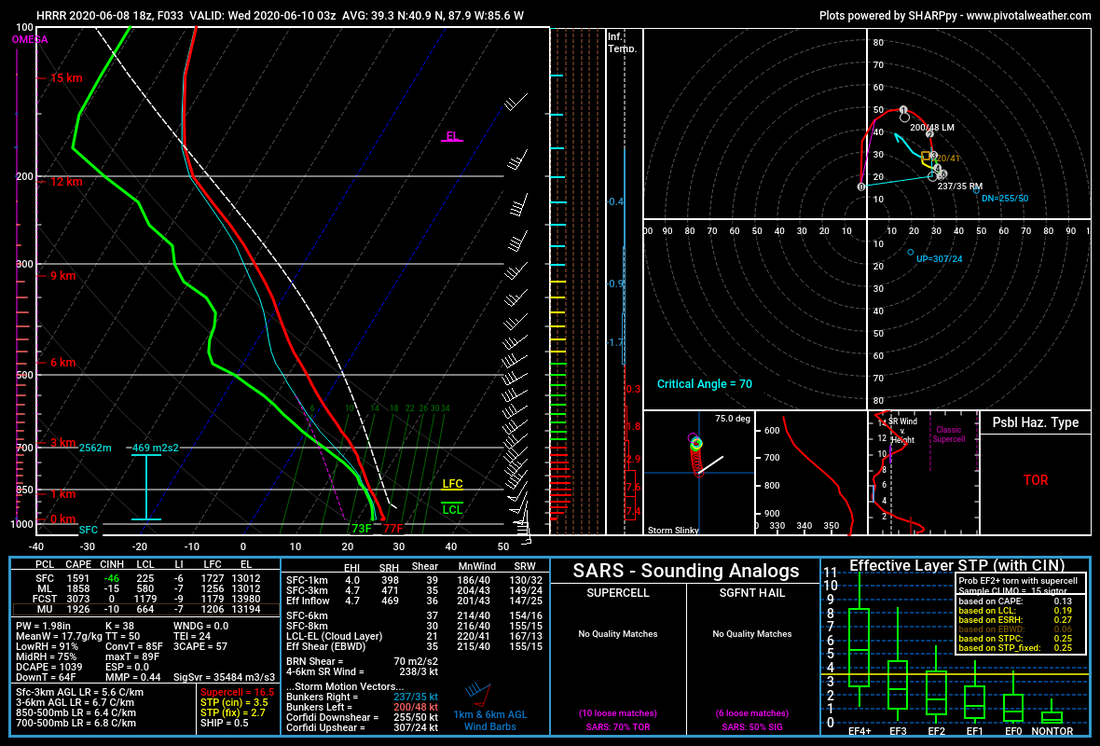 Here is one models(HRRR) simulated radar for tomorrow. remember this is just one model. One thing is for sure. these storms wuld be more of a more discrete/supercell type not a squall line which we are somewhat more used too around here. 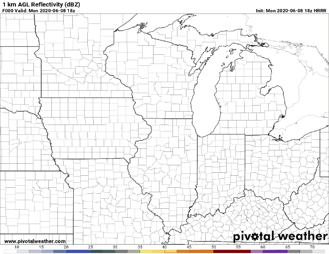 Now there is a big IF here. If there is too much cloud cover there would be as much instability to work with, but still plenty of wind shear. Summary: 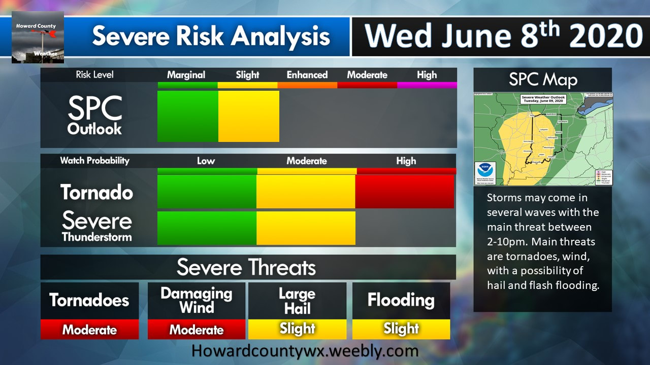
0 Comments
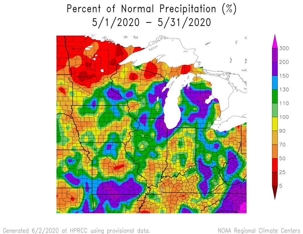
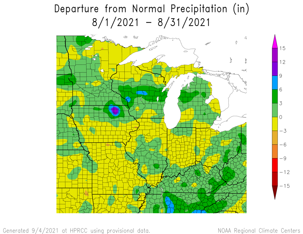
Well we ended May on a warmer note, but May did end up being cooler than average. With precipitation we were pretty close to normal with a little difference give or take.
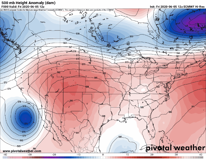
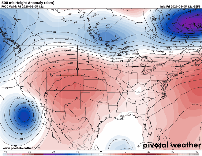
 Now climatology speaking June is the wettest month.  [Note yellow is around 4-6 inches] Now to see if we have any chances for rain, we can look at the overall pattern. Below are the american and european models respectivally showing 500mb anomalies. This is good to see locations of potential troughs and ridges. Troughs mean a center of low pressure and precip chances and more unstettled weather. Ridges show high pressure and calm weather.
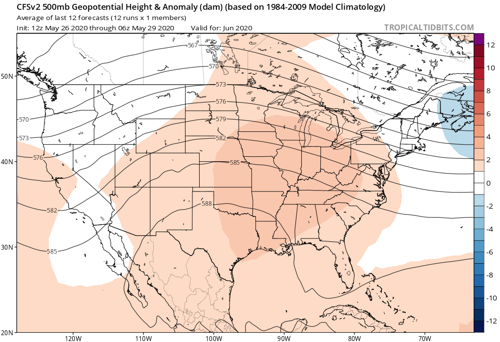 Overall it looks like there will be persistent ridging over much of the month of June. The two model loops above also show Cristobal - more on that later. One other things meteologists will look at is analogs. Analogs are years with similar patterns. So it could be inferred similar patterns lead to similar weather.That is not always the case though. One potetial analog I see with the ridging pattern and the current state of ENSO is 2012. Do not worry, we will not see the level of dryness we saw that year. Here is the CFS monthlies and NOAA forecasts. 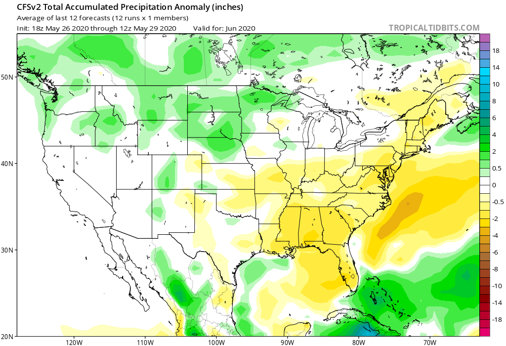 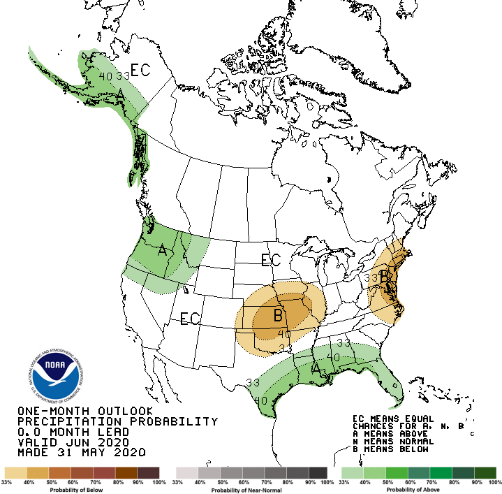 So it looks like June be be dry barring any rain evdnts form the tropics, whcih brings us to our big variable over the next week. This variable is what will remain of Tropical storm Cristobal. Here is the forecast track and total precip through late next Saturday. 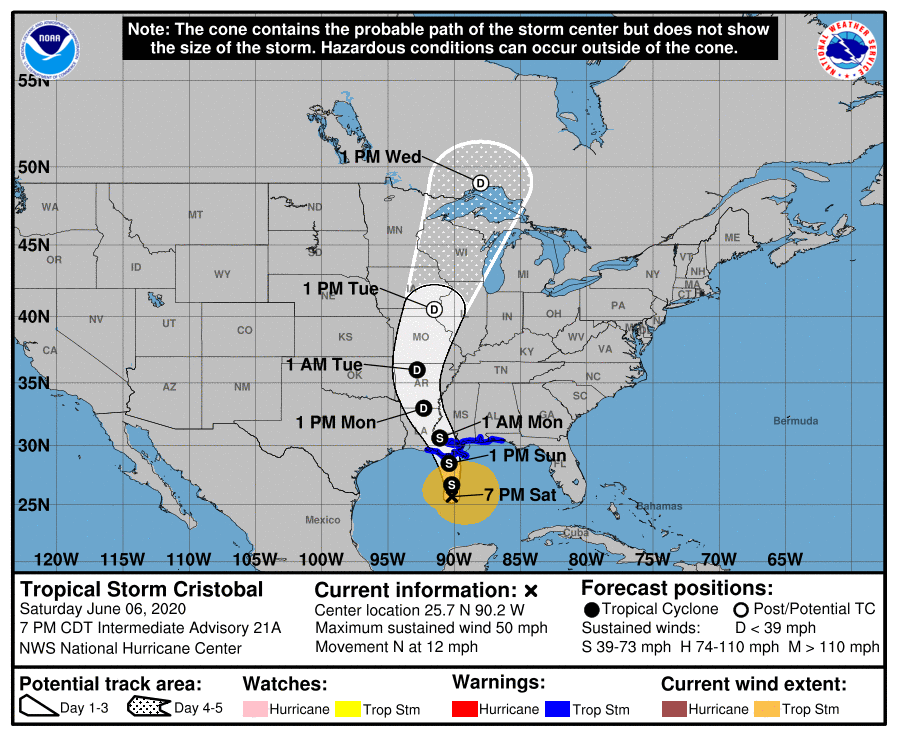 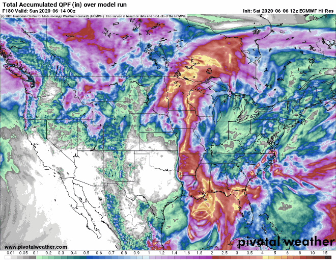 Some models are indicating cristobal will merge with an incoming cold front. it will be interesting to watch with a possibility for severe weather. Though most of the moisture and precip from Cristobal proper look to be more west into Illinois and iowa.
One last note: tropical systems can causes a bit of a "atmospheric log jam" when they occur. So whatever is above you will remain over until the blockage is cleared, and I have a feeling we will see it quite a bit as this looks to be an active hurricane season will be active in the tropics... |
 RSS Feed
