|
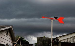
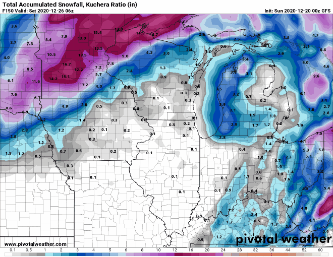
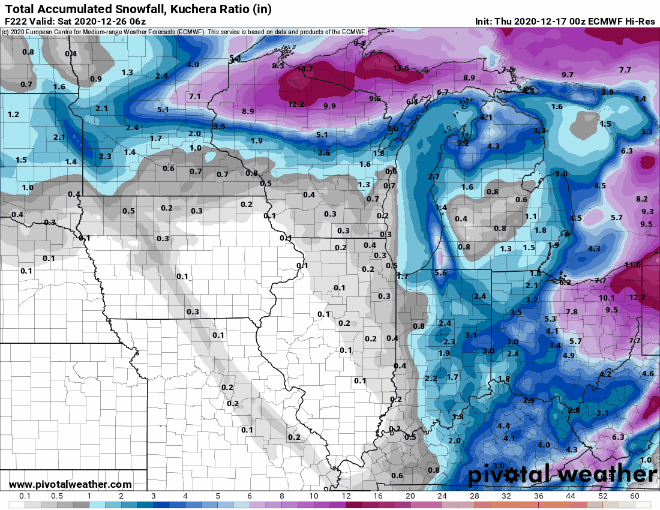
Last year we were seeing high temps on Christmas reaching the low 60s. That definitely won't be happening here this year, perhaps quite the opposite as I am monitoring a possibility of snow on Christmas eve. Here are a few interesting Christmas climatology records. The high temp record for Indianapolis was 64 deg in 1893. The lowest Christmas temp was -15 deg in 1983. The most snowfall was 5.9 inches in 1909. Ok so you are asking yourself "will we have a white Christmas?" Well first here is the annual climatology of a white Christmas. 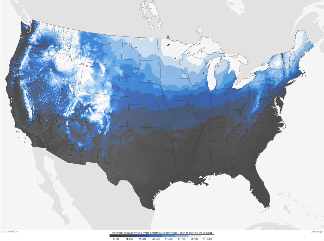 It's hard to see but most of central Indiana, including Howard county are in the 26-40% of a white Christmas. The following NWS winter outlook shows a 40%-50% chance of over an inch of snowfall Christmas eve. 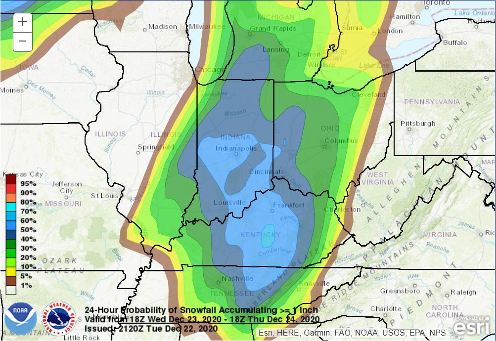 Weather Discussion: A low pressure system currently over the great plains will move into the upper midwest which will bring in a cold front Wednesday night bring rain and very cold temps. At the same time a second low pressure system will form to our south and ride up the front. The combination of lows will give snow to some. 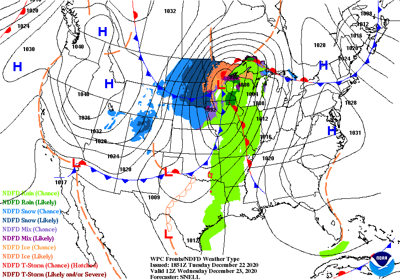 Unfortunately, for local snow lovers the heaviest accumulations look to be in eastern Ohio. 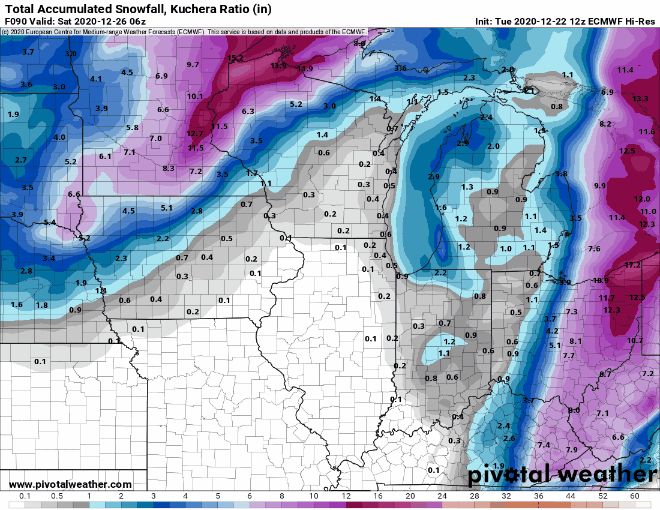 Now, there its a bad thing to take the models at face value. it more important to look at the trends. Below are the last several runs of the GFS and european models. They are trending west. Does that mean anything? I don't know. Models like to flip flop a lot so time will tell.
On simulated radar, we will get rain tomorrow night before the front passes and some snow behind the front. Areas in NW Indiana could cash in some lake effect snow as well. Winds will be very strong tomorrow ahead of the front gusting to close to 50 mph so I wouldn't be surprised if a wind advisory would be issued. 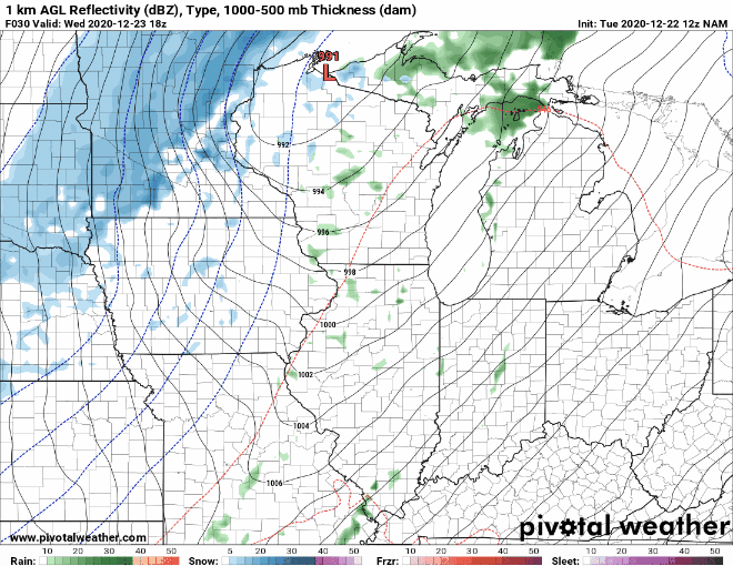 I do believe we will get some snow on Christmas eve, the question is how much. There is a possibility there could be some snow squalls where one area could get a quick 1-2 inches with low visibility for a time, but another area down the road gets nothing. What happens is with the cold air, all the moisture would be squeezed out as snow. This will be something to watch. I may attempt a snowfall map tomorrow, but it will be a very tricky forecast. The bigger danger than the snow will be the very cold air. Here are the forecast morning temps and wind chills Christmas morning from the GFS model. 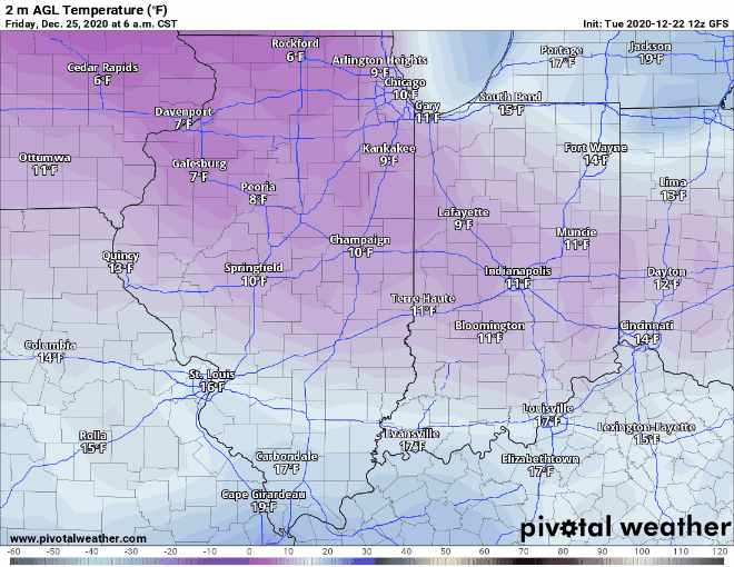 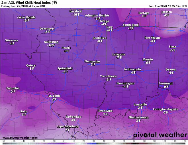 I will have updates on the Facebook page. Remember the forecast can change, but if you ae traveling to Ohio beware the possibility of heavy snow and bundle up Christmas morning so you don't get frostbite or hypothermia.
0 Comments
|
 RSS Feed
