
|
Memorial Day saw a high of 87 deg and was overall a very nice if not hot day. With a little bit of research, the average high for Memorial Day over the last 20 years or so is 78 deg! So far today we have reached 82 deg and yesterday saw a high of 88 deg. Overall May was on the cool side with much of the state averaging 2-5 deg below normal. Precip amounts were near normal with some areas below average and others above average. This is most likely due to the recent rain last week.
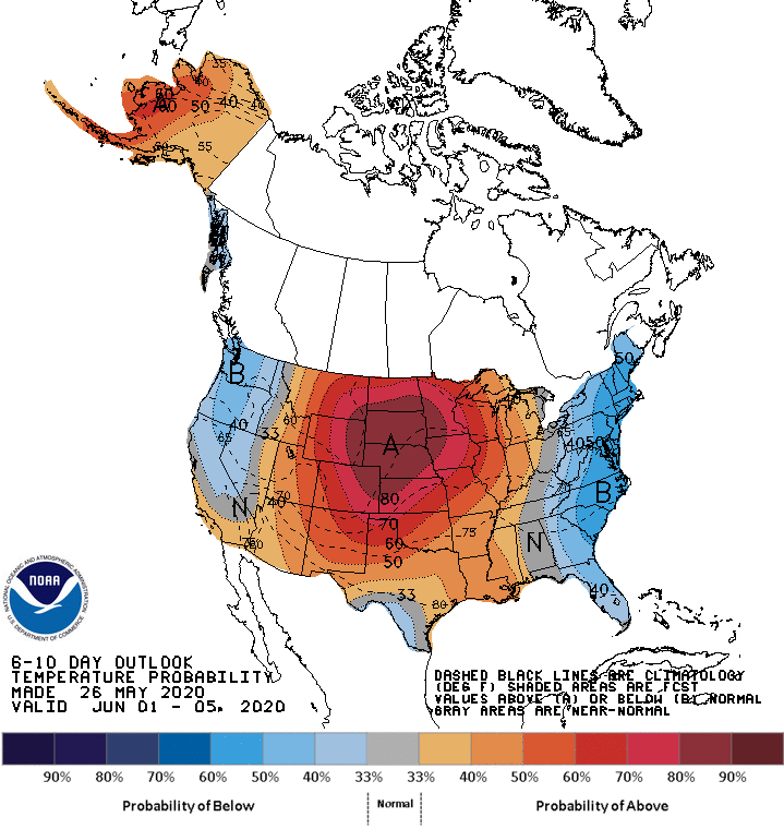
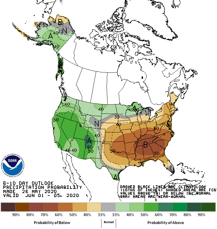
Now if you only look at the last week or so, we are above average on temperature. With the cool start to the month we will end cooler overall. 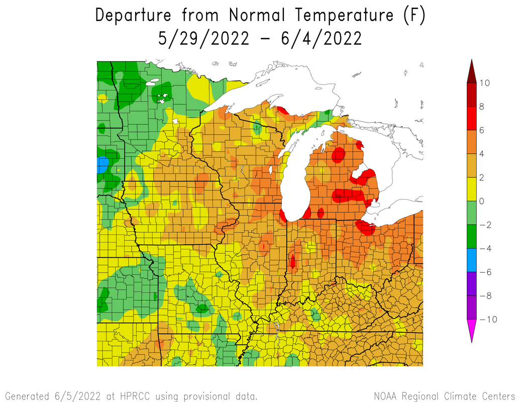 Now you may ask, what June going to be like? Lets first take a look at the official Climate prediction Center's forecast for the first week of June, and the CFS weekly.
 overall, we are warmer and drier than average. This is thanks to a strong ridge over the central US. This an example of an omega block, because the pattern looks like the greek letter omega. 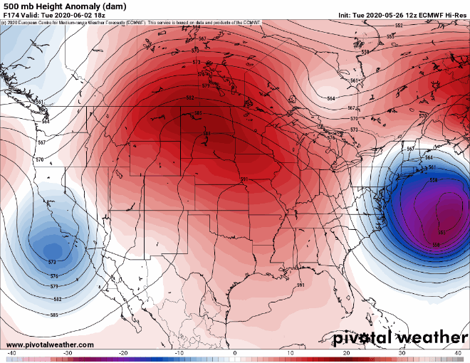 Right now this is what we are looking at. The midwest is warm while the central plains are cool. Well our old pal, a stalled cut off low over Oklahoma 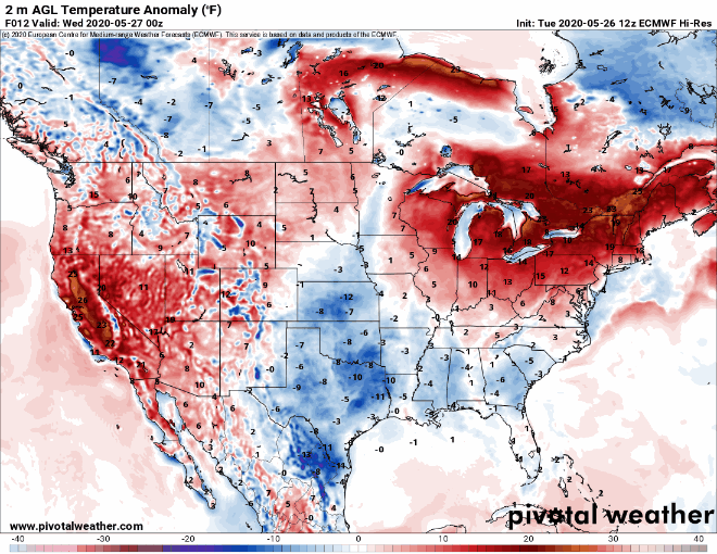 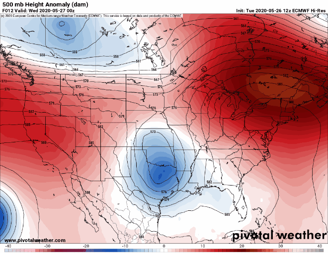 I will also include temperature anomalies out to 384 hours out for fun. 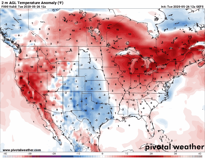 We will mostly be warmer than average, but with a cooldown this weekend from May 30th-June 2nd. This is supported by the MJO entering into phase 8 which for this time of year is cooler than average. After June 2nd the PNA flips from positive to negative which means ridging over the US. The MJO will also enter phase 1 which calls for warmer temps. Also, the that it looks like it could go cooler or average later around June 10th, but this is what I call "model fantasyland." the farther out a model goes, the more wrong it can be. it could either happen or it doesn't. june still looms to be warm. Another teleconnection you may have heard of is ENSO which is currently neutral bordering on its La Nina for much of the summer, which tend to be warmer. 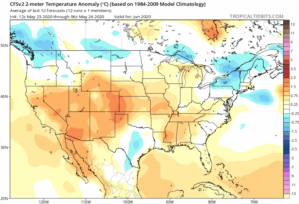
0 Comments
|
 RSS Feed
