|
It's been a while since we have talked about the chance for severe weather. Actually it has been nearly 3/4 of a year since we have seen a tornado warning in central Indiana. 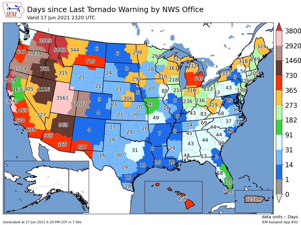 That could change tomorrow, but the threat of tornados to smaller than strait-line winds and hail or even torrential rain. There looks to be three mains rounds we should be concerned with. Round #1 should form overnight to the northwest and mainly affect the northern third or so of the state. A couple models want to take this complex in earlier and more south. I would say this round will pass through around 3am-9am timeframe. 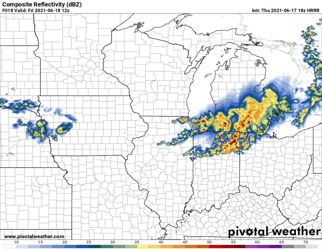 This first round is key to the strength and amount of storms tomorrow afternoon and evening. Generally the more clearing you see, the stronger potential storms can see. This allows the atmosphere to refuel. Here are the projected highs and depoints tomorrow.  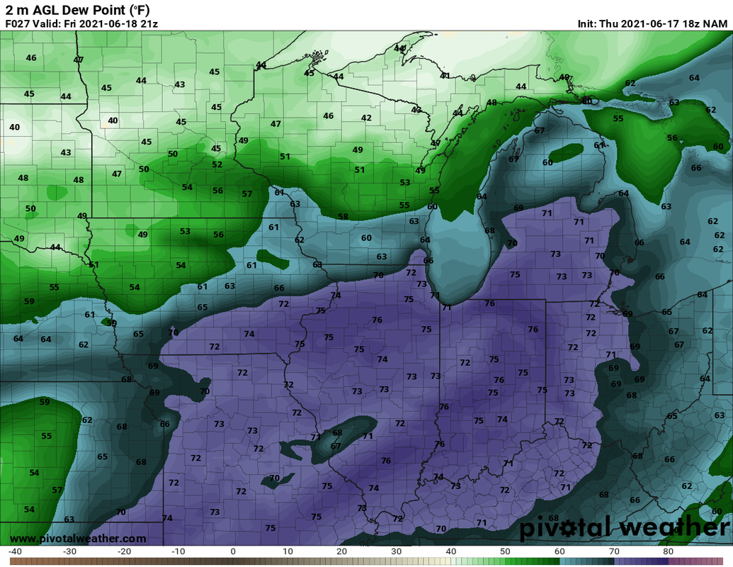 It's going to be pretty hot and very muggy day for sure. This allows for high levels of atmospheric instability or CAPE (Convective Available Potential Energy). Levels of CAPE look to be over 4000 j/kg. This is actually quite a bit of CAPE to see for our area. 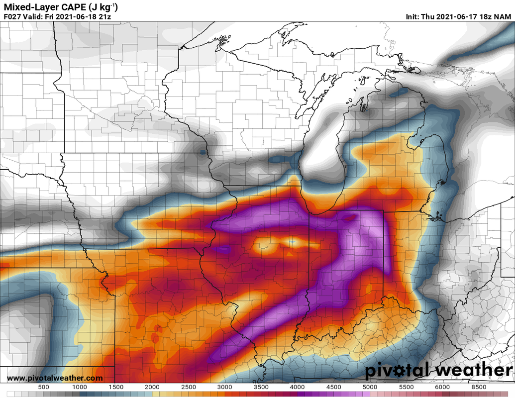 Other indices are elevated as well. While there isn't an overly large amount of wind shear, this environment can offer up risk for large hail and tornadoes in any supercells that could form. The threat for tornados is not zero, but increase from west to east. 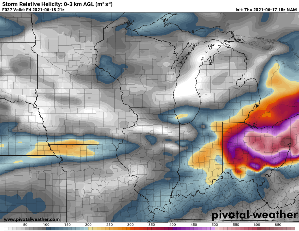 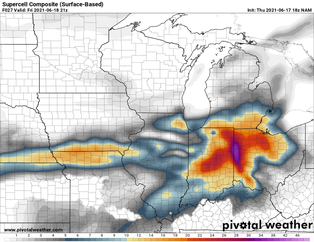 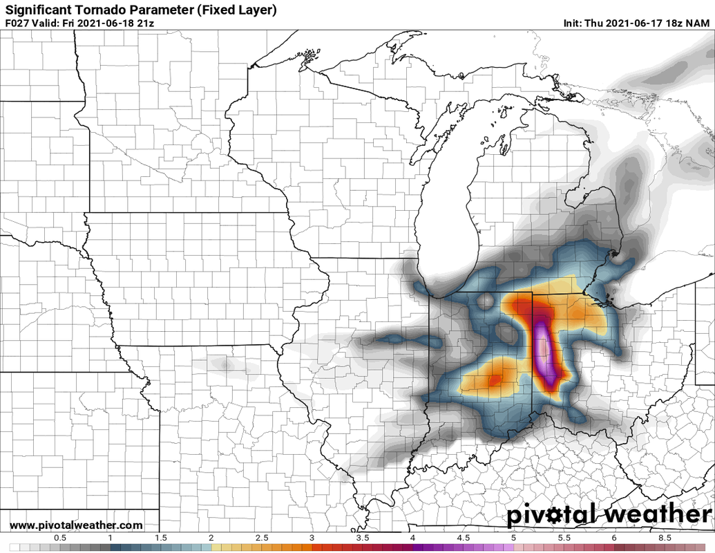 Round #2 looks to arrive between late afternoon through 10pm or so. Im attaching the NAM 3K models simulated radar during our main timeframe. There are still disagreements with specifics, but it gets the main point across of what I'm thinking. There could be several subtle boundaries that storms could fire on that dont show up well. 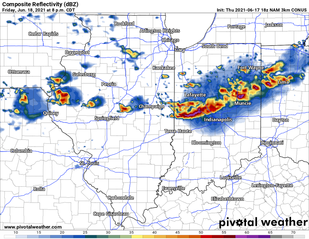 Round #3 will arrive Friday night unto Saturday morning. 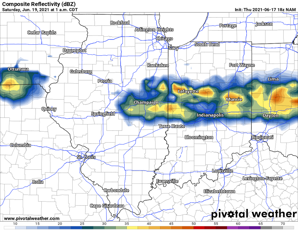 The severe weather, may make the headlines, but we need to be concerned with flash flooding as well. These storms have the potential to train 0ver the same areas for hours. Here is how much precip we could get through Sunday morning once everything is said and done. This is rain we need. 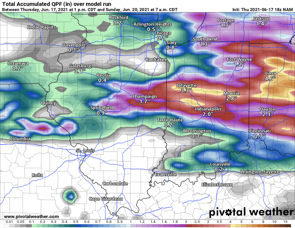 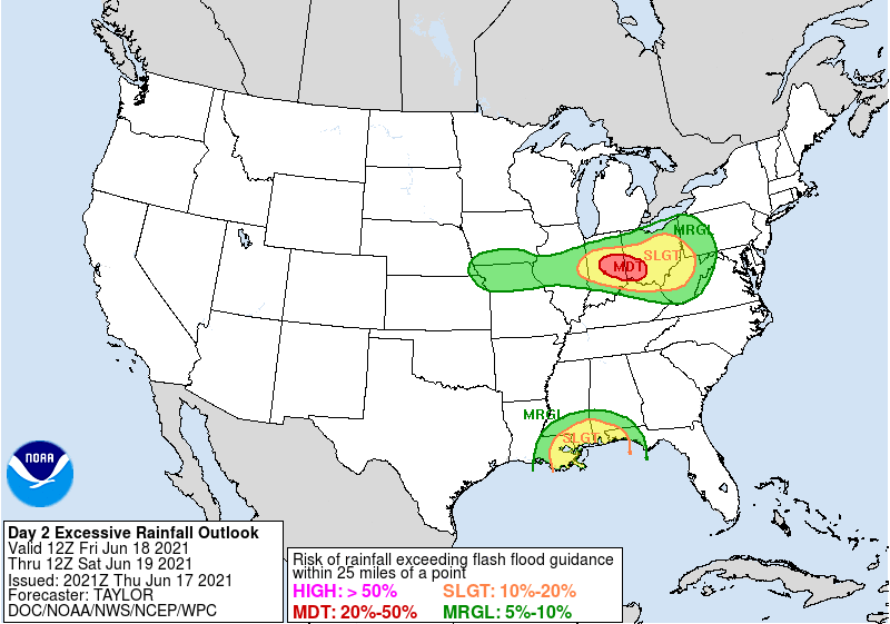 We are in an Enhanced risk for severe weather tomorrow. This has the potential to be upgraded and be a decent severe risk, but there are several failure modes that could still happen. 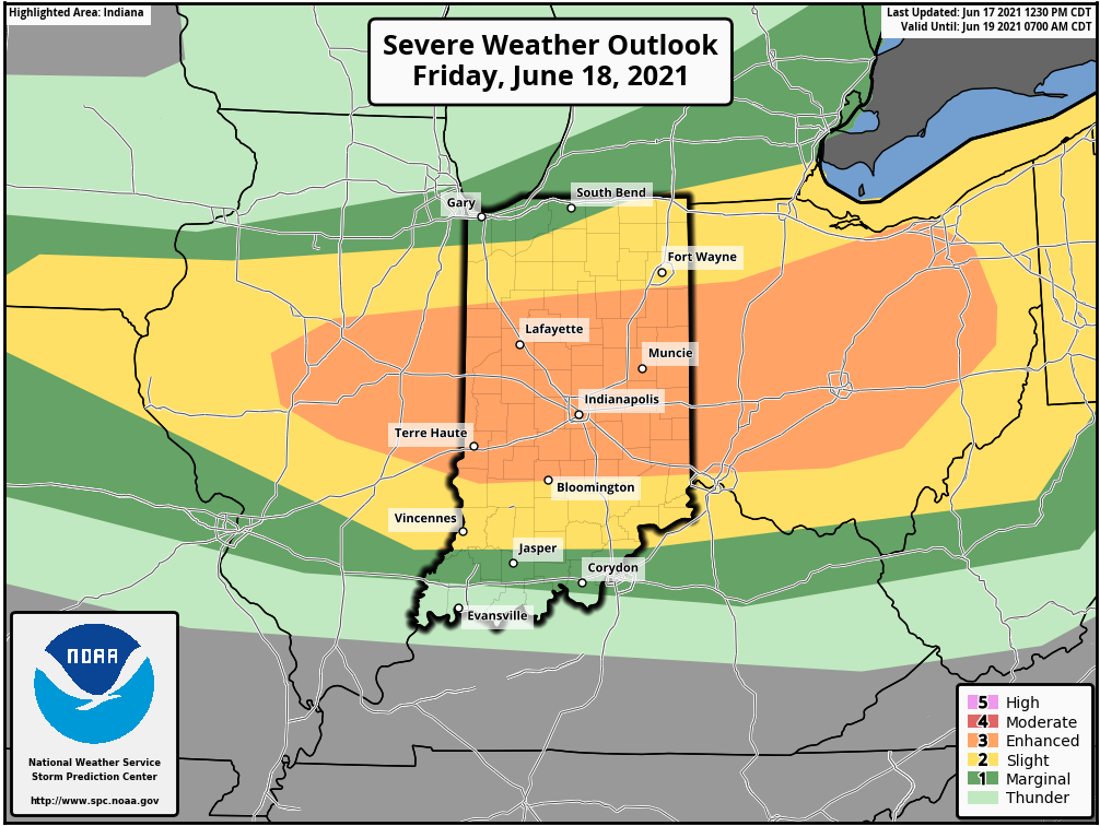 Make sure you keep an eye on the Facebook page and have several ways to get information.
0 Comments
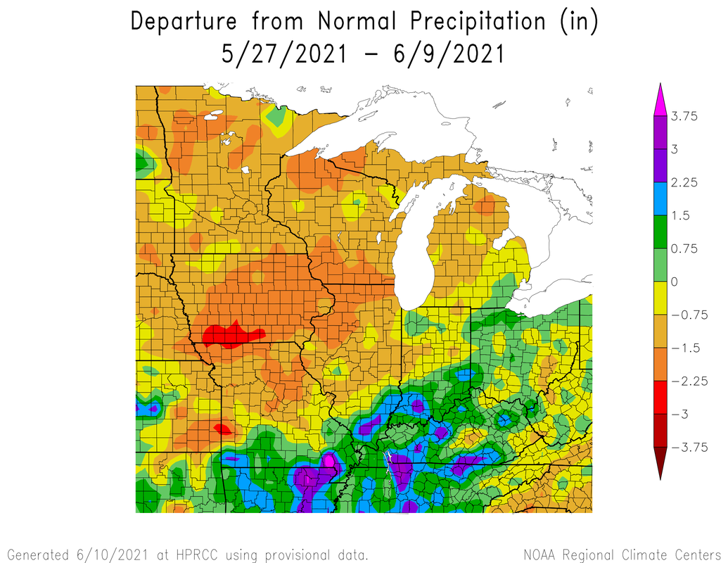
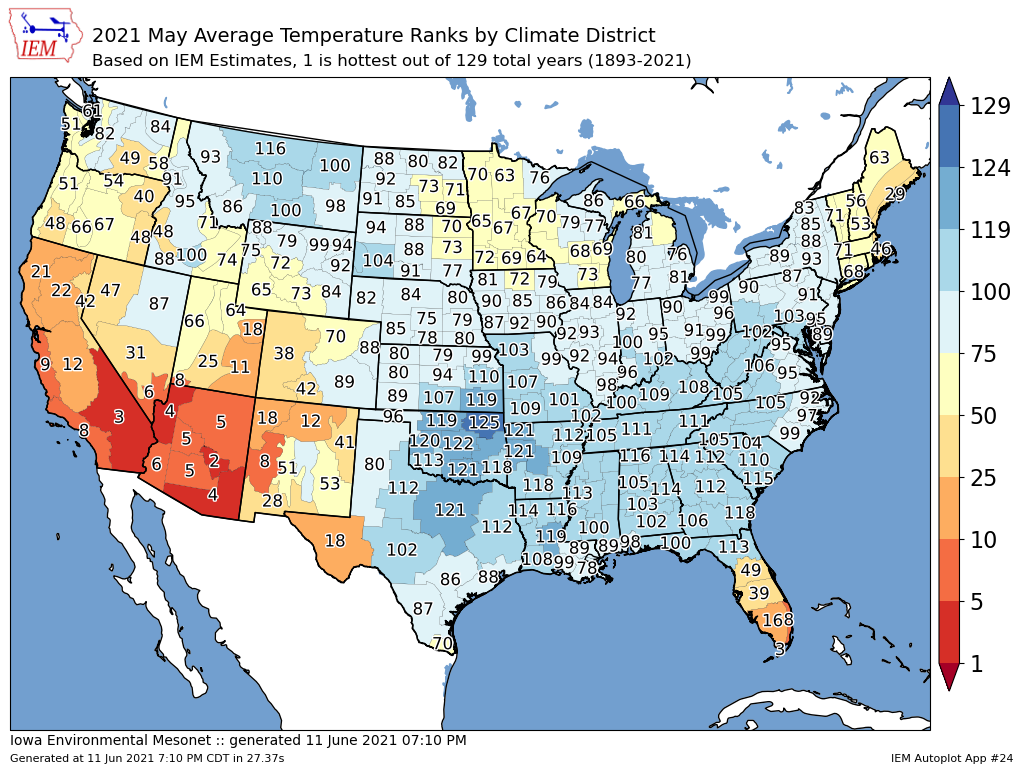
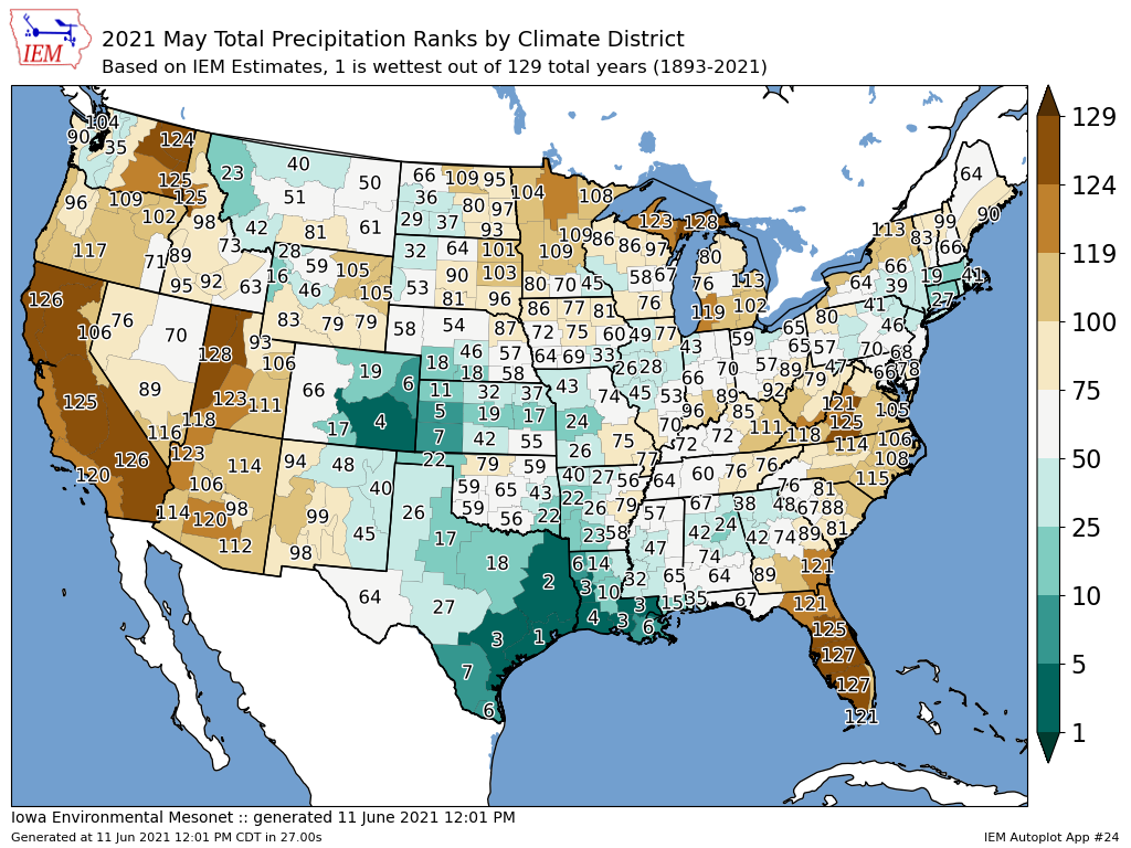
Warm and Dry.We have had a bit of a topsy-turvy pattern around. We started mid May with below average temps, then warm, to above average and then cool to seasonal again. Here are the temperature and precip averages and anomalies along with percent of normal precip.
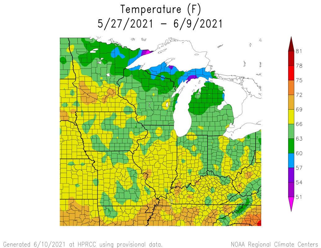
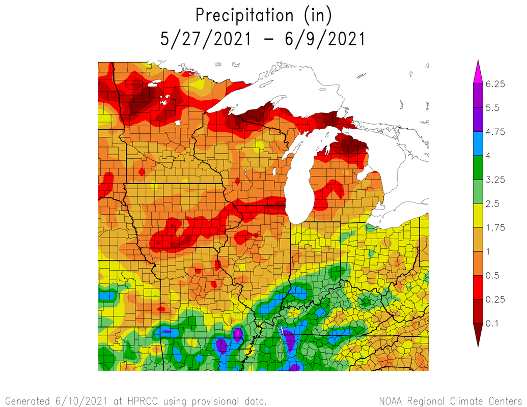
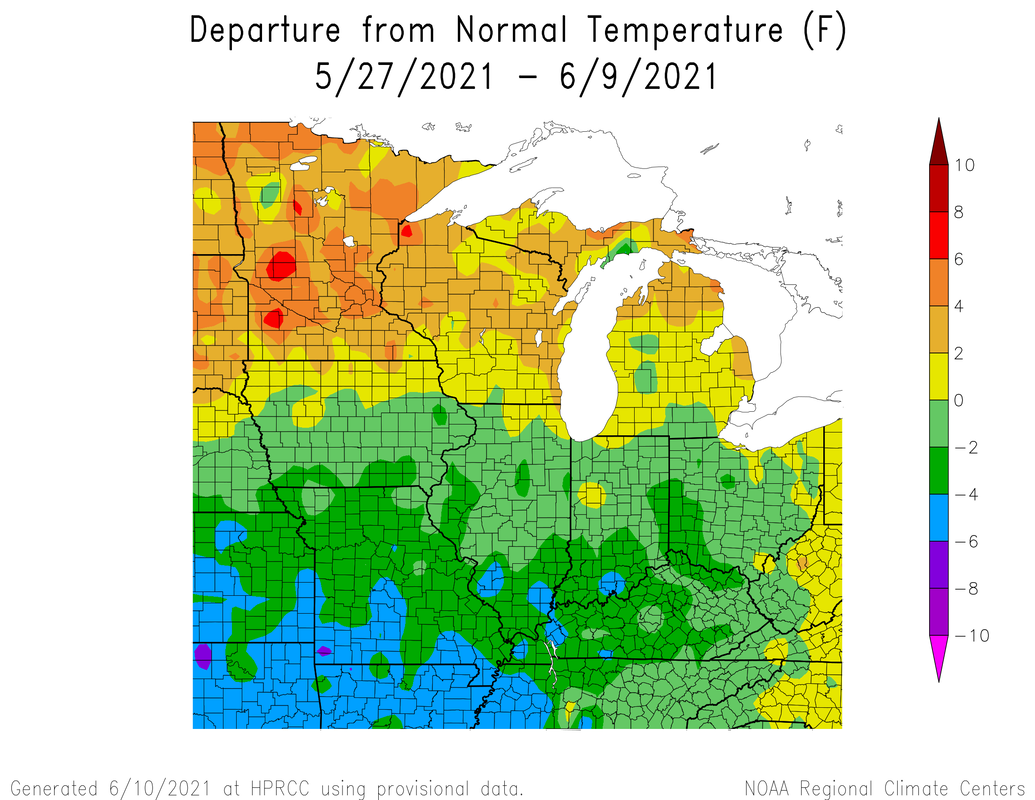
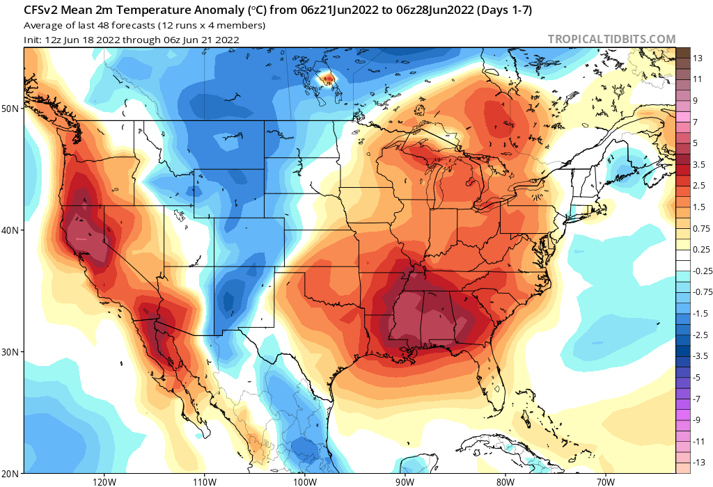
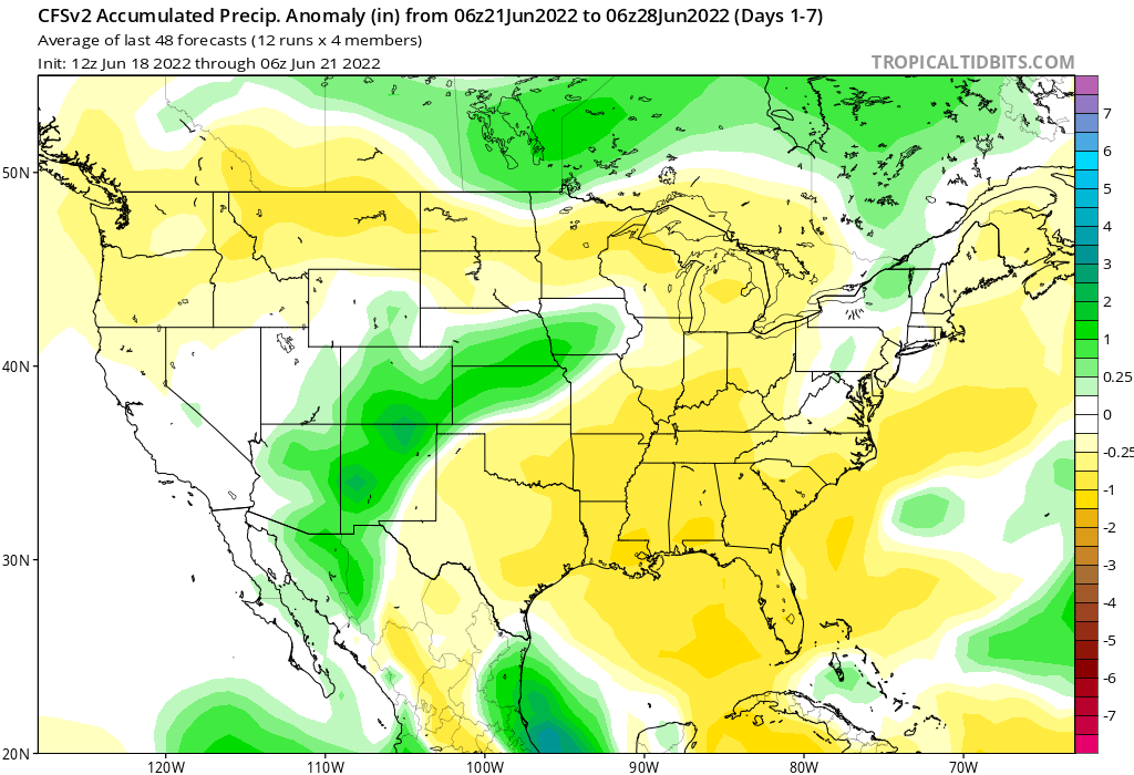
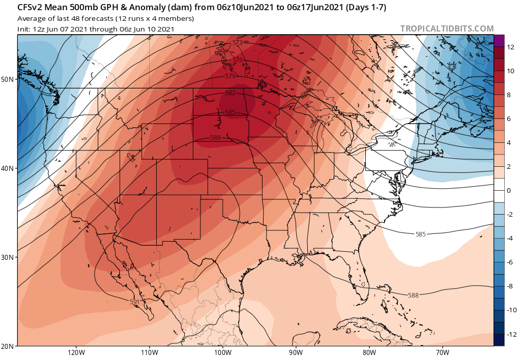
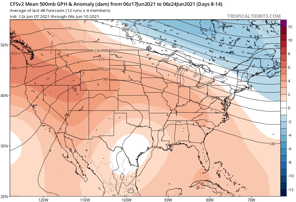
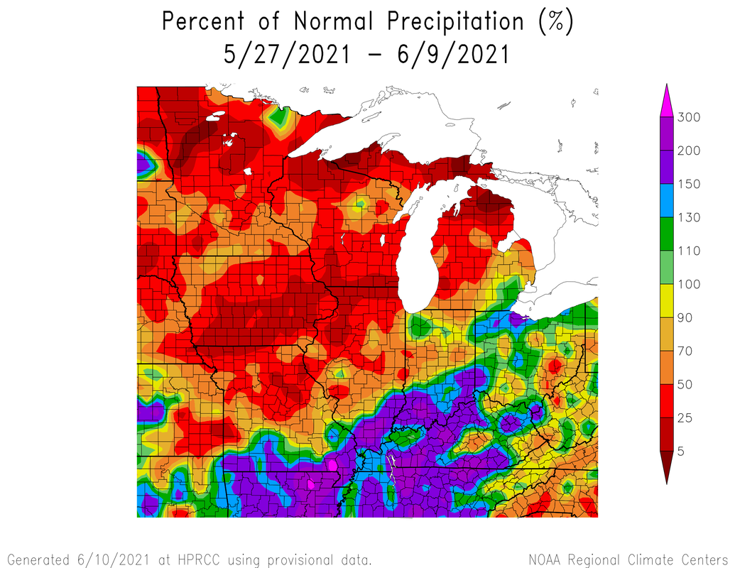 Here is the accumulated precip amounts for the last week. 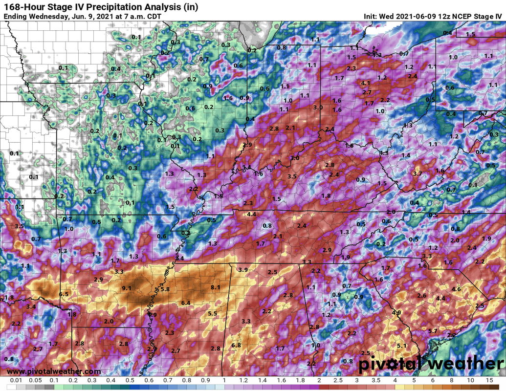 Temperatures have been close to average with the cooler temps near the beginning of the two week period. The last week has been warmer than average with most parts of my state being 0-9 degrees above average. The southern areas of the state have seen above average precipitation while the northern half have been drier. Some areas of Michigan, Wisconsin, and Illinois are in moderate-severe drought. 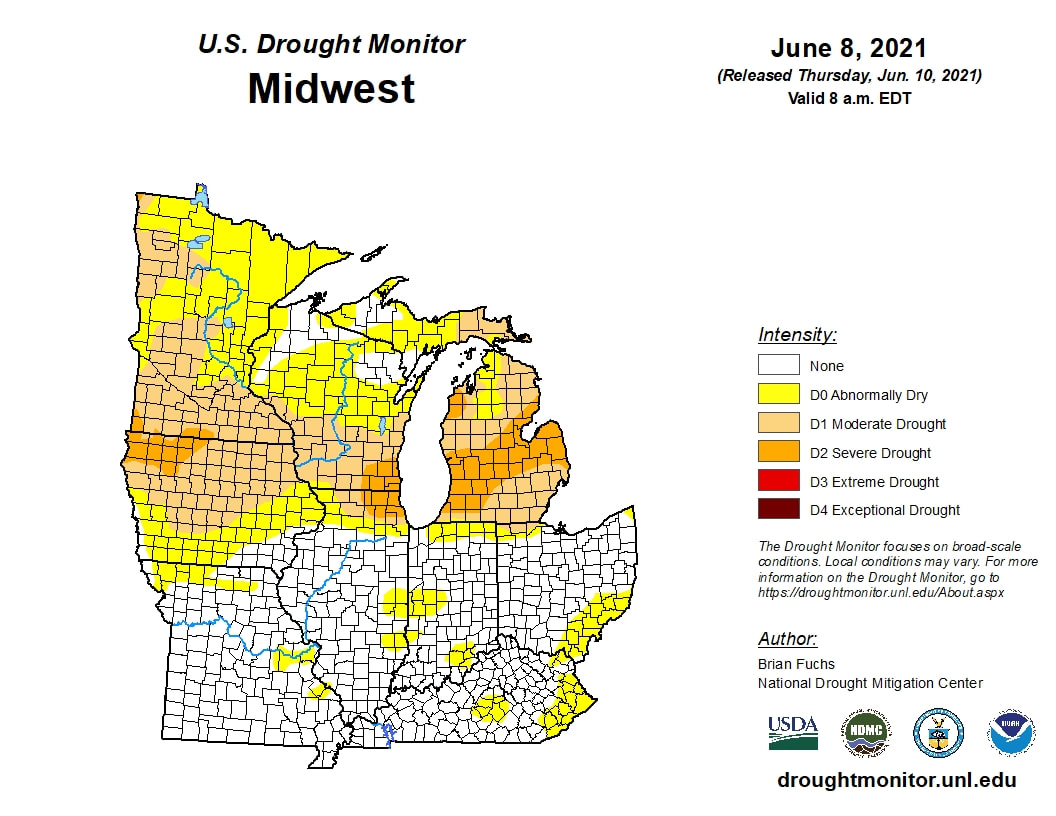 This weekend could be the warmest we have seen in a while with temps close to 90 and quite possibly could reach 90. The heat dome will be positioned to our west.  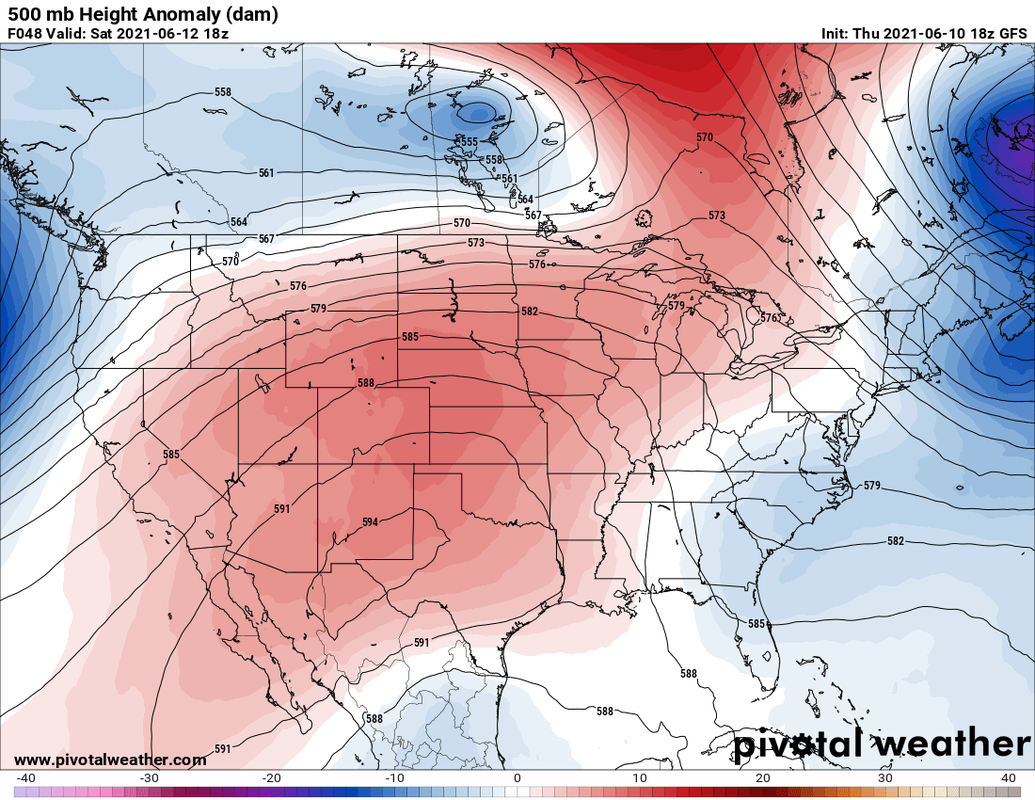 Fear not much lower dewpoints are on the horizon! 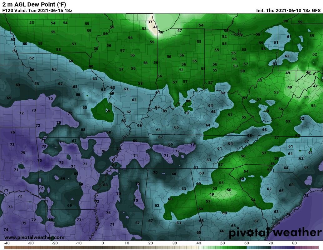 The following graphics are the temperature, precipitation, and 500mb anomalies for the next week (days 1-7) and the following week (days 8-14.) Generally we look to be warmer than average along with drier conditions.
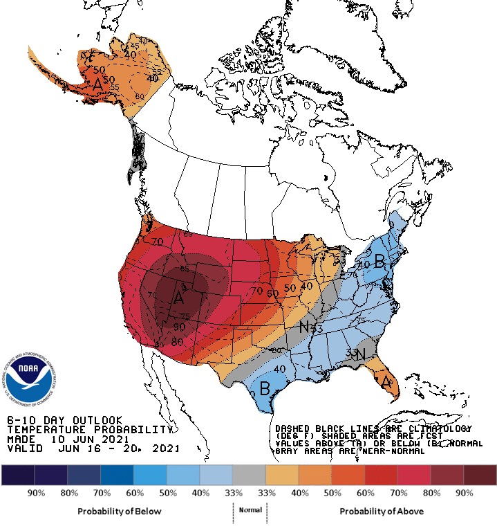
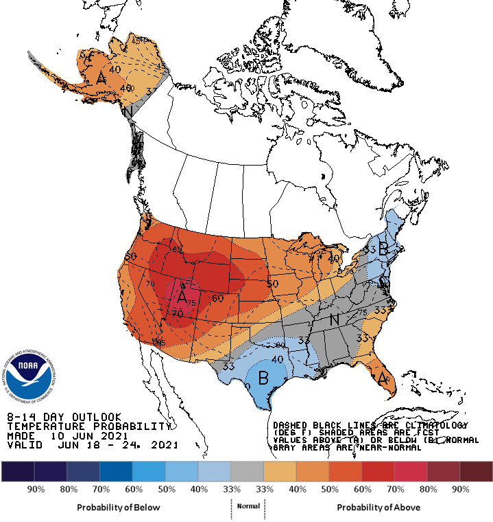
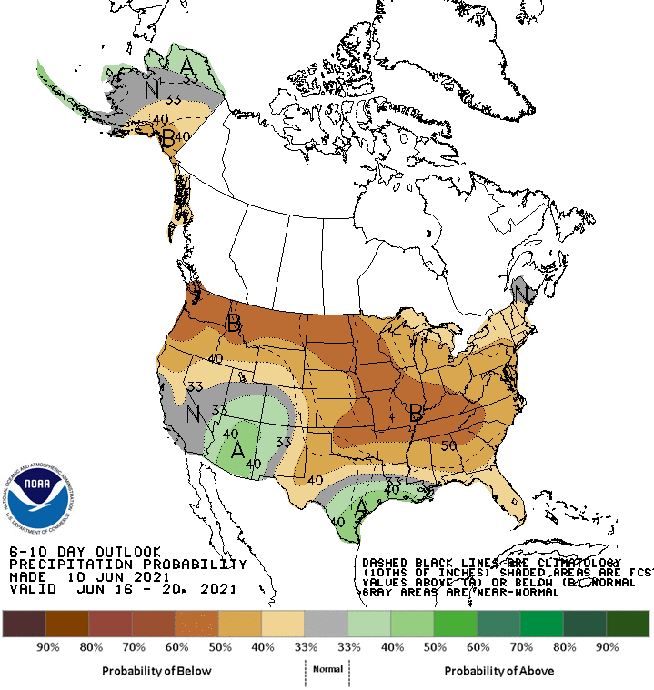
N0w the Climate Prediction Center predictions.
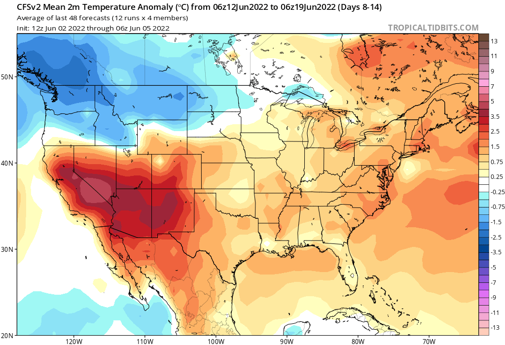
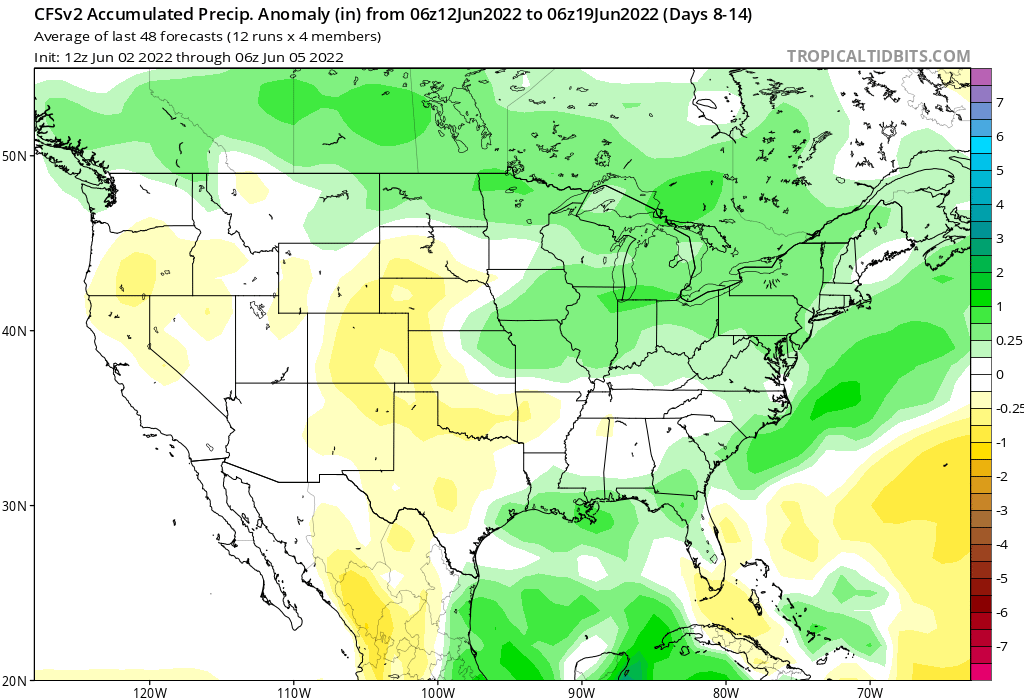
These support the ideas from above. Teleconnections also support this idea of the next couple weeks. A teleconnection is a linkage between weather changes occurring in widely separated regions of the globe. There is a presence of a positive NAO, neutral PNA and the MJO is transitionong from phase 8 to 1 and 2 over the next couple weeks. These support the idea of a drir warmer period especially after next week. So this last part doesn't focus on the local area, but the overall US. Much of the US is much warmer and drier than average.
There is a saying "same breeds more of the same." This means that if an area is warmer and dry, it will probably stay or get warmer and drier. This can also induce higher pressure. I suspect with the very dry areas out west and the upper midwest we will start seeing more ridging west of us. This could at times put us in a northwest flow pattern. 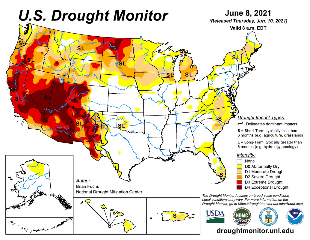  We should soak up any rain whenever we can get it with the present dry conditions in the region.
|

 RSS Feed
