
|
Meteorological winter started December 1st and we have seen some cold and some warm. I expect to see more topsy turvy weather flips like this to reoccur. Without further ado, the 2022-23 Winter outlook! I am including a quick summary if you don't want to read the entire blog post Quick Summary
December We have started the month cool and it looks like we will stay that way with short warm periods mixed in mainly early on. Look for warmth returning late this weekend and early next week, before being pushed out by colder temperatures midmonth. There is potential for some storm systems (like between the 10th-14th), but it is WAY too early to say whether they will produce sizeable impacts or not. The big question I'm sure some may ask is what the chances for a white Christmas are. At this time, I would say we have an average chance, but that can of course change. 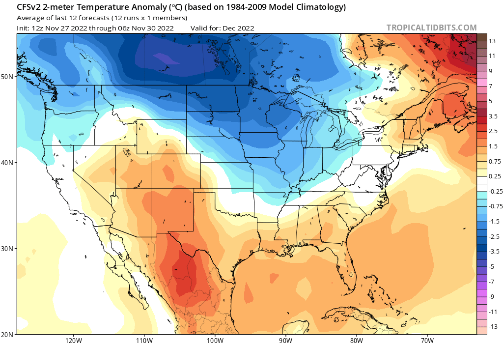 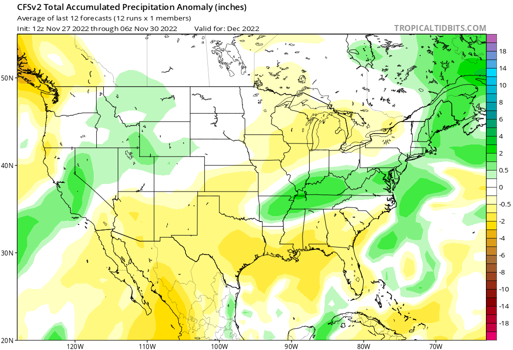 January Models have flip flopped on January temperatures, but I am more in line for a warmer solution. Based on the CFS weeklies for late October we will end 2022 cold before heading into a January thaw. Don't be fooled by the warmth, it will still most definitely be winter still. While the month msay be warmer overall we can still stee shots of average to cooler than average air midmonth. With the warmer temps with cooler than average temps just to our northwest we could see a battleground of airmasses set up in the Midwest. This would make me concerned for the threat of ice/freezing rain and wintertime severe weather. It will all depend on where the polar jet stream sets up shop. 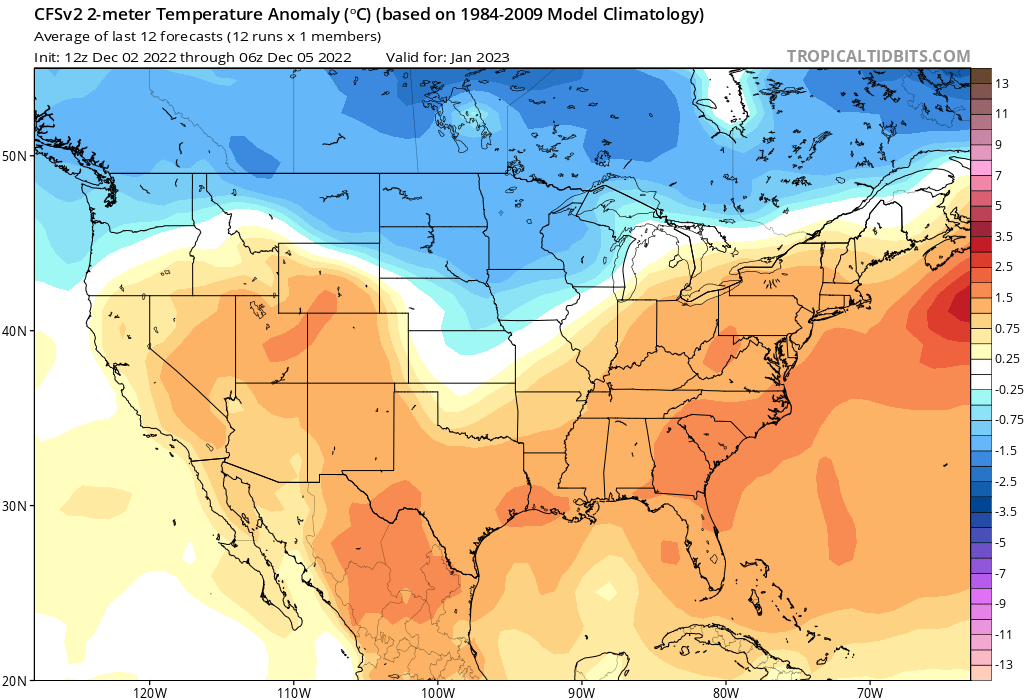 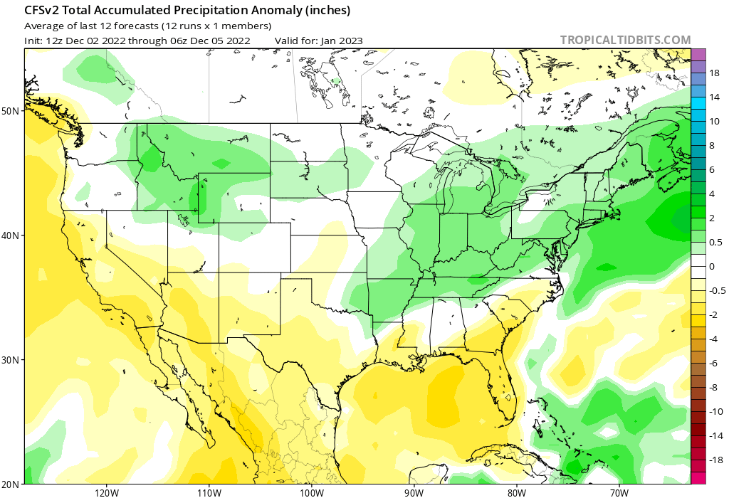 February Once you get to the end of January and enter February you only have 30 days until meteorological spring, so you're almost there with warmer temps on the horizon. But reconsider that idea. For the last couple years February has seen some of our coldest temps and biggest snowfalls. We saw over a foot of snow from one storm alone in early February this year. I don’t expect that to change especially with our rare third year La Nina which favors a back loaded winter. 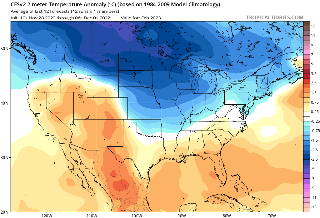 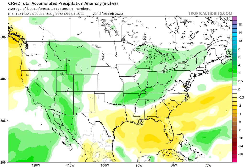 March March is still a long ways away, but I will touch on some early thoughts. Right now March looks wet and war, but that could easily change. If we go warm I can see increased chances for severe weather. If February's cold sticks around we could see more snow. Yes, March can see snow especially if there is a snowpack in place from February. 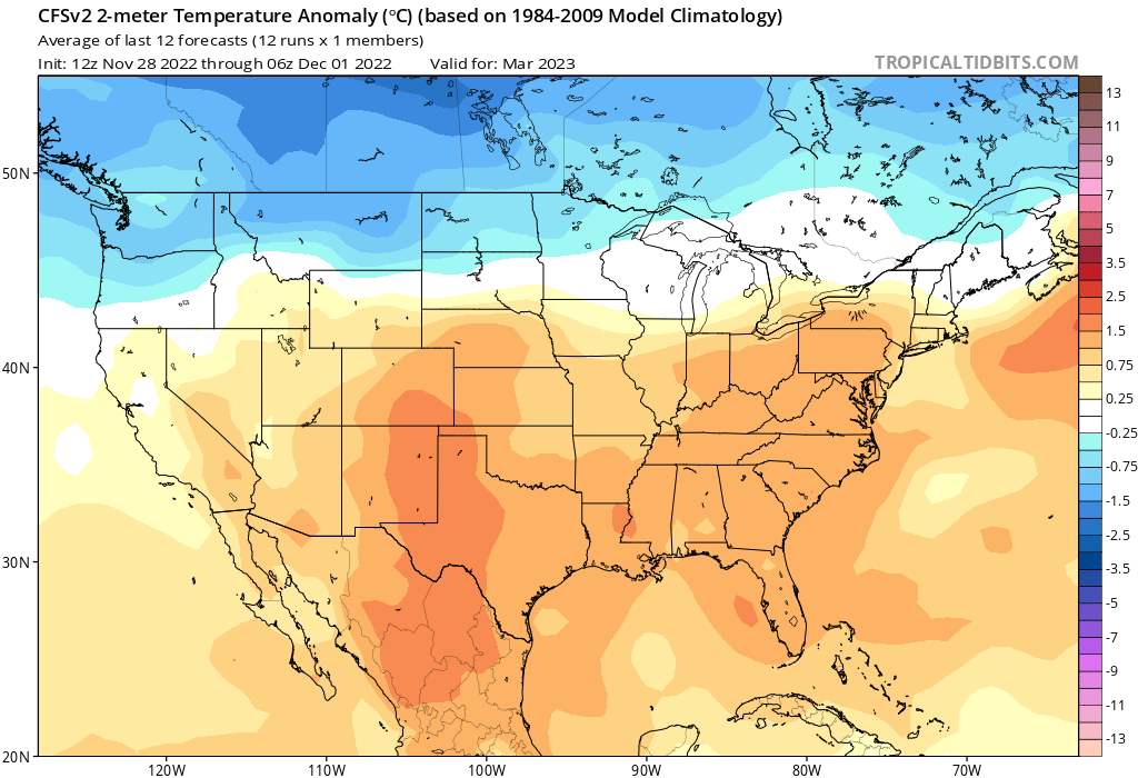 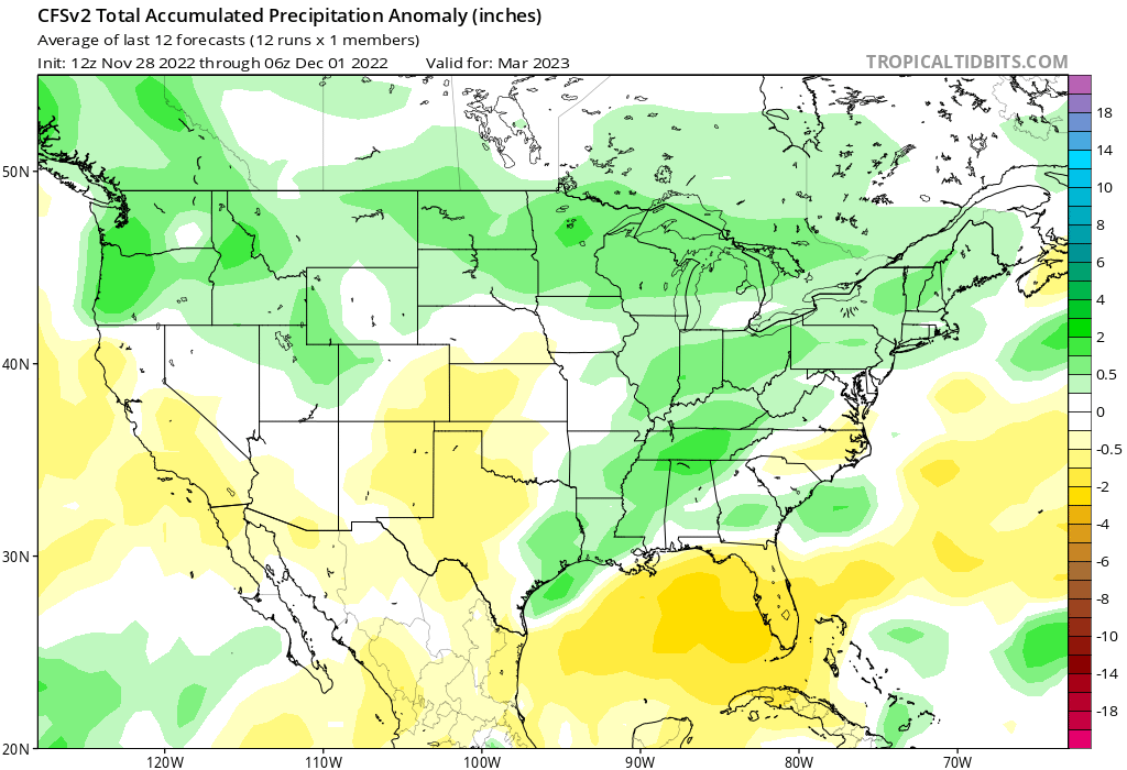 Final thoughts
There are risks with making any kind of seasonal or sub seasonal outlook/forecast. As I went over in the last blog post there are so many moving variables you need to work with and adjust for. During warm periods like January we can still see cold air and vice versa for cold periods. Another risk is whether a southeast ridge ridge sets up. If that happens, that would be a warmer risk to the forecast. Another is the speed of the change in the teleconnections and could affect timing of pattern changes though I believe the pattern above will be the main one. It's too early to say exactly how much snow we get on average this winter. When and where really depends on storm track and placement of cold air. I think I may write another post later talking about potential types of winter storms we can see later
0 Comments
|
 RSS Feed
