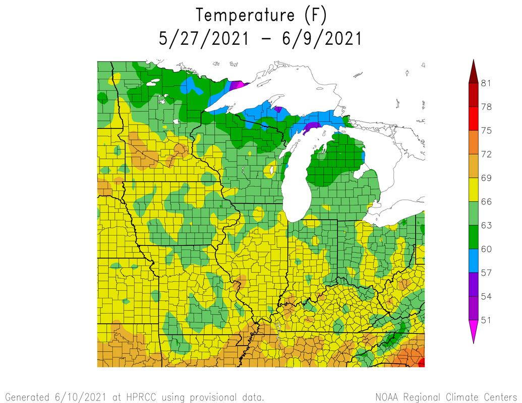
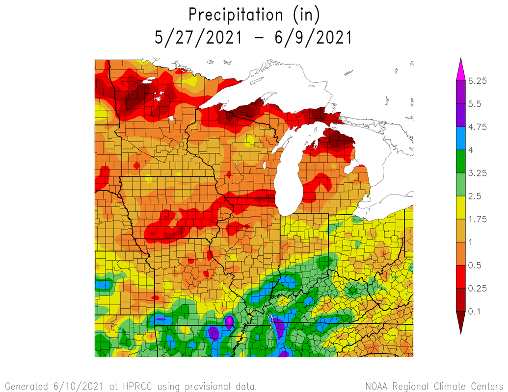
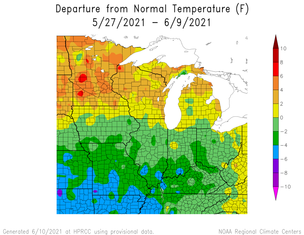
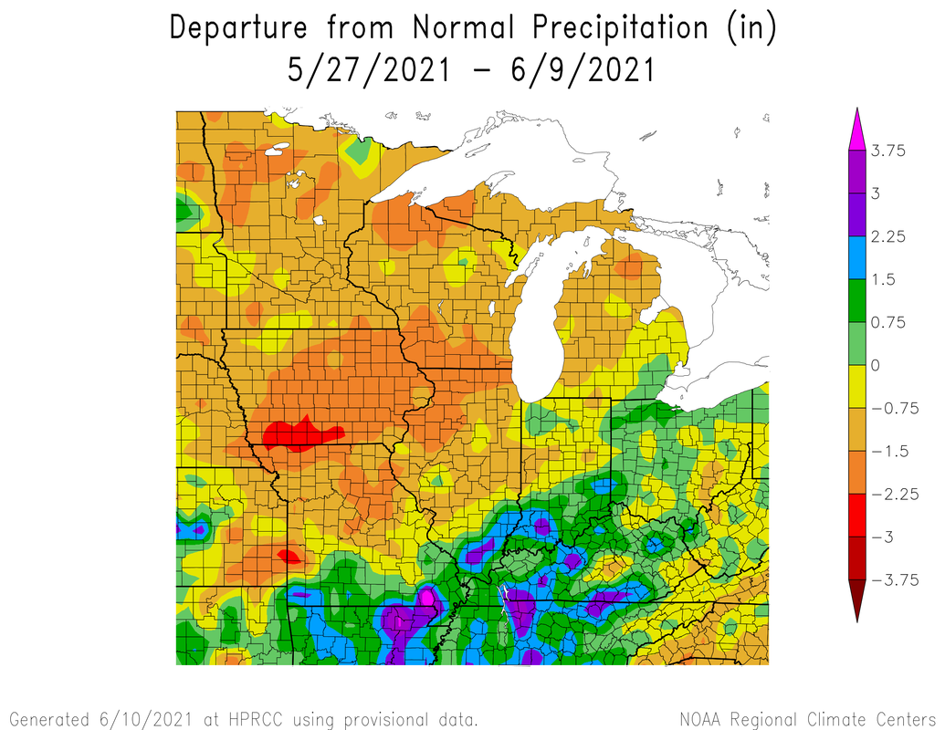
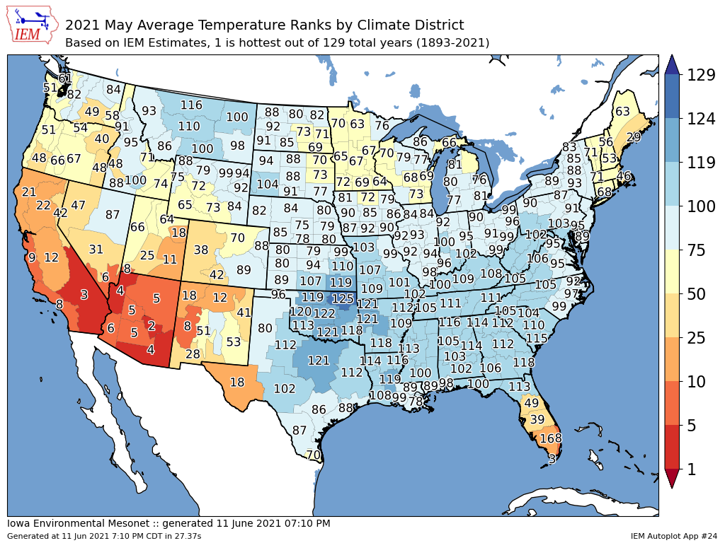
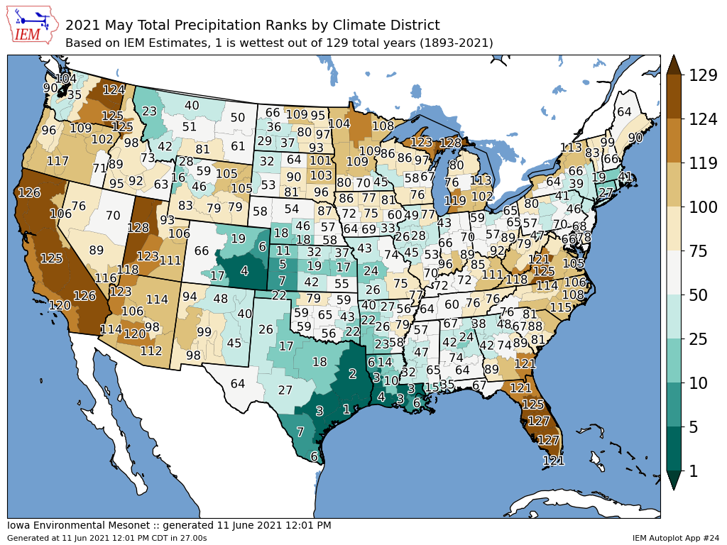
Warm and Dry.We have had a bit of a topsy-turvy pattern around. We started mid May with below average temps, then warm, to above average and then cool to seasonal again. Here are the temperature and precip averages and anomalies along with percent of normal precip.
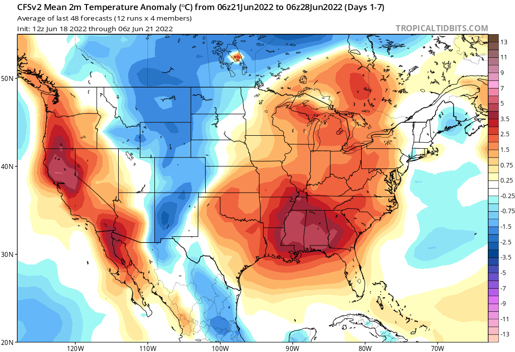
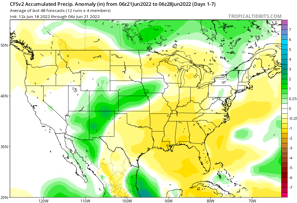
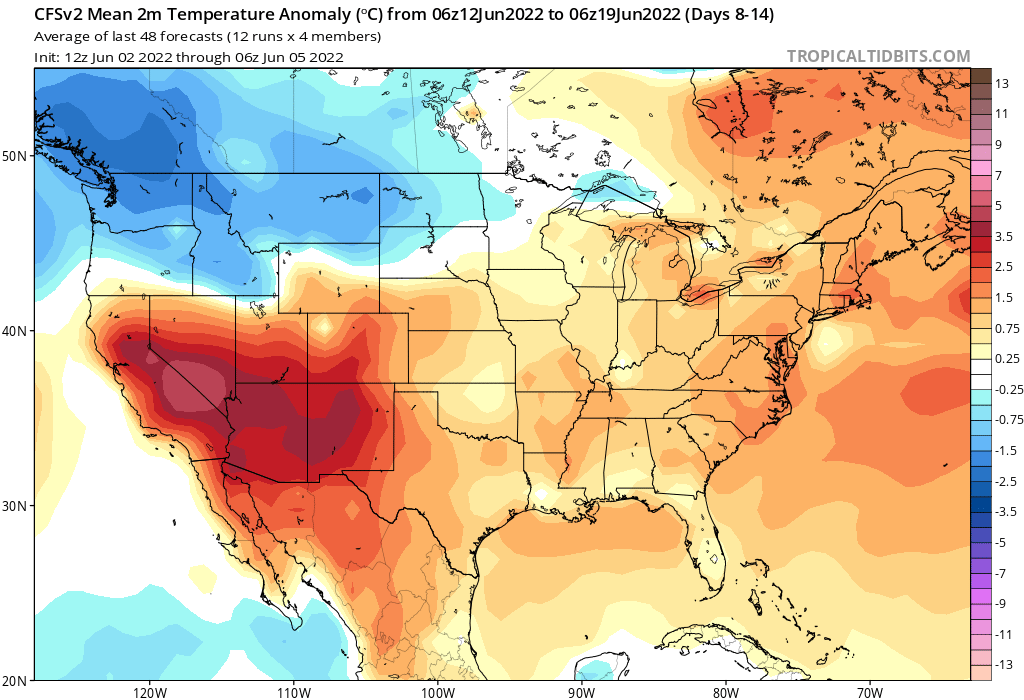
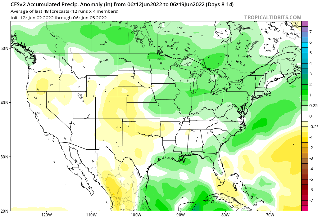
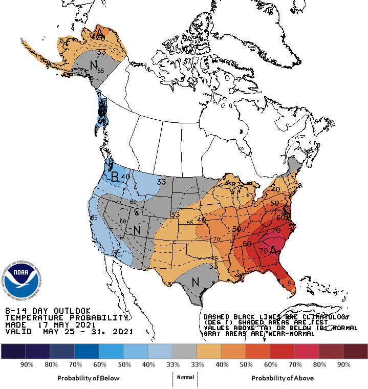
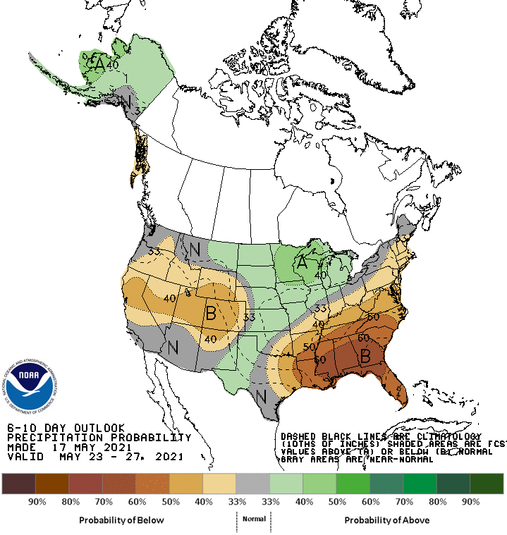
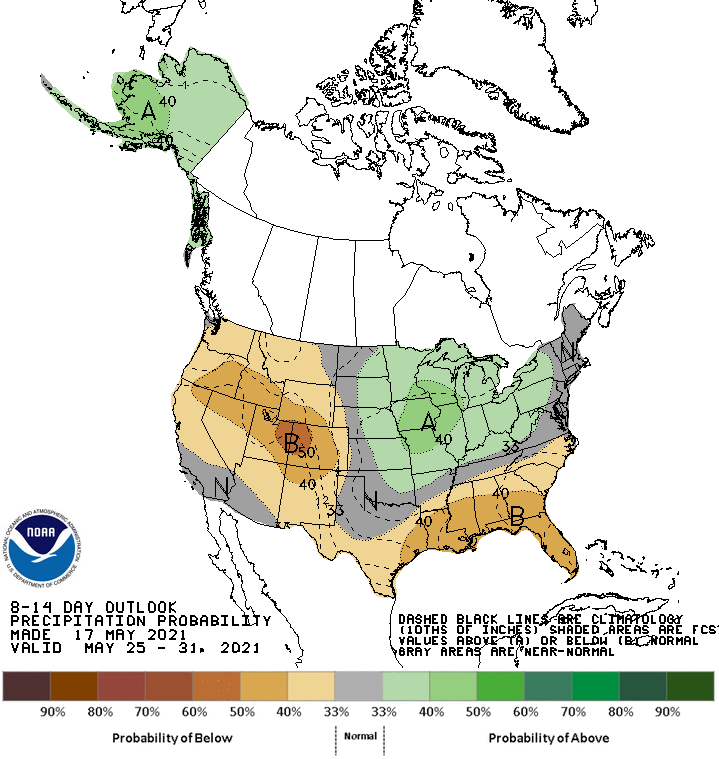
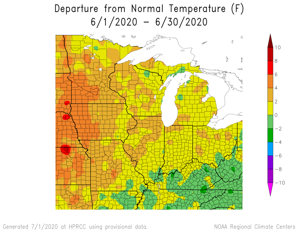
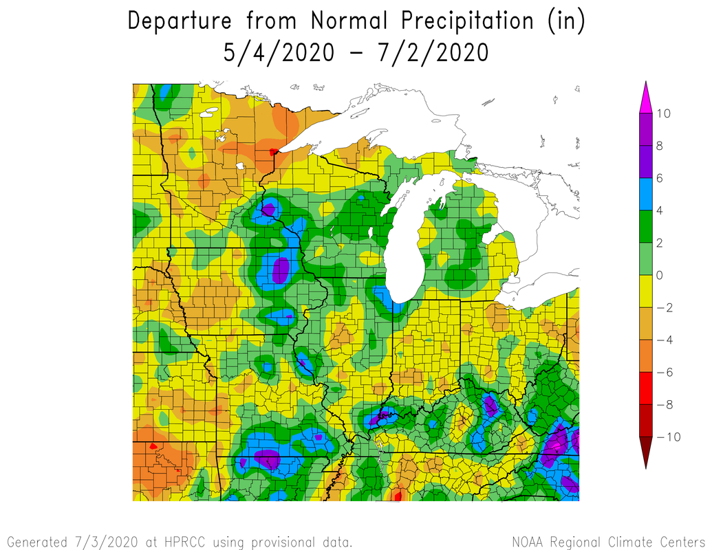
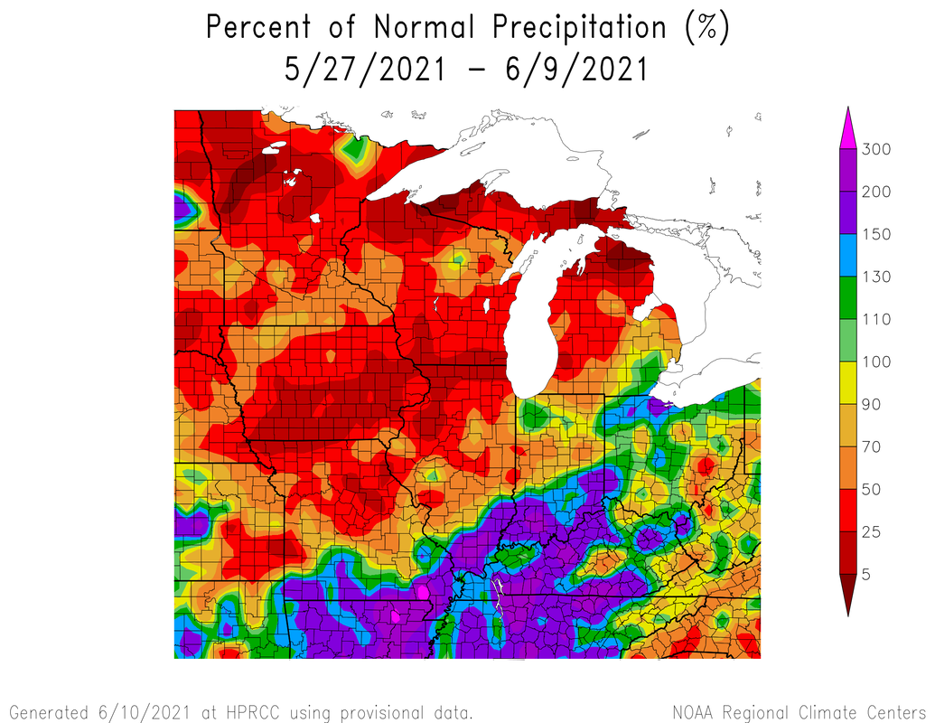 Here is the accumulated precip amounts for the last week. 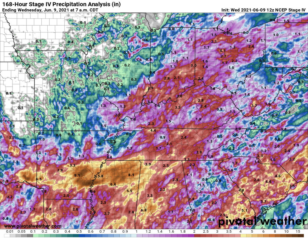 Temperatures have been close to average with the cooler temps near the beginning of the two week period. The last week has been warmer than average with most parts of my state being 0-9 degrees above average. The southern areas of the state have seen above average precipitation while the northern half have been drier. Some areas of Michigan, Wisconsin, and Illinois are in moderate-severe drought. 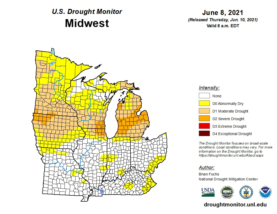 This weekend could be the warmest we have seen in a while with temps close to 90 and quite possibly could reach 90. The heat dome will be positioned to our west. 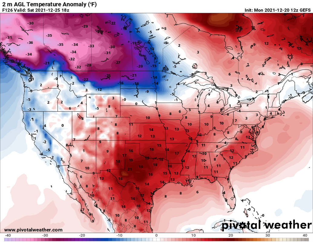 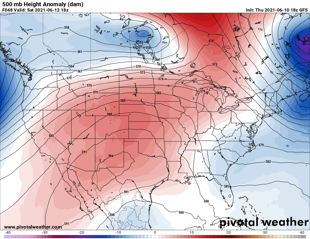 Fear not much lower dewpoints are on the horizon!  The following graphics are the temperature, precipitation, and 500mb anomalies for the next week (days 1-7) and the following week (days 8-14.) Generally we look to be warmer than average along with drier conditions.
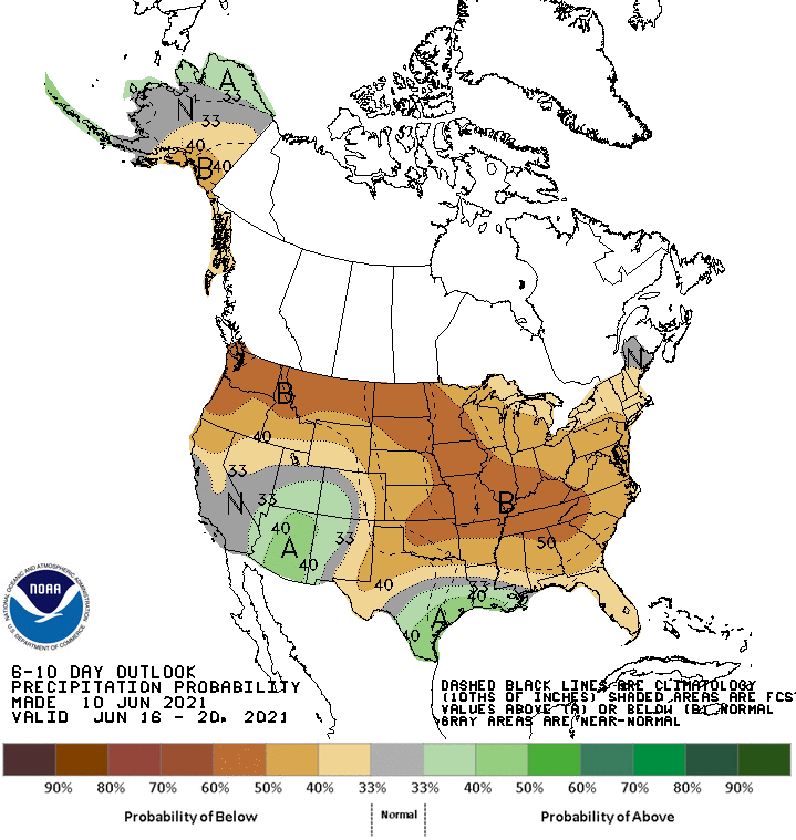
N0w the Climate Prediction Center predictions.
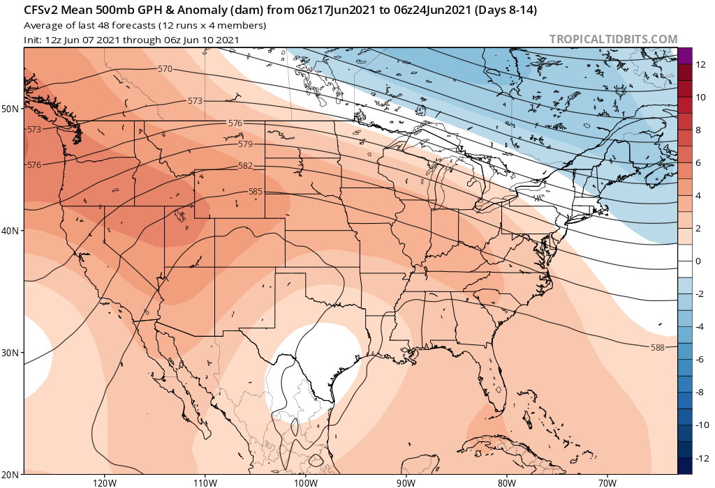
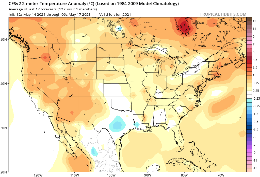
These support the ideas from above. Teleconnections also support this idea of the next couple weeks. A teleconnection is a linkage between weather changes occurring in widely separated regions of the globe. There is a presence of a positive NAO, neutral PNA and the MJO is transitionong from phase 8 to 1 and 2 over the next couple weeks. These support the idea of a drir warmer period especially after next week. So this last part doesn't focus on the local area, but the overall US. Much of the US is much warmer and drier than average.
There is a saying "same breeds more of the same." This means that if an area is warmer and dry, it will probably stay or get warmer and drier. This can also induce higher pressure. I suspect with the very dry areas out west and the upper midwest we will start seeing more ridging west of us. This could at times put us in a northwest flow pattern. 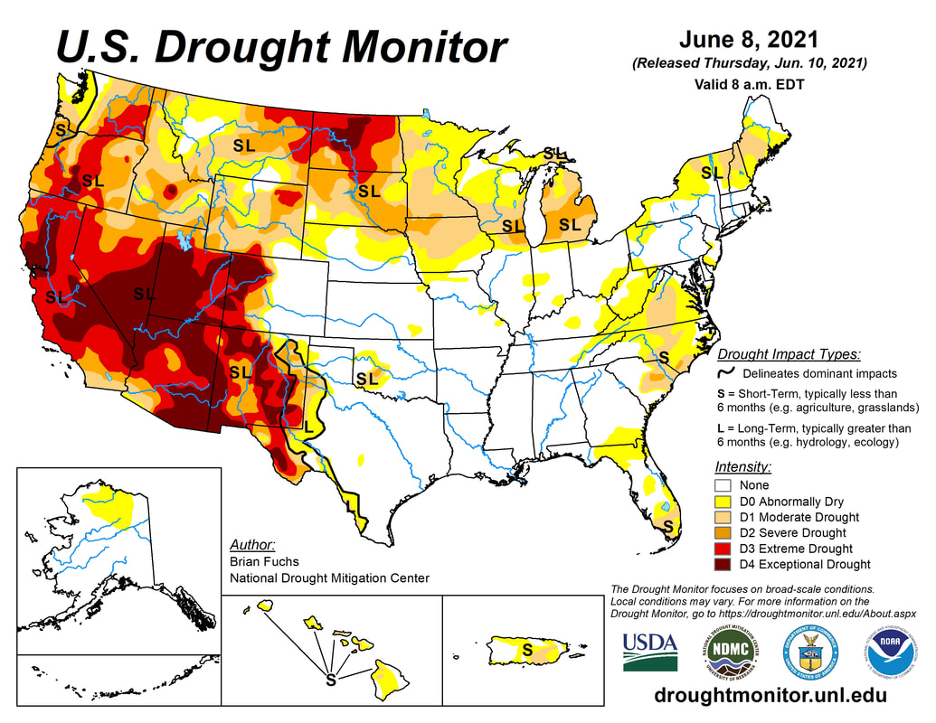 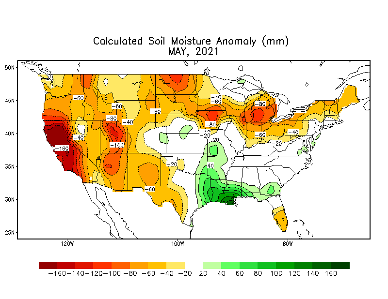 We should soak up any rain whenever we can get it with the present dry conditions in the region.
0 Comments
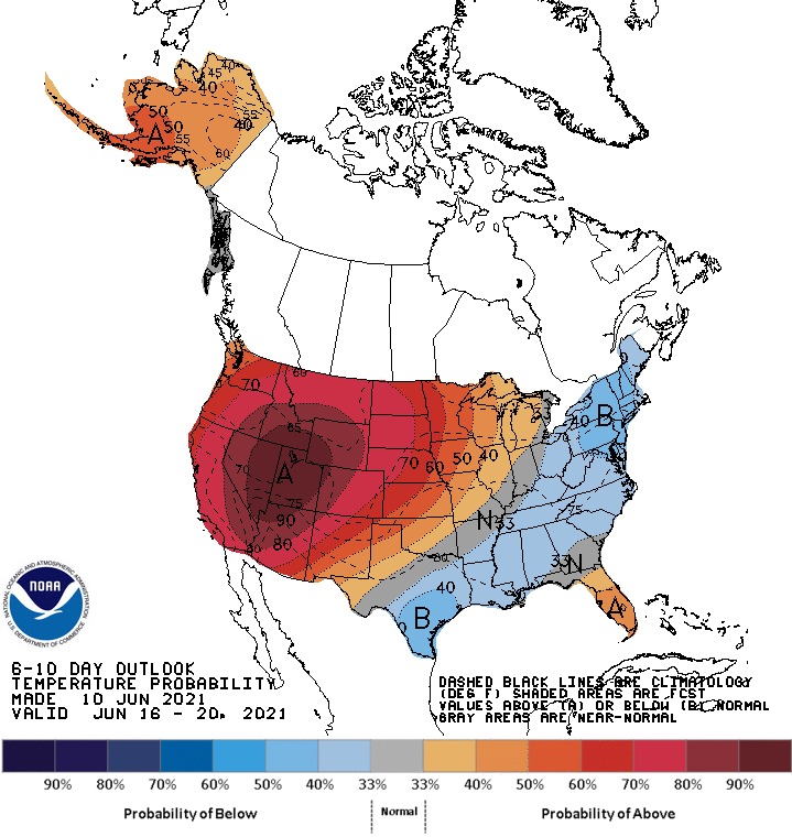
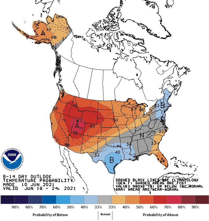
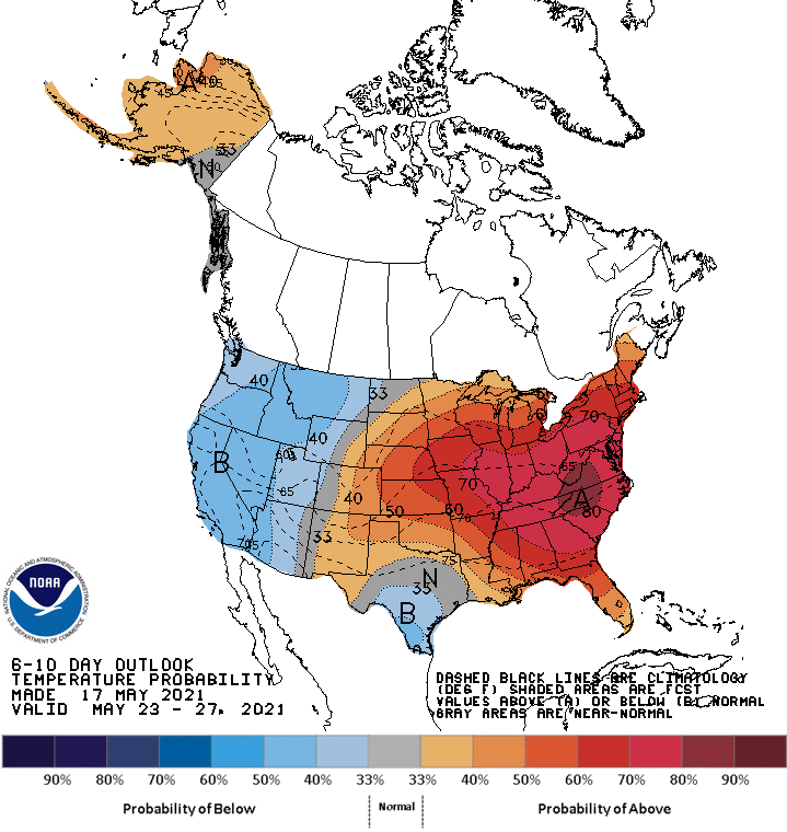
Hello everyone! I am back for the summer from Valpo, so hopefully updates will be a little more frequent and timely. So far May hasn't been real warm. We saw accumulating snow just a couple of weeks ago! The entire state is actually running 4-10 degrees below average. This looks to change soon... 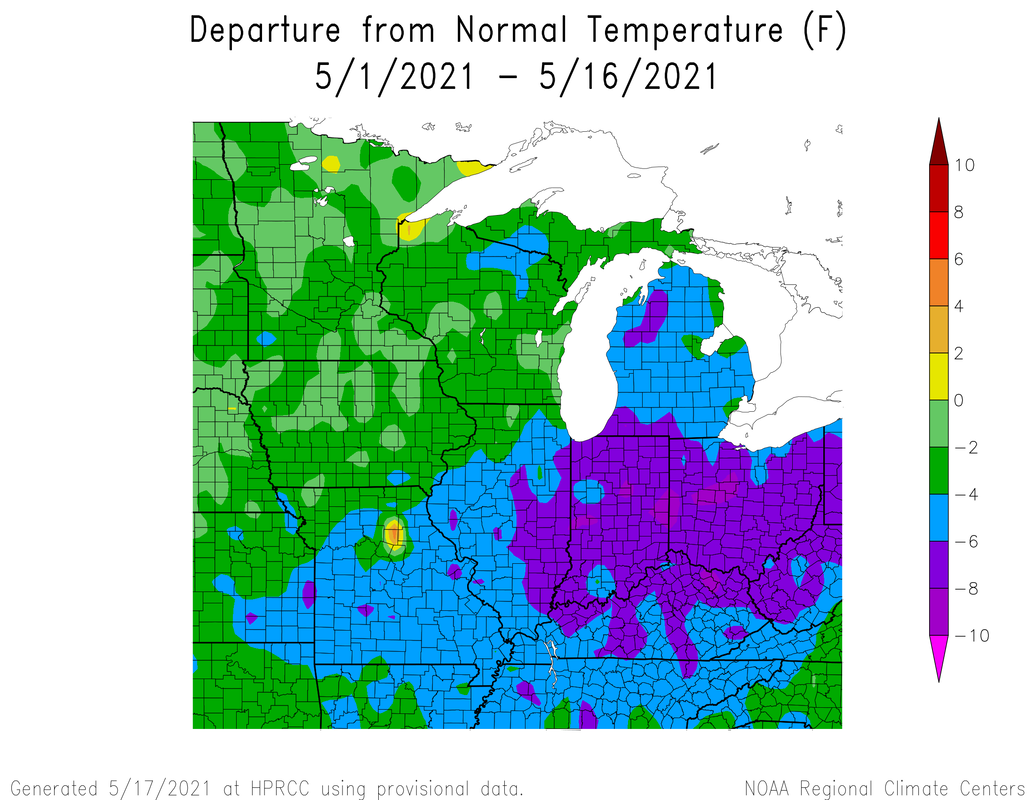 Here are the Climate Prediction Center's 6-10 and 8-14 day loutlooks through the end of the month.
Thus is due to ridging developing in the western US. This is a high pressure system that can bring relatively cal, but warm and dry conditions especially during the summer 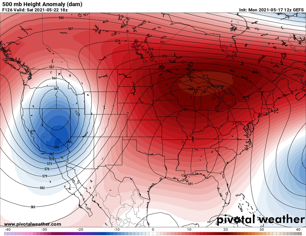 If you are going to the Indy 500, the forecast right now is for mostly cloudy skies and temps in the 70s at the moment. I'll update the race day forecast as we get closer to memorial day weekend. We enter June with the heat ridge just to our west. These ridges tend to move around and can introduce what is called a "ring of fire" pattern. This is when clusters of rain and thunderstorms develop and ride along the top of a ridge from the west. 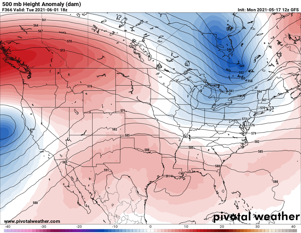 Now a few short thought s on the summer. Its looks like a hot and dry pattern will develop.
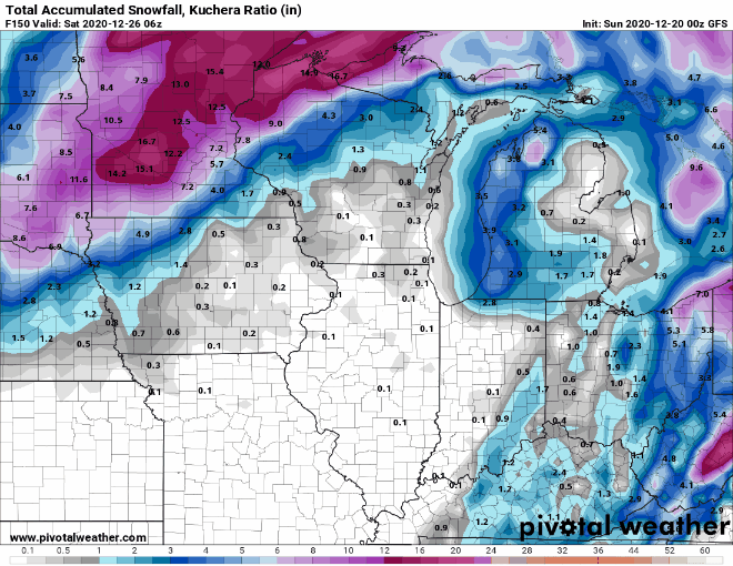
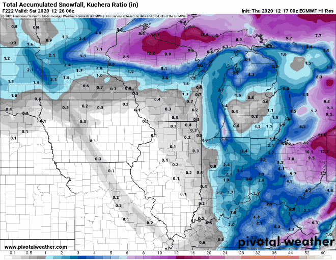
This may the type of summer when we really will want those ring of fire patterns when we can get them. Here is one final graphic. It is a comparison of the US drought monitor from early this month and the same time period in 2012. This is certainly a concern with the forecasted persistent ridging possibly present . 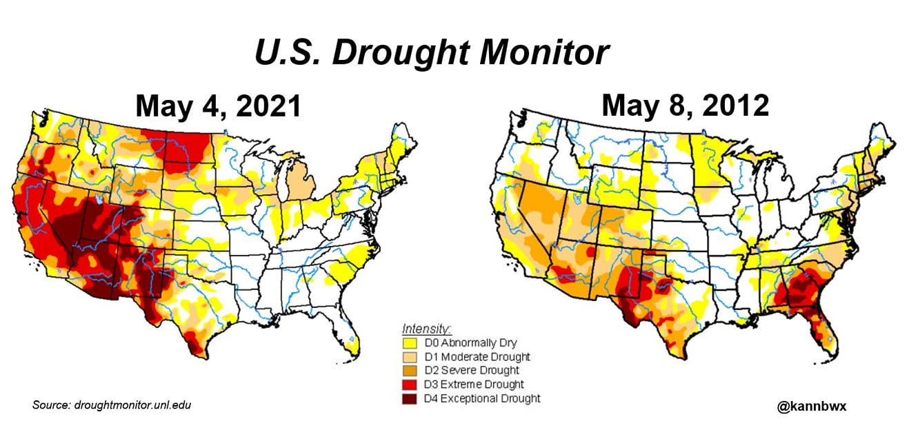 Last year we were seeing high temps on Christmas reaching the low 60s. That definitely won't be happening here this year, perhaps quite the opposite as I am monitoring a possibility of snow on Christmas eve. Here are a few interesting Christmas climatology records. The high temp record for Indianapolis was 64 deg in 1893. The lowest Christmas temp was -15 deg in 1983. The most snowfall was 5.9 inches in 1909. Ok so you are asking yourself "will we have a white Christmas?" Well first here is the annual climatology of a white Christmas. 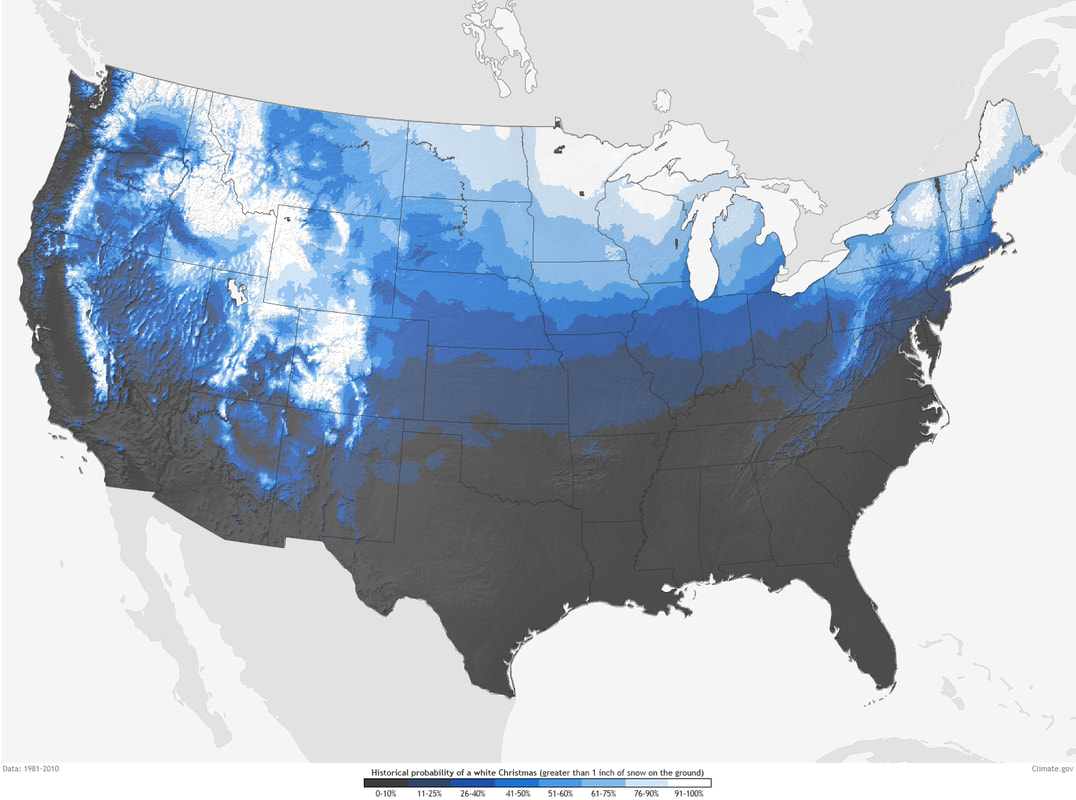 It's hard to see but most of central Indiana, including Howard county are in the 26-40% of a white Christmas. The following NWS winter outlook shows a 40%-50% chance of over an inch of snowfall Christmas eve. 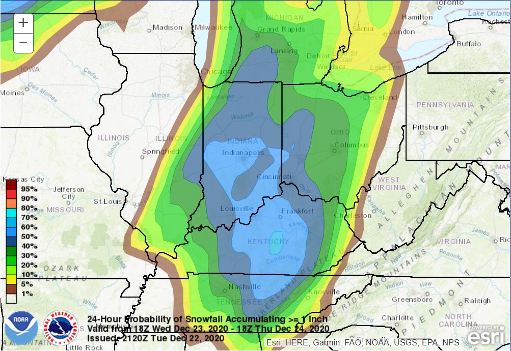 Weather Discussion: A low pressure system currently over the great plains will move into the upper midwest which will bring in a cold front Wednesday night bring rain and very cold temps. At the same time a second low pressure system will form to our south and ride up the front. The combination of lows will give snow to some. 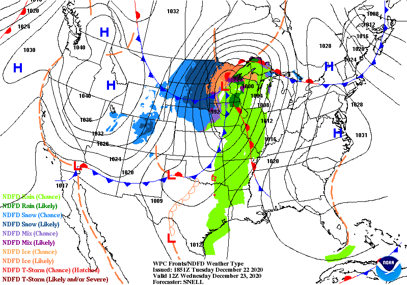 Unfortunately, for local snow lovers the heaviest accumulations look to be in eastern Ohio. 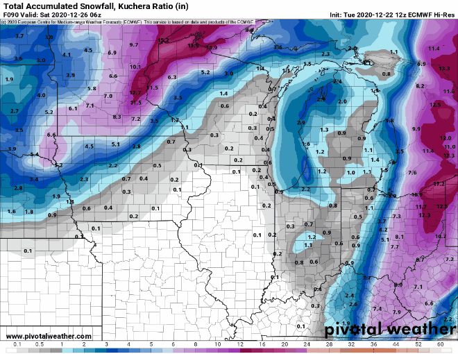 Now, there its a bad thing to take the models at face value. it more important to look at the trends. Below are the last several runs of the GFS and european models. They are trending west. Does that mean anything? I don't know. Models like to flip flop a lot so time will tell.
On simulated radar, we will get rain tomorrow night before the front passes and some snow behind the front. Areas in NW Indiana could cash in some lake effect snow as well. Winds will be very strong tomorrow ahead of the front gusting to close to 50 mph so I wouldn't be surprised if a wind advisory would be issued. 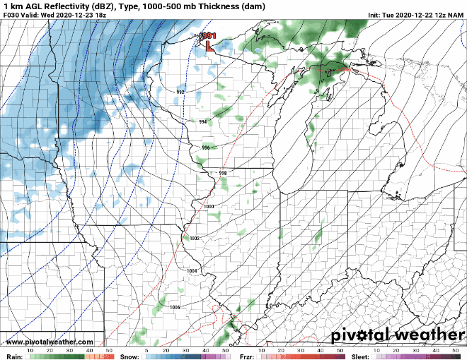 I do believe we will get some snow on Christmas eve, the question is how much. There is a possibility there could be some snow squalls where one area could get a quick 1-2 inches with low visibility for a time, but another area down the road gets nothing. What happens is with the cold air, all the moisture would be squeezed out as snow. This will be something to watch. I may attempt a snowfall map tomorrow, but it will be a very tricky forecast. The bigger danger than the snow will be the very cold air. Here are the forecast morning temps and wind chills Christmas morning from the GFS model. 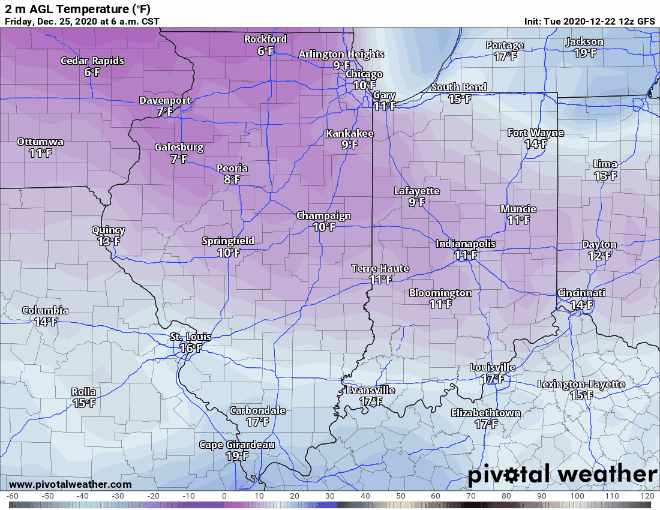 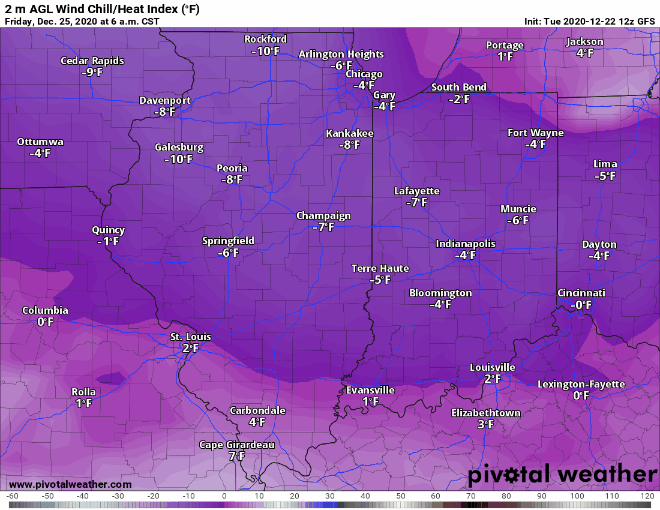 I will have updates on the Facebook page. Remember the forecast can change, but if you ae traveling to Ohio beware the possibility of heavy snow and bundle up Christmas morning so you don't get frostbite or hypothermia.
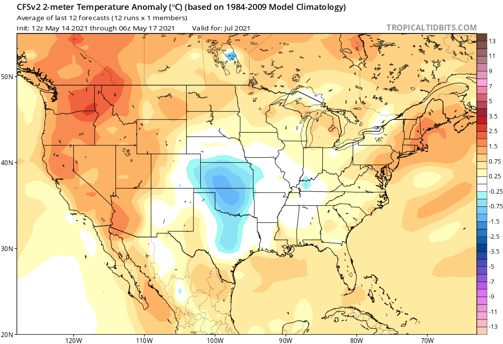
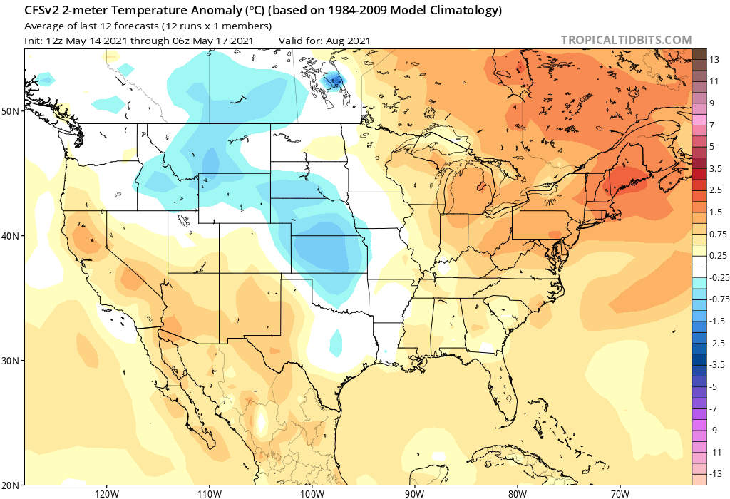
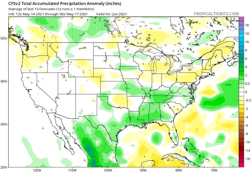
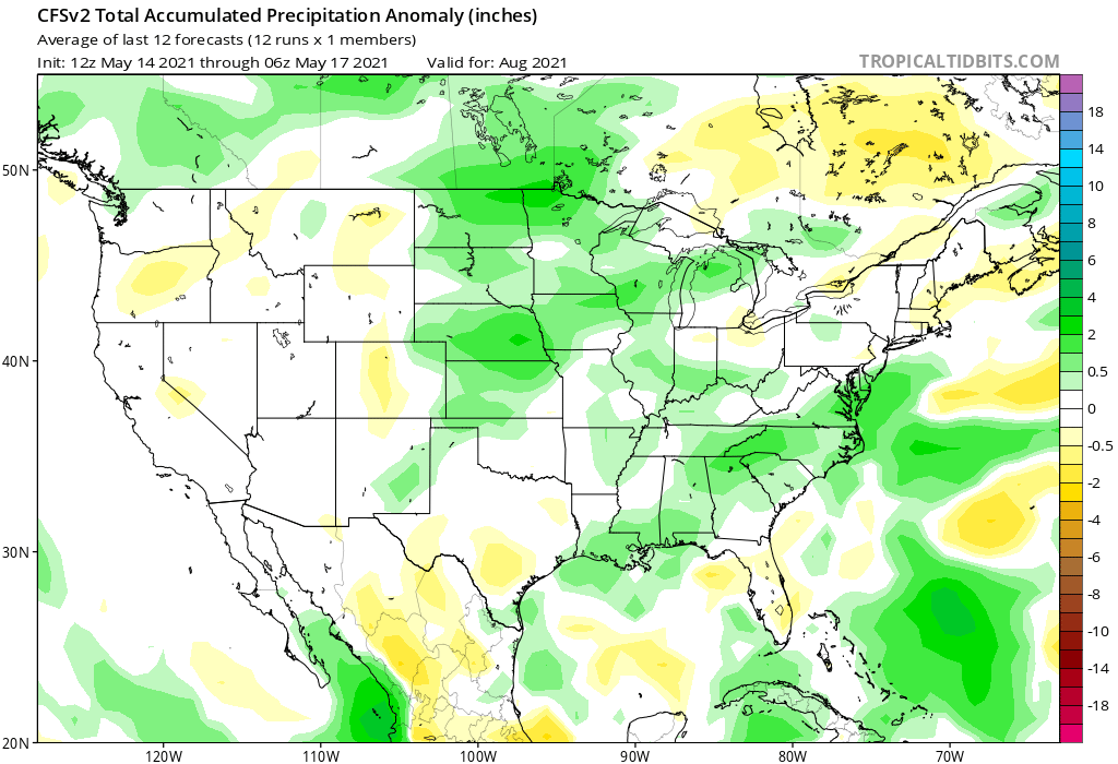
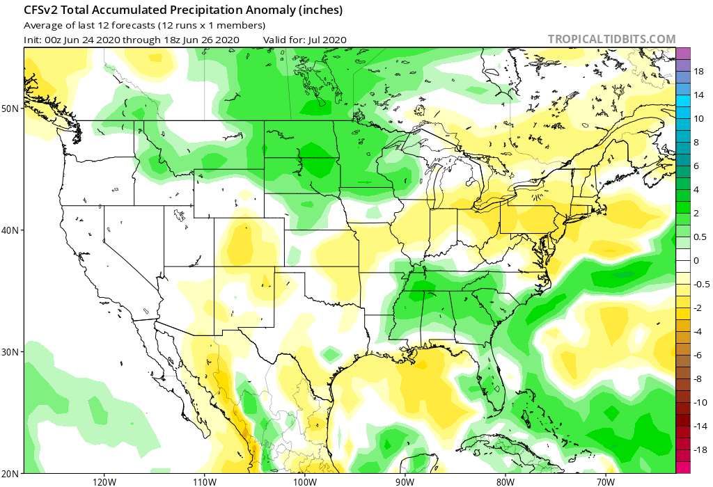
We just came out of a warm and dry month and we have entered into July.
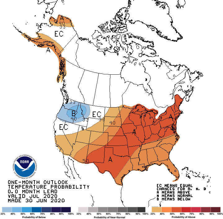
So here in Indiana we ranged anywhere from 2-4 deg warmer than average and since May 4th we have seen a fairly big deficit in rainfall. With the dry conditions much of the state categorized as abnormally dry in the latest US drought monitor. 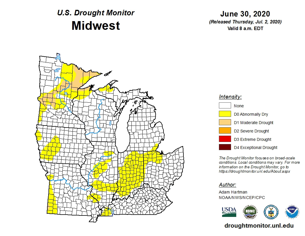 So what does the rest of July have in store for us. Well the answer looks like hot and dry. Looking at the CFS monthlies look, that looks to be the answer.
Now this depends on where the strong ridging sets up. 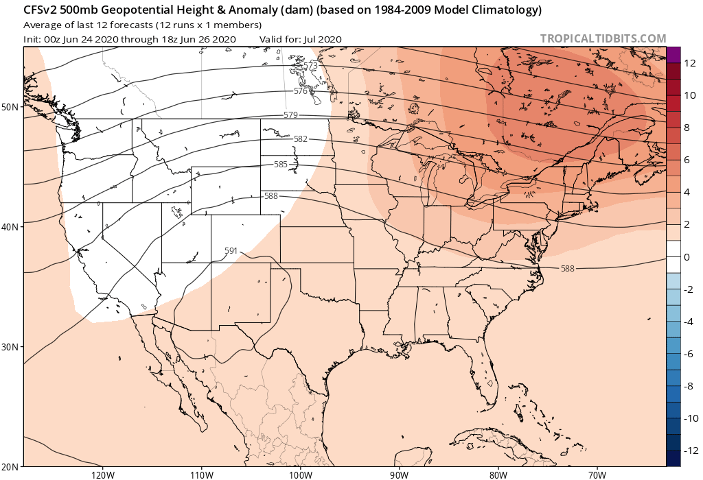 Remember ridges often mean warmer and dry conditions due to the high pressure. The models have some disagreements on placement, but both the GFS and Euro have strong ridges with the cores being at 594-600dm. The Euro places thre ridge more out west and the GFS more in the center of the country. This ridge can also wobble a bit over time, putting us under the hot dome or just slightly outside of it at times. This pattern looks to continue throughout the month and Id venture to say even ito August. Teleconnection patterns are also supporting this with ENSO entering into more La Nina like conditions along with the NAO and PNA.
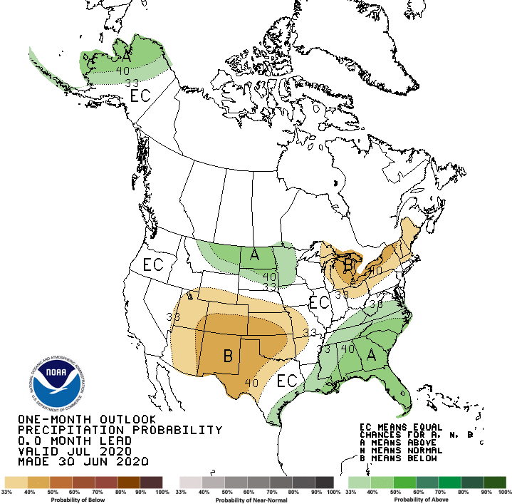
Another thing. There is a saying "same breeds same." If its dry it will become even dryer and if wet, even wetter later. That is we are losing soil moisture of around 0.20" a day or so and it will just get dryer and hotter. If there's more rain there would be higher dew points and probably more precipitation. We would have more rain chances if the ridge moves west enough to create a northwest flow type pattern, but thats dependent on the upper levels. Here is the NOAA monthly forecast.
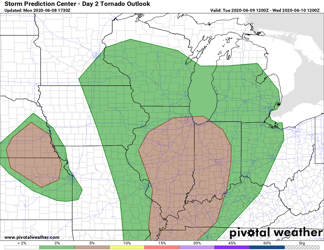
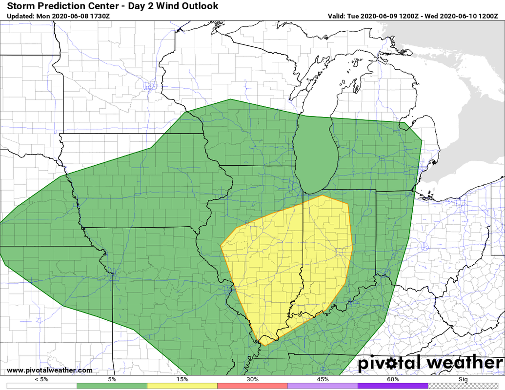
I'll leave you with the total rainfall through July 13 from several models (remember these are just possibilities and not set in stone.) Lets hope we can break out of this pattern before it begins. 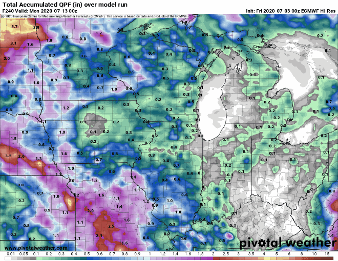 Well when I was talking about Cristobal being he source of the areas last good rain for at least a good chunk of June, I didnt think there would be severe weather involved. I decided to write this weather discussion as a blog post, not Facebook. I will also include a summary graphic at the end. Here is the official SPC day 2 outlook. 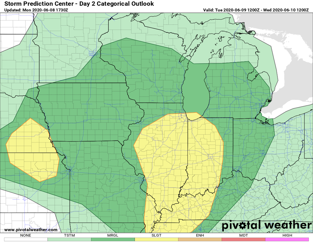
There is a smaller chance for hail, but right now the main threats look to be the possibility of tornados and winds, along with flash flooding and deadly lightning. Here are a few graphics of the main ingredients we look often look at. 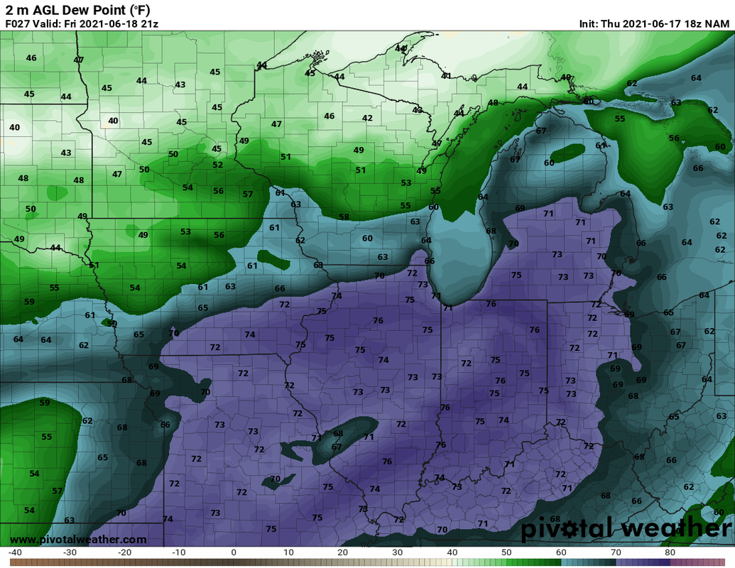 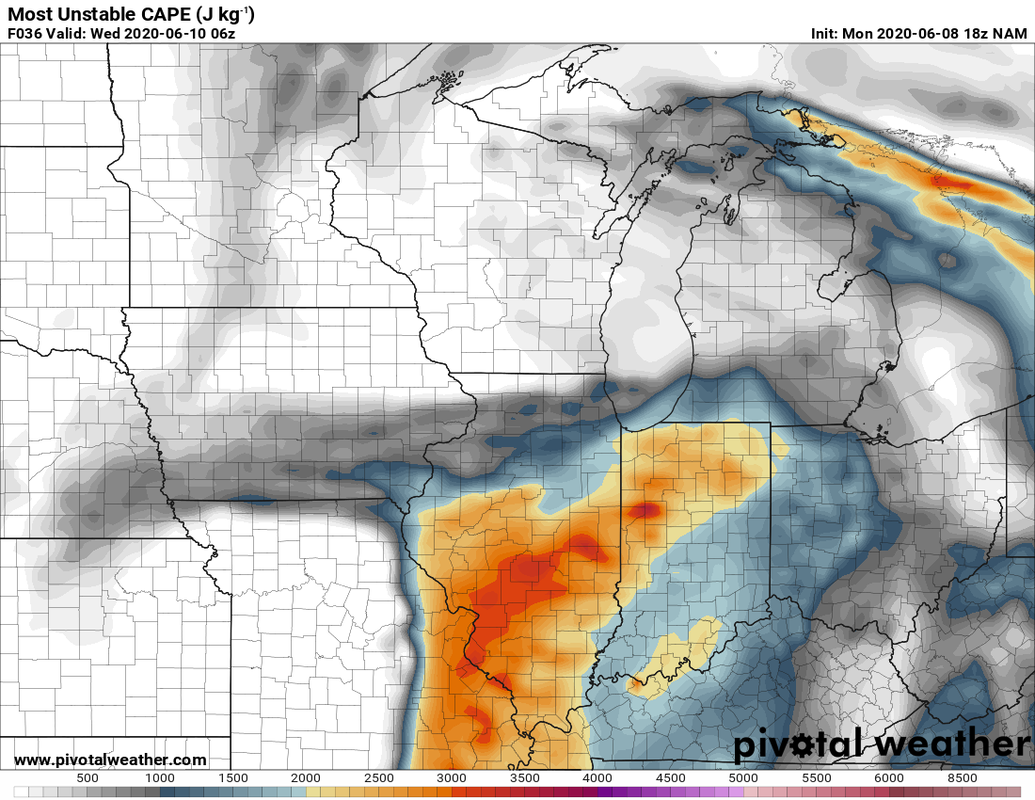 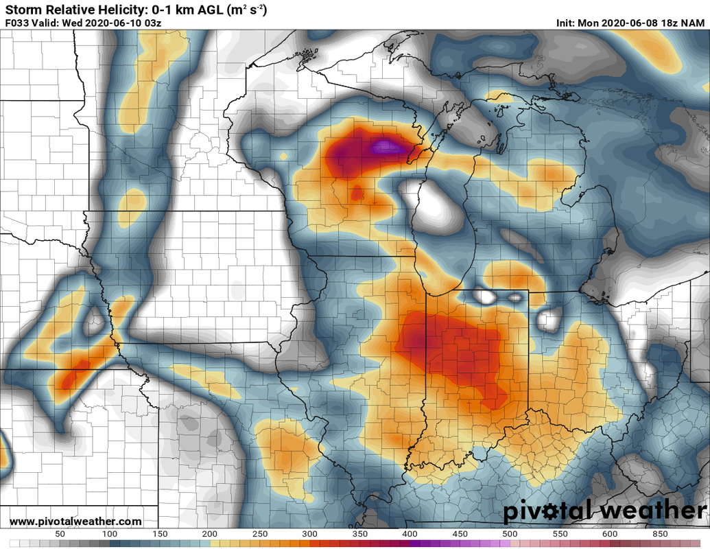 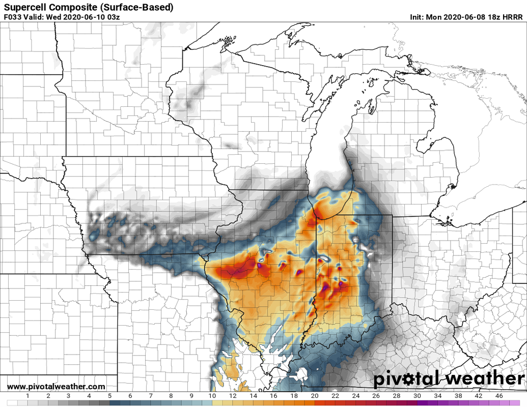 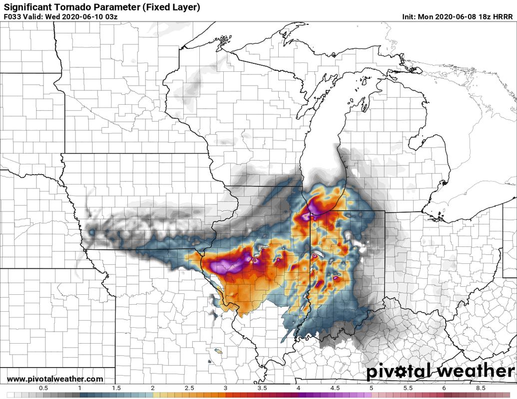 Dont focus on where the great areas are. look more at the pattern of where they are. And just for fun a point sounding for the area. 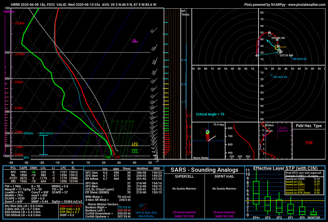 Here is one models(HRRR) simulated radar for tomorrow. remember this is just one model. One thing is for sure. these storms wuld be more of a more discrete/supercell type not a squall line which we are somewhat more used too around here.  Now there is a big IF here. If there is too much cloud cover there would be as much instability to work with, but still plenty of wind shear. Summary: 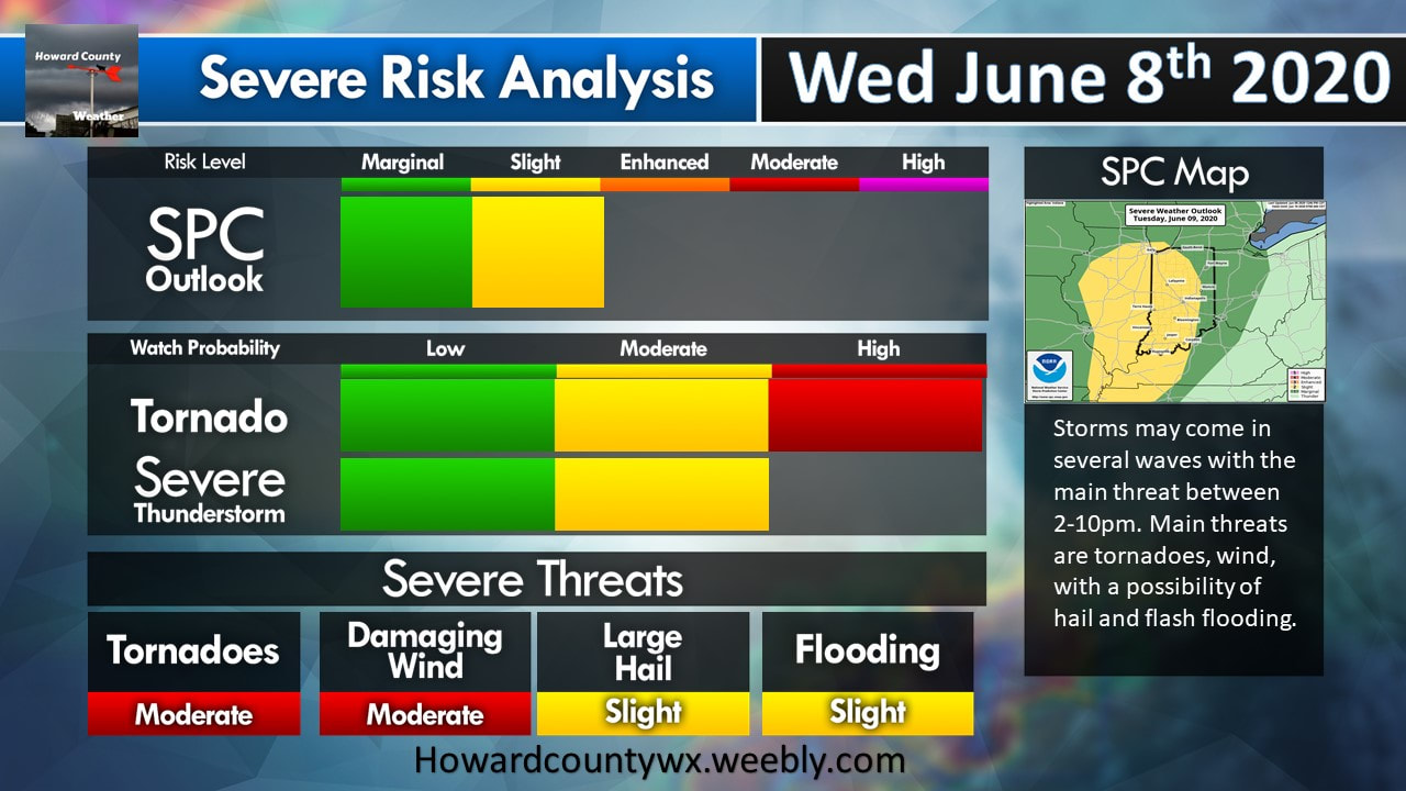 |


 RSS Feed
